Country:

 City:
City:


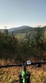
You start this ride in front of Villé Secondary School, which is on Rue du Klosterwald.
(S/E) With your back to the secondary school, turn right and head uphill towards the forest. You’ll enter the Honcourt State Forest via the forest track (gravel-surfaced) which climbs and is signposted with a Blue Saltire and a Red Cross. You’re heading towards the Banc du Forestier.
(1) At a junction with a large meadow (picnic table), keep to your left and continue following the Blue Saltire signposts towards the Banc du Forestier. The path continues to climb up to the Col du Banc du Forestier.
(2) At the pass, head towards the hamlet of Blanc Noyer and follow the Blue Crosses and Yellow Discs along a path on your left. The gradient levels off slightly and you’ll be heading towards Le Broemert.
(3) At a fork in the road, follow the Blue Cross markings to the right. Further on, pass a path on your left. You’ll join a forest track at a wide bend.
(4) You then follow the Red Triangle markings to the right. This forest track climbs gently and passes beneath the Honel.
(5) At the second junction, carry straight on. The signposting changes to a Green Triangle. You are still heading towards Blanc Noyer.
(6) At a fork in the road, keep left onto the main forest track (ignore the signposting heading right).
(7) At a crossroads, stay on the wide forest track and follow the Yellow Diamond and Yellow Rectangle markings. At the next crossroads, turn left.
(8) At the next junction, take a sharp left onto the forest road leading downhill (be careful, there may be cars).
(9) At the Fork in the road, keep right towards Blanc Noyer and head uphill to cross the housing estate.
(10) As you leave the housing estate, follow the signs for Beheu / La Rancinière / Climont. Follow the ‘Green Ring’ signposting as far as La Rancinière.
(11) At the junction after La Rancinière, take the path on the right. The signposting is now ‘Green Saltire’; follow this to the next junction.
(12) At the junction after La Grande Basse, take the path leading uphill to your right, signposted ‘Yellow Saltire’, towards Le Climont. The path climbs gently until it reaches a road, the D214 (you are now in Le Climont).
(13) Turn left onto the D214 towards the Col d’Urbeis (mountain bike signpost no. 9).
(14) Leave the road by veering to the right; immediately ignore a turn-off on the right and follow theGR®531, signposted with a Blue Rectangle. The path is quite steep and may have some loose stones. So control your speed.
(15) At the end of the path, you’ll pass a riding centre and continue straight on, downhill, along the tarmac road.
(16) Take the first forest track on your right and enter the woodland (concrete electricity substation). The path climbs up a somewhat rugged but truly lovely track. You are heading towards the Col d’Urbeis. Follow the Blue Rectangle markings.
(17) At the Col d’Urbeis, head towards the Col de la Hingrie (Yellow Ring and Blue Rectangle). You’ll begin a long climb – not technically difficult but quite steep.
(18) At the junction, carry on straight ahead following the Blue Rectangle markings (ignore the Yellow Ring markings heading off to the left). Continue climbing along the Perry forest track. At every junction you come to, carry on following the Blue Rectangle markings towards the Col de la Hingrie.
(19) At the Col de la Hingrie, take a path leading down to your left, signposted with a Red Disc, Blue Triangle and Red Ring. Keep heading towards the Col de Noirceux.
(20) At the first junction, carry on along the wide path marked with a Red Disc and a Red Ring.
(21) At the second junction, keep left onto the path that climbs, still following the Red Disc and Red Ring markings.
(22) At the Col de Noirceux (a lovely viewpoint), carry on straight ahead, following the Red Triangle markings, towards Fouchy.
(23) At the junction in the wide bend, turn right, following the Red Triangle markings.
(24) At the junction, carry on straight ahead downhill to the tarmac road at Froide Fontaine.
(25) Follow the road to the right.
(26) As you come out of a hairpin bend to the right, take a path on your left (marked with mountain bike sign no. 9).
(27) The track soon gives way to a wider path; follow the Blue Ring – Green Disc signposting.
(28) At a place called La Barrure, carry straight on following the Green Disc and Blue Ring markings. You’ll come to a tarmac road; follow it to the right for about a hundred metres.
(29) When you reach a reservoir, leave the road and turn right onto a nature trail signposted with a Green Disc and then a Yellow Triangle. Please note that the trail is busy and can be challenging in places.
(30) At the end of the nature trail, head towards Breitenau, following the Yellow Triangle and Blue Triangle markings.
(31) Once in Breitenau and back on the tarmac, take the first left. You’ll find yourself in the middle of the fields on a path marked with a Yellow Diamond and a Yellow Rectangle.
(32) At the roundabout, take the D439 straight ahead towards Villé.
(33) At the ‘give way’ sign, turn left and head downhill.
(34) At the next junction, turn right. Then take thesecond left and pass a care home. At the next junction, turn left. At the end of the street, turn right to return to the starting point (S/E).

 Visorando Member
 Moderate
 Tourist office
 Easy
Easy