


Please note that a large part of the route follows quiet country lanes with little traffic… only a stretch of about 500 metres on the N826 requires real caution.
Beauplateau and l’Agaric via the Côte de la Chapelle


The Agaric walk, adapted here, offers a wide variety of landscapes along the route: sometimes wooded with scrub, sometimes with deciduous trees, and often open, with beautiful panoramic views of the neighbouring rolling countryside.
Details
Creation:
Last update:
Last review:
–
–
-
 Activity: Walking
 -
 Distance: 9.98 mi
 -
 Average duration: 5h 20
 -
 Difficulty: Moderate
 -
-
 Back to start: Yes
 -
 Ascent: + 840 ft
 -
 Descent: - 843 ft
 -
-
 Highest point: 1,680 ft
 -
 Lowest point: 1,329 ft
-
 Country:
Belgium
Country:
Belgium
-
 Area: Massif des Ardennes
 -
 City:
Sainte-Ode
City:
Sainte-Ode -
 Start/End: N 49.996243° / E 5.531273°
 -


 Hour-by-hour weather
Photos
Waypoints
- S/E : mi 0 - alt. 1,575 ft - Beauplateau
- 1 : mi 0.94 - alt. 1,509 ft - Rancour Stream
- 2 : mi 1.55 - alt. 1,637 ft - Bois du Chênet
- 3 : mi 3.24 - alt. 1,339 ft - Ourthe occidentale (rivière) - Affluent de l'Ourthe
- 4 : mi 3.72 - alt. 1,417 ft - Bonnerue, Saint-Hubert Chapel
- 5 : mi 4.61 - alt. 1,526 ft - Fork in the road towards the picnic table
- 6 : mi 5.59 - alt. 1,394 ft - Jenneville - Ourthe occidentale (rivière) - Affluent de l'Ourthe
- 7 : mi 6.39 - alt. 1,516 ft - Côte de la Chapelle
- 8 : mi 7.51 - alt. 1,450 ft - Remagne
- S/E : mi 9.98 - alt. 1,575 ft - Beauplateau
Notes
Other walks in the area
The Sentier de la Girolle from Beauplateau
 Visorando Member
 11.25 mi
+853 ft
-866 ft
5h 55
Moderate
11.25 mi
+853 ft
-866 ft
5h 55
Moderate
 Departure from Sainte-Ode (Province de Luxembourg)
With beautiful panoramic views over the delightfully undulating countryside, this walk starting from the hamlet of Beauplateau is sure to delight many. Cow pastures dominate the landscape: there are few crops and no real woodland sections, although you do skirt round the odd copse here and there… and are sometimes in for a lovely surprise. Those who dislike tarmac, however, might want to give this a miss, even though the many small country roads taken aren’t particularly busy. The church at Tillet, with its freestanding bell tower, is well worth a visit.
Around the hamlet of Beauplateau
 8.89 mi
+794 ft
-768 ft
4h 45
Moderate
Departure from Sainte-Ode (Province de Luxembourg)
8.89 mi
+794 ft
-768 ft
4h 45
Moderate
Departure from Sainte-Ode (Province de Luxembourg)
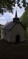
Starting from the hamlet of Beauplateau and the former convent built in 1880, set off to discover the Chapel of Notre-Dame de Lorette via covered and uncovered trails, roads and dirt tracks.
Around the Tram and Laval
 11.49 mi
+951 ft
-928 ft
6h 05
Moderate
Departure from Sainte-Ode (Province de Luxembourg)
11.49 mi
+951 ft
-928 ft
6h 05
Moderate
Departure from Sainte-Ode (Province de Luxembourg)
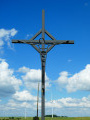
Le Laval is the name given to the stream that originates upstream of Magerotte and flows into the Western Ourthe at Sainte-Ode after passing through Magery, Houmont, Rechrival, Laval (near Laval Castle), Fosset and Sprimont.‘Le Tram’ is the former local railway line that linked Marche to Bastogne: you’ll only really see the route itself near the ‘Espace de jeux’ in Chenogne. A number of signposted walks have been marked out in the region based on this railway line.This highly scenic walk takes you through the rolling Ardennes countryside, with its meadows and farmland. There is only 1.5 km of woodland on this route, towards the end between Chenogne and the gigantic commemorative cross erected ‘in the middle of nowhere’.
The Art Trail of the Orti Nature Reserve
 2.59 mi
+92 ft
-105 ft
1h 15
2.59 mi
+92 ft
-105 ft
1h 15
 Easy
Departure from Sainte-Ode (Province de Luxembourg)
Easy
Departure from Sainte-Ode (Province de Luxembourg)
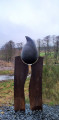
The walk begins in an orchard with heritage fruit varieties and an apiary, before following a sunken path that descends to the bottom of the Laval Valley. Beavers, ponds, artistic installations... so many discoveries await you.
Circular route via Lavacherie
 13.01 mi
+866 ft
-846 ft
6h 45
13.01 mi
+866 ft
-846 ft
6h 45
 Difficult
Departure from Sainte-Ode (Province de Luxembourg)
Difficult
Departure from Sainte-Ode (Province de Luxembourg)
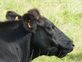
As a result, the walk is more rural than wooded, offering more panoramic views of this beautiful region. Whilst the natural scenery is lovely, don’t expect too many architectural or artistic highlights: there are a few works of art along the old country lane between Amberloup and Lavacherie, the Saint-Hubert Chapel in Bonnerue and the Church of Saint-Ouen in Tillet with its separate bell tower, but that’s about it.
Cheslin loop
 10.40 mi
+1,198 ft
-1,201 ft
5h 50
Moderate
Departure from Sainte-Ode (Province de Luxembourg)
10.40 mi
+1,198 ft
-1,201 ft
5h 50
Moderate
Departure from Sainte-Ode (Province de Luxembourg)
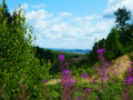
This beautiful hike in Sainte-Ode takes you on a journey of discovery through the valleys of the Ourthe, Baseille and Laval streams, alternating between forest and pretty panoramic views of this region of the Ardennes, with a return trip through the Orti Nature Reserve.
In the Laval and Western Ourthe valleys
 6.15 mi
+453 ft
-430 ft
3h 15
Moderate
Departure from Sainte-Ode (Province de Luxembourg)
6.15 mi
+453 ft
-430 ft
3h 15
Moderate
Departure from Sainte-Ode (Province de Luxembourg)
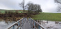
A few sculptures, a bit of nature reserve with the occasional sign of beavers here and there, and a bit of countryside: that’s what this walk has to offer.
Ardennes landscapes in Chenogne
 11.43 mi
+771 ft
-771 ft
5h 55
Moderate
Departure from Vaux-sur-Sûre (Province de Luxembourg)
11.43 mi
+771 ft
-771 ft
5h 55
Moderate
Departure from Vaux-sur-Sûre (Province de Luxembourg)
No dazzling monuments here, just nature at its best! The walk begins on a stretch of an old local track and gradually winds its way into the woodland.After passing the hamlet of ‘Mesy’ – a charming clearing with a few beautifully restored houses – the route reaches the village of Poisson-Moulin and continues towards Magerotte and Houmont along country lanes offering magnificent panoramic views of the green hills, which are coloured in season by a profusion of flowers and fields of rapeseed.The return to the starting point first climbs up to the wooded heights between Hubermont and Senonchamps before descending once more towards Chenogne through the Ardennes countryside.
For more walks, use our search engine .
The GPS track and description are the property of this route's author. Please do not copy them without permission.

