Neuweiher – Lac des Perches circular loop starting from Oberbruck

Circular route starting from Oberbruck towards the Grand Neuweiher and then on to Lac des Perches.

Details

19348119
Creation:
Last update:
Last review:
  • Walking
    Activity: Walking
  • ↔
    Distance: 9.39 mi
  • ◔
    Average duration: 6h 15 
  • ▲
    Difficulty: Difficult

  • ⚐
    Back to start: Yes
  • ↗
    Ascent: + 2,221 ft
  • ↘
    Descent: - 2,208 ft

  • ▲
    Highest point: 3,550 ft
  • ▼
    Lowest point: 1,526 ft

Description of the walk

Park at the Oberbruck stadium car park.

(S/E) Cross the road carefully and follow the path marked ‘Blue Cross’ opposite. It climbs a little. Join a forest track and head for the nearby three-way junction on the left.

(1) Keep to the right towards Gresson Bas. Before reaching the buildings in the hamlet, turn left, following the signposting, and you’ll come out onto a forest track. Follow it to the right, keeping to the ‘Blue Cross’ signposting. The path heads north and climbs to a junction with theGR®531(Blue Rectangle), which leads off to the right towards Grand Neuweiher.

(2) Ignore theGR®, turn left following the Red Ring signpost marked “Tour du Lac”. This stony path is crossed by numerous springs. After a viewpoint overlooking the lake, the path descends towards a junction with another path (a variant ofthe GR®531Blue Rectangle and White Rectangle).

(3) Turn right, following the Red Ring markings. Walk past the viewpoint and continue to a fork in the path.

(4) Leave the Red Ring trail and head straight on towards Lac des Perches on theGR®531path (marked with a Blue Rectangle). You’ll reach a junction as you emerge from the forest.

(5) At the edge of the forest, veer right onto theGR® and cross the Haute Bers. Continue to Lac des Perches.

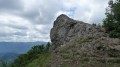
(6) Return by taking the path marked with a Red Triangle on the right. Walk past the Rocher du Corbeau and reach the three-way junction at Basse Bers.

(7) Carry on straight ahead towards Rimbach, following the Yellow Ring markings. You’ll come to a wide path.

(8) Keep to the left, following the signposts, join the path marked with a Blue Triangle and carry on straight on to Rimbach-près-Masevaux, which you reach via Rue du Sternsee then Rue du Belacker, and at the junction in front of the Auberge du Touriste.

(9) Once you reach the hills above Rimbach, turn left after the Auberge into Rue des Sapins. Continue for 100 m and turn right between the houses: the Blue Triangle signposting is subtle, so pay close attention. You’ll come out onto Rue du Riedelsbourg.

(10) Follow it to the left, keeping to the signposts. Continue along the path which joins Rue du Buhl; follow this in the same direction until you reach a junction opposite the cemetery entrance.

(11) Carry on straight ahead, skirting the cemetery on your left, and head downhill to the D466 (Rue Principale). Follow this road to the right for about fifty metres.

(12) Turn left towards the aerodrome via Rue de la Renardière, then turn right onto the cycle path to reach the car park (S/E).


Waypoints

  1. S/E : mi 0 - alt. 1,539 ft - Stadium car park. Near the - Source de la Doller
  2. 1 : mi 1.66 - alt. 2,503 ft - Three-way junction: turn right towards Gresson Bas
  3. 2 : mi 2.81 - alt. 2,825 ft - Turn left at the fork, Tour du Lac
  4. 3 : mi 3.34 - alt. 2,995 ft - Junction, turn right
  5. 4 : mi 3.57 - alt. 2,887 ft - Head straight on towards Lac des Perches
  6. 5 : mi 4.4 - alt. 3,540 ft - Haute Bers
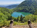
  7. 6 : mi 5.17 - alt. 3,228 ft - Lac des Perches
  8. 7 : mi 5.83 - alt. 2,802 ft - Basse Bers
  9. 8 : mi 6.5 - alt. 2,320 ft - Junction, turn left
  10. 9 : mi 7.37 - alt. 1,893 ft - Auberge du Touriste
  11. 10 : mi 8.02 - alt. 1,768 ft - Rue du Riedelsbourg
  12. 11 : mi 8.96 - alt. 1,598 ft - Junction, go straight on
  13. 12 : mi 9.13 - alt. 1,532 ft - Rue de la Renardière
  14. S/E : mi 9.39 - alt. 1,535 ft - Stadium car park

Notes

A pleasant walk, completed in mid-February 2022.
Make sure you have waterproof boots and crampons at this time of year, as there is snow and ice on the upper part of the route.
You’ll need to be in good physical condition, even though the elevation gain isn’t very significant, as some sections are quite rugged.

Always be cautious and plan ahead when you're outdoors. Visorando and the author of this route cannot be held responsible for any accidents occurring on this route.

The GR® and PR® markings are the intellectual property of the Fédération Française de Randonnée Pédestre.

Reviews and comments

4.3 / 5
Based on 2 reviews

Reliability of the description
4 / 5
Ease of following the route
4 / 5
Route interest
5 / 5
Mv Agusta
Mv Agusta

Overall rating : 4.3 / 5

Date of your route : Aug 21, 2023
Reliability of the description : ★★★★☆ Good
Ease of following the route : ★★★★☆ Good
Route interest : ★★★★★ Very good
Very busy route : Yes

A brilliant walk 🥾

My 10-year-old son made it all the way to the end; it’s still accessible for children if you take your time…

Machine-translated

Rose de Vernon
Rose de Vernon

I reckon it’s down to those three weeks of rain as well… ☺️ Everyone was keen to get out and about.

Thanks so much, and I hope you all have some lovely walks.

Sandra

Machine-translated

Adèle Baroque
Adèle Baroque

Hello. Thank you for your comment – I’m delighted you enjoyed the walk. It was very busy this long weekend, with the 1st May bank holiday. I usually go there at the weekend and the crowds are usually quite manageable. I hope you enjoy many more lovely walks in the future.
Adeline

Machine-translated

Rose de Vernon
Rose de Vernon
• Edited:

Overall rating : 4.3 / 5

Date of your route : Apr 29, 2023
Reliability of the description : ★★★★☆ Good
Ease of following the route : ★★★★☆ Good
Route interest : ★★★★★ Very good
Very busy route : Yes

A really lovely walk, quite busy. We hesitated a bit in a few places, but with the map we found our way round quite quickly. The Lac des Perches is as magnificent as ever ❤️. This walk is definitely one to do.

Machine-translated

Other walks in the area

For more walks, use our search engine .

The GPS track and description are the property of this route's author. Please do not copy them without permission.