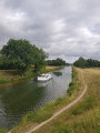
Guerchy–Fleury circular loop through fields and valleys

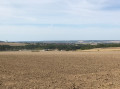
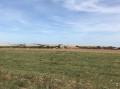
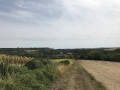
A lovely circular route starting from Guerchy with beautiful scenery as you climb to the top of the valley, with distant views of Neuilly, Fleury-la-Vallée and Branches.

Details

n°2460074
Creation:
Last update:
Last review:
  • Walking
    Activity: Walking
  • ↔
    Distance: 4.57 mi
  • ◔
    Average duration: 2h 20 
  • ▲
    Difficulty: Easy

  • ⚐
    Back to start: Yes
  • ↗
    Ascent: + 262 ft
  • ↘
    Descent: - 240 ft

  • ▲
    Highest point: 538 ft
  • ▼
    Lowest point: 371 ft
  • ⚐ Country: France
  • ⚐ City: Guerchy (89113)
  • ⚑
    Start/End: N 47.893417° / E 3.440525°
  • ❏
    IGN map(s): Ref. 2620SB
  • Hour-by-hour weather

Photos

Description of the walk

Park in the car park at Guerchy Town Hall.

(S/E) Head along Rue de Saint-Germain towards the car repair shop, then take Rue de la Tuilerie opposite. Atthe first junction on the left, follow the signs for the Foyer Communal to reach the Salle des Fêtes.

(1) Walk past it on the left, then take the path at the back which leads across the fields and up the hillside.
Follow it and turn left at the next junction. You’ll reach the four-way crossroads at a place called La Petite Champagne.

(2) Turn right. Continue due south, then head down alongside the copse to reach the edge of the Autoroute du Soleil, the A6.

(3) Follow it until you reach the bridge at the hamlet of Jappe-Loup.

(4) Turn left and tackle thesecond climb. You will then reach the junction with the D19.

(5) Turn left onto it towards Guerchy, and walk a short way along the road through the woods.
As you emerge from the woods, start heading down towards Guerchy, using the large mobile phone mast by the roadside as a landmark (blue dot on the map).

(6) 200 metres before this mast, take the path branching off to the right across the fields.
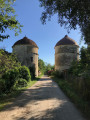
Walk alongside the fields; at the very end, turn left and head downhill to reach the crossroads by Cordeil Castle.

(7) Behind the farmhouses, take the white-gravel path on the left. You’ll reach the junction with Rue Saint-Roch. Turn right here, then turn left onto Rue Saint-Germain to return to the town hall car park (S/E).

Waypoints

  1. S/E : mi 0 - alt. 374 ft - Guerchy Town Hall car park
  2. 1 : mi 0.41 - alt. 430 ft - Village hall
  3. 2 : mi 0.89 - alt. 522 ft - 2nd junction
  4. 3 : mi 1.3 - alt. 453 ft - A6 motorway junction
  5. 4 : mi 1.85 - alt. 476 ft - Bridge at the hamlet of Jappe-Loup
  6. 5 : mi 2.28 - alt. 525 ft - D19
  7. 6 : mi 2.92 - alt. 518 ft - Path to the right
  8. 7 : mi 3.99 - alt. 384 ft - Cordeil Castle junction
  9. S/E : mi 4.57 - alt. 371 ft - Guerchy Town Hall car park

Notes

No water sources or shelters

Worth a visit

Panoramic view across the entire Valravillonnais valley

Reviews and comments

4 / 5
Based on 2 reviews

Reliability of the description
5 / 5
Ease of following the route
5 / 5
Route interest
2 / 5
Lilie89
Lilie89

Overall rating : 4 / 5

Date of your route : Jul 11, 2021
Reliability of the description : ★★★★★ Very good
Ease of following the route : ★★★★★ Very good
Route interest : ★★☆☆☆ Disappointing
Very busy route : No

Between points 1 and 3 on the map, there is no proper path as it appears not to have been maintained; the grass and brambles were tall (almost knee-high for me, as I’m 1m61) and watch your ankles as the ruts and holes were well hidden. Making progress was very laborious, verging on discouraging.

Once you reach point 3, the path becomes much more passable and pleasant.

On a sunny, hot day, make sure you bring a cap, sunglasses and plenty of water, as there is very little shade (apart from between points 5 and 6).

Machine-translated

mchlsgchr
mchlsgchr
• Edited:

Overall rating : 4 / 5

Date of your route : Mar 17, 2020
Reliability of the description : ★★★★★ Very good
Ease of following the route : ★★★★★ Very good
Route interest : ★★☆☆☆ Disappointing

Circular route of farm tracks, so deep ruts; a lovely view at La Petite Champagne, return along the A6 then via the D19; finally, a lovely view at Cordeil Castle and some interesting houses on Rue Saint-Germain
Places to explore: the Bois de Chassaigne and the Ravillon footpaths
A beautiful region

Machine-translated

Other walks in the area

For more walks, use our search engine .

The GPS track and description are the property of this route's author. Please do not copy them without permission.