Country:
 City:


Start at the church in Thuilley-aux-Groseilles, Rue de l’Église.
(S/E) Facing the church, turn left onto Rue de l’Église. At the end of the street, turn left, then right, pass a wayside cross and continue along Rue de la Corvée until you reach the Route de Toul (D904).
(1) Turn left and keep to the left to reach the junction with the D974. At the junction, cross carefully and set off along the road towards Crépey.
(2) After a few metres, take the track leading uphill to the left, pass the pylon and enter the Bois de Brais, then carry on straight ahead.
(3) At the end of the track, at the junction with the small stone marker, turn right onto the downhill track. Join the D904 and follow it to the left, passing in front of the barracks.
(4) After the barracks, take the first track on the right and enter the Bois de la Champelle. At the T-junction, turn left and continue straight on to leave the woods.
Join a stony track leading to the D4.
(5) Cross with care and carry on straight ahead along the grassy track. Join a stony track and turn left. At an X-junction, turn right; at another X-junction, turn left, then left again.
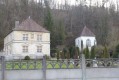
(6) At a T-junction, with No. 12 visible in the distance at the entrance to the woods, turn right, go round the Saint-Lambert Chapel and its wayside cross. Return to this junction and turn right to head down towards the village. At the T-junction, carry on straight ahead.
(7) Cross the D4 with care and continue straight ahead along Rue du Diarrou, then turn left into Rue des Trois Maisons.
(8) At the end of the street, at a wayside cross, turn right onto Rue de la République, walk past the wash house – which welcomes you with a mural – and take the first street on the left, Rue du Petit Richebourg.
(9) At the end of the street, turn left onto Rue du Grand Richebourg and carry on straight ahead. At the end, continue up the track and join Rue du Haut Chemin (D904).
(10) First turn right then left, and at the wayside cross cross a small road; immediately turn right onto the grassy, uphill track, join a road and turn left.
(11) At the end of the road, turn right towards Germiny, passing a wayside cross covered in ivy and then a farmhouse with a painted landscape (sorry, but this isn’t really typical of the local landscape – there are no snow-capped mountains here).
(12) In the centre of Germiny, at the junction with the fountain, turn left onto Rue des Quatre Fils Aymon and carry on straight ahead through the village.
(13) After the monumental wayside cross, carry on straight ahead along the small road to reach the village of Thuilley-aux-Grosseilles, following the River Ar.
(14) At the end of the road, turn left onto the Grande Rue, cross it at the pedestrian crossings and continue straight ahead along Rue de l’Église to return to the starting point (S/E).

 Visorando Member

 Easy