Country:
 City:
City:


Park in the car park at Mâlain Castle.
(S/E) With your back to the car park, walk up towards the castle, go round it on the left and you’ll come to a fork in the path.
(1) Take the path that turns sharply to the right and continue for a few dozen metres until you reach a track leading down to the left.
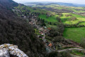
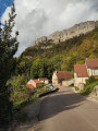
(2) You can follow this to the entrance of the ‘Trou du diable’ cave: a vast chamber closed off by a low wall at the bottom. Turn back and head up the path that runs alongside the ruins. There’s a lovely view of the village below, the Roche Aiguë, Ancey behind you and the Ouche valley. You’ll arrive in the woods.
(3) Head back down to the left along a small path lined with metal sculptures (animals and figures made from assemblages of old agricultural tools and scrap metal) and you’ll come out onto Rue du Four. Then head up this street to the right for 100 metres, until you reach a path that climbs to the left.
(4) Take this path, which climbs beneath the Roche Vauxalle and leads you towards the summit of the Truchot. At the top of the slope, a faint path branches off to the right.
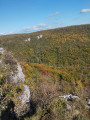
(5) Follow this small path, which takes you to a viewpoint. Take in the view of Mâlain, its castle and the Ouche valley.
(6) Turn back and return to the starting point.
(5) Keep to the right on the path that winds round the Bois de Perrigny hill, with the fields below the path. After going round the hill, look out for a path branching off at an acute angle to the right.
(7) Take this path, which leads straight down towards the Route de Prâlon, through woodland and then along the meadows.
(8) At the road, turn left. You can go and see the gorges bordering the Ruisseau de Prâlon below the road. Above the stream are the Montoillot cliffs. Follow the Route de Prâlon to the entrance to the village.
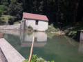
(9) At the entrance to the village, on your right below the road (on the edge of private property), you will see the village wash house. A few metres further on, turn right onto Rue du Moulin, then walk alongside the Prâlon Stream until you reach a bridge. At the bridge, head up to the left towards the church and follow Rue de l’Église. Turn left onto Rue des Vignes Hautes to rejoin Rue du Moulin.
(9) At the wash house, head up to the right towards the north-east along a wide track that climbs steadily for about 1 km until you reach a pass.
(10) Head back down the opposite side towards the village of Mâlain, entering the village via Rue de Prâlon. Cross Rue du Four and, a few metres further down, admire the washhouse, which is full of water during wet winters.
(11) Behind the washhouse, climb the grassy embankment to rejoin Rue Mialet, which leads onto Rue des Ferrettes. Follow this street to the junction with Rue de l’Église. Just past this junction, take the cross-country path and join Rue du Dessus.
After barely 20 metres, look out for a path that climbs to the left towards the woods.
(12) Take this path, which will lead you back to the track you took at the start, running alongside the water collection facilities.
(1) Head back down to the right towards the car park (S/E).

 Visorando Member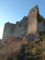
 Easy
Easy