Country:

 City:


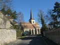

Start from the south car park of Auvers-sur-Oise station (one of the sections of the Transilien Line H).
(S/E) Enter the station and go down the stairs to pass under the railway line. Leave the station and turn left onto Rue du Général de Gaulle.
(1) With your back to the town hall, cross the road at the pedestrian crossing in front of the Auberge Ravoux. Turn left, then take Rue de la Sansonne on the right. Follow a ramp on the left to reach Rue Daubigny and continue straight on.
(2) At a small square, rejoin theGR®1by turning left onto Rue de Léry. Pass Rue des Ponceaux and then Rue Callé on your left.
(3) Opposite the entrance to the Château d’Auvers-sur-Oise, use the pedestrian crossing and then head up Rue François Mitterrand on the right.
(4) Turn left onto Rue des Carrières Notre-Dame, then right onto Chemin de la Longue Rue. Ignore the paths branching off to the left or right. At the junction at the bottom of the descent, cross Chemin de la Chevalerie to head up Chemin des Clos. Ignore a path on the right. Head down the third path marked in red and white on the left.
(5) Head up Rue de la Chérielle to the right. Continue to the end of Chemin des Monts.
(6) Turn right onto the Chemin des Glaises and ignore a path branching off to the right. You’ll come to a fork.
(7) After a narrow path on the left, pass the Chemin des Houx on your right. Continuing along the Chemin des Glaises, follow the Chemin du Gobelin. On the descent, turn right. Pass the small flight of steps and go down the slope which leads to Rue du Valhermeil.
(8) Turn left twice in succession onto the Chemin de la Vallée de Cléry. A little further on in the woods, let a path branch off to the right. At the Stop sign, cross the D 927 carefully and continue straight on through the fields.
(9) Before reaching the cross, turn left onto the Vieux Chemin de Pontoise. Ignore the paths branching off to the left and then to the right.
(10) Ignore Rue de la Mare on the left, then take the first turn left then right. Ignore the paths branching off to the right and left until you reach a crossroads with a cross; turn right and carry on straight ahead. At the second ‘Stop’ sign, turn into Rue du Chêne and, after No. 33 – just as Rue du Chêne turns left – turn into Allée des Lilas against the flow of traffic and immediately turn left between the two blocks of houses.
(11) Cross the D 927Z with care and take the road opposite, which is closed to all motor vehicles. First turn left then right, then follow the Fond de Saint-Antoine to the main road.
(12) Carefully cross the Route d’Osny to reach the tunnel that passes under the D 27. Continue along the path with your back to the roundabout. Ignore a path on the left, then turn right into the woods.
(13) At the road, first turn left then right and pass a yellow-markedPR® sign on your left. Follow Rue de Vaunay to the right as far as Livilliers church.
(14) Take the pedestrian crossing and go round the church on the right. Leave theGR®1by taking the second right and, after the basketball court, take the path on the right. At the crossroads, first turn right then left. At the end, turn left and pass under the high-voltage power lines, then turn right to reach the D 927.
(15) Cross the road carefully and continue through the fields. At the four-way junction, leave the yellow markings and turn left at a 90° angle.
(16) At the next junction, which also has four directions, keep to the left. At the roundabout, head straight ahead. Ignore the dead-end road.
(17) Walk to the back of the church. On the left, take a path and turn right onto the D 928. 50 metres before the roundabout, turn right. Ignore a path coming from the right.
(16) At the junction you passed earlier, take the path on the left. Continue straight on until you reach the D 27.
(18) Cross the road and, after the pond, turn right. Enter a small wood. Back in the fields, at the four-way junction, turn left onto the Chemin du Haut Buisson and, at the next junction, take the Chemin des Houx straight ahead to reach a fork you passed on the way out.
(7) Join theGR®1that you took on the way out, turning left. Ignore a path branching off to the left. You’ll come to the crossroads you passed on the way out.
(6) Leave theGR®1by first turning left then right to head down Chemin des Meulières. Continue left twice along Rue des Meulières until you reach the end of the street.
(19) Turn right onto Rue François Coppée, which leads into Rue Rémy.
(20) After a right-left turn, start along Rue du Docteur Gachet. Continuing on from Rue Gachet, follow Rue Victor Hugo. After the one-way Rue Roger, turn right down Rue Frédéric Fabre.
(21) Cross at the pedestrian crossing and turn left onto Rue Carnot. Pass two streets on your right.
(1) At the junction, take Rue du Général de Gaulle straight ahead. Very soon, turn right, pass to the left of the town hall, then turn left onto Passage des Tournesols, which runs alongside the railway line to the station. Enter the station as you did on the way there to take the tunnel and reach the car park (S/E).

 Visorando Member
 Moderate

 Very difficult
 Association / Club / Walk leader

 Easy