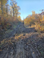
Circular walk in the Mormal State Forest from Locquignol

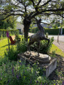
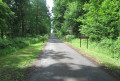
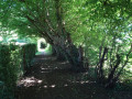
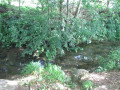
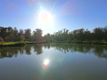
Set off to explore this route and let yourself be charmed by a nature getaway in the heart of the Mormal State Forest. Starting from the central square of the village of Locquignol, this invigorating circular route invites you to enjoy a moment of absolute tranquillity and leads you to the picturesque Étang de la Pâture d’Haisne. It’s the ideal route for recharging your batteries with family or friends. Between land and water, treat yourself to a breath of fresh air and come and admire the rich local flora and fauna on a lovely walk that’s accessible to everyone!

Details

n°111876182
Creation:
Last update:
Last review:
–
  • Walking
    Activity: Walking
  • ↔
    Distance: 5.88 mi
  • ◔
    Average duration: 2h 45 
  • ▲
    Difficulty: Easy

  • ⚐
    Back to start: Yes
  • ↗
    Ascent: + 39 ft
  • ↘
    Descent: - 39 ft

  • ▲
    Highest point: 554 ft
  • ▼
    Lowest point: 489 ft

Photos

Description of the walk

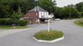
Park in the village’s central square, near the town hall (free parking).

(S/E) Opposite the town hall, turn left towards Aulnoye - Berlaimont. Take the pavement on the left.

(1) At the bend, ignore a return path on the right and continue along the pavement until you reach the ‘Chez Mado’ hiking café. Carry on for 60 metres.

(2) Pass another return path on the right and you’ll soon reach a fork in the road.

(3) Turn left onto the Chemin de la Maîtrise. After about 70 m, turn right onto a forest track (the Carnoy to Locquignol path) to reach the Route Forestière de La Flaquette (GR® 122).

(4) Turn left onto the GR®, ignoring three forest tracks and paths on the right, to reach a fourth junction after 1,100 m.

(5) Turn left, heading south-west along the Laie St-Hubert, cross the RD 33 with care and continue for 250 m until you reach the first junction.

(6) Turn left onto the Laie du Vert Donjon and walk for about a hundred metres.

(7) Turn left onto the Sentier du Pont à Vaches à la Chênaie and continue straight on for 650 metres until you reach the edge of the forest. Turn right, heading south, and follow the edge of the forest for approximately 450 metres.

(8) Once back on the Laie du Vert Donjon, follow it to the left and continue for 550 metres until you reach a junction with several forest tracks.

See “Practical Information”

(9) Turn left, heading north-east, onto the Laie Pâture d’Haisne and walk 300 metres to a T-junction

(10) Take the left-hand branch, which takes you round the “Pâture d’Haisne” pond and back to the junction.

(10) Head straight ahead onto the route marked “Boucle des Fontaines”. Continue in this direction until you reach the hamlet of Vert Donjon, 300 m away.

(11) Turn right onto a forest track, and after 450 m, turn left and continue for 250 m.

(12) Turn right and continue along the path until you reach Carrefour de la Touraille.

(13) Cross the D233 with care and head straight on along the Route d’Hercq towards Hargnies. Walk for about a hundred metres until you reach a junction.

(14) Take the Chemin des Grandes Pâtures and continue for 360 m until you reach a forest track a few metres past an EDF pylon (Please note: the entrance to the track is not very obvious).

(15) Turn left onto this path, cross the Route d’Hercq in Hargnies, and head straight ahead onto another path. After 350 metres, pass a wooden footbridge on your left and continue along this path, which runs along the edge of the forest for about 1 km, until it joins the D33 road.

(2) Follow it to the left, in the opposite direction to the outward journey, cross the Ruisseau l’Écaillon, and immediately turn left onto a country lane, emerging a little further on onto the D33 – don’t forget to take a look at the little wash house at Locquignol as you pass.

(1) Continue left along the D33, in the opposite direction to your outward journey, and return to the car park (S/E).

Waypoints

  1. S/E : mi 0 - alt. 515 ft - Town hall car park
  2. 1 : mi 0.11 - alt. 505 ft - Common junction for out-and-back route
  3. 2 : mi 0.2 - alt. 515 ft - Common junction for out-and-back route - Ecaillon (rivière)
  4. 3 : mi 0.22 - alt. 515 ft - Chemin de la Maîtrise
  5. 4 : mi 0.41 - alt. 535 ft - GR122
  6. 5 : mi 1.09 - alt. 518 ft - Laie Saint-Hubert
  7. 6 : mi 1.63 - alt. 489 ft - Laie du Vert Donjon
  8. 7 : mi 1.69 - alt. 499 ft - The Pont à Vaches to La Chênaie Trail
  9. 8 : mi 2.32 - alt. 522 ft - Laie du Vert Donjon
  10. 9 : mi 2.71 - alt. 535 ft - Laie pasture in Haisne
  11. 10 : mi 2.89 - alt. 531 ft - Entrance to the - Étang de la Pâture d'Haisne
  12. 11 : mi 3.62 - alt. 512 ft - Forest path
  13. 12 : mi 4.05 - alt. 518 ft - Forest path
  14. 13 : mi 4.35 - alt. 548 ft - Route d’Hachette (D233)
  15. 14 : mi 4.43 - alt. 548 ft - Chemin des Grandes Pâtures
  16. 15 : mi 4.65 - alt. 554 ft - Forest path
  17. S/E : mi 5.88 - alt. 515 ft - Town hall car park

Notes

Picnic tables near the Étang de la Pâture d’Haisne. Restaurant in Locquignol.

In wet weather, waterproof footwear (or wellington boots) is essential to cross the logging areas and where wild boars have dug (particularly between (6) and (8).

Please note: if the start of the path at (4) is not visible (logging operations on 15/11/2026), continue straight ahead to reach point (5).

Following the storms in September and October 2026, a few trees have fallen across the paths. However, there are no particular difficulties.

Worth a visit

Do take a detour to the Church of Saint-Pierre in Locquignol. Rebuilt after the terrible hurricane of 1876, this typical brick church houses, behind its unadorned façade, a remarkable collection of 18th-century furnishings.”

There are a few chapels and calvaries to discover along the route, notably the Calvaire des Grandes Pâtures and the Chapelle de l’École, dedicated to Saint Sylvester.

Always be cautious and plan ahead when you're outdoors. Visorando and the author of this route cannot be held responsible for any accidents occurring on this route.

The GR® and PR® markings are the intellectual property of the Fédération Française de Randonnée Pédestre.

Other walks in the area

For more walks, use our search engine .

The GPS track and description are the property of this route's author. Please do not copy them without permission.