Country:
 City:


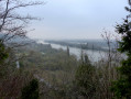
Parking is available in the car park next to the Rond-Point du Nouveau Monde, at the lower end of the Essarts D938 route, where there is also a bus stop for lines F9 and G on the Astuce network.
(S/E) Head towards the car park exit and turn right onto Rue Gustave Coudert. Turn left immediately onto the uphill road, Chemin des Sangles, until you reach the first right-hand bend. Turn left onto the path leading uphill into the forest, Chemin de la Roche Foulon.
(1) Ignore the path on the left – this will be your return route – and follow the path straight ahead, ignoring another turn-off to the left, and continue until you reach the signpost for ‘Troglodytes’.
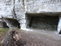
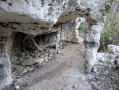
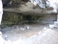
(2) Turn right, following the signs for ‘Troglodytes’. Walk past the troglodyte caves and continue for about 900 metres until you reach the first path on your left.
(3) Turn left, following the yellow markings. Follow this path, ignoring two turn-offs to the left. At the next T-junction, turn right and continue until you reach the third turn-off on the right, marked with yellow markings.
(4) Turn right, go straight on, ignoring the turnings on the left and right, until you reach a tarmac road after about 750 m.
(5) Ignore the road, follow the path on the right for a few metres and turn left immediately; continue for about 1 km until you reach the T-junction directly opposite the power line.
(6) Ignore the track branching off to the left and take the first turn right then left, following the yellow markings. Follow this track, turn onto the first track on the left and continue to the wire-mesh gate.
(7) Go through the gate and follow the tarmac road on your left until you reach the first road junction in a residential area.
(8) Turn left onto Rue du Pavillon and continue to the end. Pass the large building on your left, the Institut Médico-Éducatif les Montées. Continue to the car park, a few metres further on, at the edge of the woodland on your left.
(9) Ignore Rue des Tribunes on your right, as well as the cycle path running parallel to it. Take the path leading into the woodland directly opposite. Ignore a turn-off on your left and continue along this path on your right until you reach Route Forestière des Roches.
(10) Cross it and carry on straight ahead. Follow the wider path, which is tarmac in places, running alongside the D938 (formerly the Circuit des Essarts) on your right. Continue down this wide path until you reach a tarmac road that curves sharply to the right.
(11) Turn right, walk 140 m and turn left onto the path which climbs quite steeply. At the first T-junction, turn left, ignore the next left-hand turn-off and continue to the right, following the yellow markings, downhill to the third junction you passed on the way out.
(1) Turn right and, following the route in the opposite direction to the outward journey, return to the car park at the Rond Point du Nouveau Monde (S/E).

 Visorando Member
 Moderate