Vanook Circular Trail

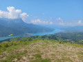
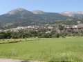
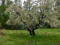
A circular loop beneath the foothills of Mont Guillaume offering views over the Embrun region. A short walk in the footsteps of Vanook.

Details

31696190
Creation:
Last update:
Last review:
  • Walking
    Activity: Walking
  • ↔
    Distance: 1.80 mi
  • ◔
    Average duration: 1h 25 
  • ▲
    Difficulty: Moderate

  • ⚐
    Back to start: Yes
  • ↗
    Ascent: + 676 ft
  • ↘
    Descent: - 679 ft

  • ▲
    Highest point: 4,518 ft
  • ▼
    Lowest point: 3,839 ft

Description of the walk

Take the D9 and, when you reach Puy-Sanières, follow the D309 towards Le Serre. Park where you can in the village square.

(S/E) From the village square, continue on foot along Impasse du Serre; when you reach a private car park, turn left and head uphill to join the path. Follow this northwards until you reach a track.

(1) At this junction, take the path on the right. At its end, continue along a track that passes through a wetland. Then walk along a balcony-like path through an open area and pass under a high-voltage power line. Continue parallel to the power line and look out for a discreet start to a path on the left.

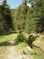
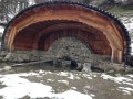
(2) Take this path on the left, which winds upwards in switchbacks before reaching a flat area. The path continues through a wooded area criss-crossed by numerous offshoots and tracks. Ignore these offshoots and follow the Sentier de Vanook carefully, guided by the numerous cairns and prominent red markings. You will reach the Fontaine de Vanook.

(3) Carry on along the same path, which descends through the woods. Further down, at a junction, turn left (leaving the path shared with the Fontaines trail). The path alternates between wooded areas and meadows, and the view opens out. Continue to the junction you took on the way there.

(1) Carry on straight ahead and, following the route in the opposite direction to the outward journey, return to the car park (S/E).

Waypoints

  1. S/E : mi 0 - alt. 3,842 ft - Car park at Impasse du Serre
  2. 1 : mi 0.26 - alt. 4,039 ft - Junction of the circular loop
  3. 2 : mi 0.74 - alt. 4,259 ft - Start of the trail
  4. 3 : mi 0.98 - alt. 4,469 ft - Fontaine de Vanook
  5. S/E : mi 1.8 - alt. 3,839 ft - Car park at Impasse du Serre

Notes

Although you’ll pass the Fontaine de Vanook, make sure you take water with you, especially in summer.

This walk faces due south: bear this in mind, especially in summer, even though you’ll often be in wooded areas.

The trail is fully signposted in red.

Worth a visit

Serre-Ponçon Lake, Embrun.

Reviews and comments

4.3 / 5
Based on 2 reviews

Reliability of the description
4.5 / 5
Ease of following the route
4.5 / 5
Route interest
4 / 5
mimipinson33
mimipinson33

Overall rating : 4 / 5

Date of your route : Aug 15, 2023
Reliability of the description : ★★★★☆ Good
Ease of following the route : ★★★★☆ Good
Route interest : ★★★★☆ Good
Very busy route : No

Hike completed on 29 July 2023
The final section of the ascent is very steep, very narrow and on a slope, which makes this part not as easy as it might seem for people of average fitness or those with young children. On the way back, there is also a section over scree which is a bit exposed, so it should be avoided by those who are afraid of heights. Even so, the walk as a whole is pleasant and not difficult

Machine-translated

patembrun
patembrun

Thank you, that’s been corrected for Impasse du Serre.

Machine-translated

sophie Revenaz
sophie Revenaz

Overall rating : 4.7 / 5

Date of your route : Jun 11, 2023
Reliability of the description : ★★★★★ Very good
Ease of following the route : ★★★★★ Very good
Route interest : ★★★★☆ Good
Very busy route : No

A lovely little path.
The start was a bit tricky to find; in the hamlet of Le Serre, you had to take the Impasse du Serre rather than the main road, but the directions were perfectly clear from then on.
The path was blocked after the fountain by a sheep farm, and as the sheepdogs don’t like being disturbed, we preferred to head back up a little to the ‘Sentier des Fontaines’, which we followed for a while before coming out onto a forest track and arriving back at Le Serre without any trouble.
It’s the same old problem in spring, but here everything worked out easily.

Machine-translated

Other walks in the area

For more walks, use our search engine .

The GPS track and description are the property of this route's author. Please do not copy them without permission.