Circular walk starting from Saône

Walk starting from Saône towards Gennes and back via the Bois de la Petite Chevillotte.

Details

12122071
Creation:
Last update:
Last review:
  • Walking
    Activity: Walking
  • ↔
    Distance: 6.62 mi
  • ◔
    Average duration: 3h 15 
  • ▲
    Difficulty: Moderate

  • ⚐
    Back to start: Yes
  • ↗
    Ascent: + 269 ft
  • ↘
    Descent: - 246 ft

  • ▲
    Highest point: 1,463 ft
  • ▼
    Lowest point: 1,266 ft
  • ⚐ Country: France
  • ⚐ City: Saône (25660)
  • ⚑
    Start/End: N 47.226125° / E 6.116598°
  • ❏
    IGN map(s): Ref. 3323ET
  • Hour-by-hour weather

Photos

Description of the walk

Park on Rue de la Mairie, in the small car park below the wash house.

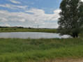
(S/E) After the washhouse, take the Route de Genne, which will become closed to motorists after a few metres. Stay on this road until you reach the D464, which you follow alongside. Pass the small pond (the “Creu des Poissons”)

(1) Before a roundabout, turn right onto Rue de la Combe Guérin, then take the first path on the left.

(2) Turn right onto a tarmac road and follow it until you reach a T-junction, after the telecoms mast.

(3) At the junction, turn left, then take the first path on the right which leads into the Bois de la Petite Chevilotte.

(4) Cross the road and continue straight on through the Bois de la Sagette until you reach a road.

(5) At the road, turn right, follow the yellow and blue markings for the Sentier des Essarts and walk about a hundred metres along the road, then take the first path on the left. Pass under the power lines.

(6) At the Fork in the road, take the path on the right. At the top, you’ll reach Saône via Rue des Prairies.

(7) Continue straight on along Rue des Ronces.

(8) At the end, turn right onto the Grande Rue (D246).

(9) After the chemist’s, turn left onto Rue de la Mairie, which will take you back to the starting point (S/E).

Waypoints

  1. S/E : mi 0 - alt. 1,283 ft - Parking near the wash house, Rue de la Mairie
  2. 1 : mi 1.29 - alt. 1,280 ft - Turn right at the fork
  3. 2 : mi 1.53 - alt. 1,289 ft - Rue de la Combe d’Argent
  4. 3 : mi 2.5 - alt. 1,401 ft - EDF substation
  5. 4 : mi 3.56 - alt. 1,437 ft - Exit from the Bois de la Petite Chevillotte
  6. 5 : mi 4.57 - alt. 1,417 ft - Sentier des Essarts
  7. 6 : mi 5.03 - alt. 1,417 ft - The Champs de Pénéval
  8. 7 : mi 5.88 - alt. 1,404 ft - Rue des Prairies
  9. 8 : mi 6.22 - alt. 1,306 ft - Grande Rue
  10. 9 : mi 6.49 - alt. 1,302 ft - Rue de la Mairie
  11. S/E : mi 6.62 - alt. 1,283 ft - Parking near the wash house, Rue de la Mairie

Reviews and comments

4.3 / 5
Based on 4 reviews

Reliability of the description
4.8 / 5
Ease of following the route
4.5 / 5
Route interest
3.5 / 5
User 18170601

Overall rating : 4.3 / 5

Date of your route : Jul 06, 2026
Reliability of the description : ★★★★★ Very good
Ease of following the route : ★★★★★ Very good
Route interest : ★★★☆☆ Average
Very busy route : No

A route with little shade; best avoided in hot weather.

Machine-translated

wassi2015
wassi2015

Overall rating : 4.3 / 5

Date of your route : Mar 12, 2026
Reliability of the description : ★★★★★ Very good
Ease of following the route : ★★★★☆ Good
Route interest : ★★★★☆ Good
Very busy route : Yes

enjoyable to do.

Machine-translated

augustine
augustine

Overall rating : 4 / 5

Date of your route : Feb 26, 2026
Reliability of the description : ★★★★☆ Good
Ease of following the route : ★★★★☆ Good
Route interest : ★★★★☆ Good
Very busy route : Yes

Hike completed under beautiful sunshine.

Machine-translated

Éric Denisot
Éric Denisot

Having lived in Saône for a few years, we weren’t familiar with this circular walk. So the idea of exploring new trails right on our doorstep was quite appealing.
We followed the route using the app. I didn’t pay much attention to the signposting. But there aren’t any signs on the route – you just have to let the app guide you.
A bit too much road for our liking. Be careful in the height of summer!
Half of the route is through woodland, which makes it more enjoyable.
All in all, it was well worth exploring.

Machine-translated

Paps
Paps

Overall rating : 4.3 / 5

Date of your route : Aug 28, 2023
Reliability of the description : ★★★★★ Very good
Ease of following the route : ★★★★★ Very good
Route interest : ★★★☆☆ Average
Very busy route : No

It is a easy route, much of which takes place through woodland.

Machine-translated

Other walks in the area

For more walks, use our search engine .

The GPS track and description are the property of this route's author. Please do not copy them without permission.