Neptune’s circular buckle in Andernay

From the Fountain of Neptune on the banks of the Saulx, via the Bubbling Fountain, this route takes you to meet Neptune, the ancient god of the waters.

This walk offers two distinct circular loops: the first is a longer route through the forest, whilst the second mainly follows dirt tracks.

Details

n°9191547
Creation:
Last update:
Last review:
  • Walking
    Activity: Walking
  • ↔
    Distance: 6.42 mi
  • ◔
    Average duration: 3h 10 
  • ▲
    Difficulty: Moderate

  • ⚐
    Back to start: Yes
  • ↗
    Ascent: + 262 ft
  • ↘
    Descent: - 279 ft

  • ▲
    Highest point: 607 ft
  • ▼
    Lowest point: 449 ft
  • ⚐ Country: France
  • ⚐ City: Andernay (55800)
  • ⚑
    Start/End: N 48.791289° / E 4.954131°
  • ❏
    IGN map(s): Ref. 3014E, 3015E
  • Hour-by-hour weather

Photos

Description of the walk

Start at the church square in Andernay.

(S/E) Begin your walk around the church square in an anti-clockwise direction. Cross the D995 using the pedestrian crossing and follow the road to the right. Turn into thefirst street on the left, Rue Varnerot, towards the Fontaine Bouillonnante.

(1) Cross the Chemin de Derrière les Jardins on your left and continue straight on along the Chemin de la Fontaine. Pass a riding centre on your left and continue along a dirt track.

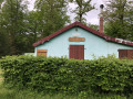
(2) At the Fork in the road, keep to the right (yellow and black markings). Stay on the main track and ignore the side paths. Pass the Loge de chasse de la Bouillonnante and reach a junction about fifty metres further on.

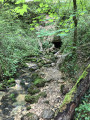
(3) Then take the path on the right. This shaded path soon turns left and leads to the Fontaine Bouillonnante.

(4) Leave the path to the left and, after about thirty metres, you’ll reach the fountain. Retrace your steps.

(4) Cross the small bridge and turn left. At the T-junction, turn left. After about 150 m, take thefirst path on the right.

(5) At the end of the path, turn left (north-east) and walk alongside a conifer plantation on your right. Cross two streams using the wooden stepping stones.

(6) Directly beneath a high-voltage power line, take the path on the left that runs between plots 22 and 23. At the T-junction, turn right. Cross a stream and you’ll immediately reach a junction.

(7) First turn left then right onto a grassy path. Join a track and follow it, veering slightly to the left. Ignore a turn-off on the right and then one on the left, cross a river and you’ll immediately reach a junction you passed on the way out.

(2) Turn right towards the village. Pass the riding centre and reach a junction you have already passed through.

(1) Turn right onto the Chemin de Derrière les Jardins. At the three-way junction, take the right-hand branch. Pass under two high-voltage power lines and arrive at a crossroads.

(8) First turn left then right to follow a path eastwards into the Bois du Rulot. You’ll come to a T-junction.

(9) Turn left, then ignore a path branching off to the right. At the next junction, veer left, passing a hunting lodge on your right. You’ll arrive near the River La Saulx (with access to a fountain on the left).

(10) Carry on straight ahead, keeping parallel to the river, which lies some distance to your right.

(11) Cross the D995. Immediately afterwards, turn left onto a path leading back up to the village. Join the D955 and follow it along the pavement. At the church, turn right to return immediately to the starting point (S/E).

Waypoints

  1. S/E : mi 0 - alt. 505 ft - Église Notre-Dame de l'Assomption (Andernay)
  2. 1 : mi 0.28 - alt. 512 ft - Ch de la Fontaine x Ch de Derrière les Jardins
  3. 2 : mi 0.63 - alt. 479 ft - Trident
  4. 3 : mi 1.24 - alt. 577 ft - Intersection
  5. 4 : mi 1.53 - alt. 489 ft - Bubbling Fountain
  6. 5 : mi 1.86 - alt. 587 ft - Intersection
  7. 6 : mi 2.35 - alt. 594 ft - A junction directly beneath a high-voltage power line
  8. 7 : mi 2.66 - alt. 568 ft - Crossroads
  9. 8 : mi 4.1 - alt. 531 ft - Crossroads
  10. 9 : mi 4.74 - alt. 581 ft - T-junction
  11. 10 : mi 5.53 - alt. 453 ft - Access to a fountain is possible - Saulx (rivière) à finaliser
  12. 11 : mi 5.99 - alt. 459 ft - Crossing the D955
  13. S/E : mi 6.42 - alt. 505 ft - Église Notre-Dame de l'Assomption (Andernay)

Worth a visit

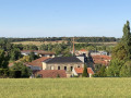
The Church of the Assumption, dating from the 13th and 16th centuries, in Andernay.
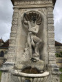
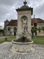
Neptune’s Fountain.
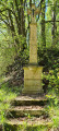
The Bubbling Fountain.

In the early 19th century, thanks to the sale of timber, the commune of Andernay enjoyed a healthy financial position.
Keen to improve the daily lives of its inhabitants, most of whom were livestock farmers, the first drinking-water fountain was built – and the only one in Lorraine fed by a natural spring.
The surplus water was used partly to supply the livestock troughs, but also to feed the communal washhouse.
Thus, in 1939, this complex water distribution system was designed, the centrepiece of which – the village fountain – was adorned with a statue of Neptune created by the famous Meuse-based funerary sculptor Jean-Joseph Caveneget (1806–1870).
Set within a shell-shaped niche, the Roman god of springs and running waters is depicted here threatening a dolphin with his trident. Water pours from the dolphin’s mouth into a distribution basin before flowing into a semi-circular receptacle.

Reviews and comments

4.7 / 5
Based on 1 review

Reliability of the description
5 / 5
Ease of following the route
5 / 5
Route interest
4 / 5
Nh6165
Nh6165

Overall rating : 4.7 / 5

Date of your route : Jun 08, 2022
Reliability of the description : ★★★★★ Very good
Ease of following the route : ★★★★★ Very good
Route interest : ★★★★☆ Good
Very busy route : Yes

The Neptune Circular Route is divided into two ‘sub-circles’, each starting from a different location in Andernay and which can be walked independently of one another.
In the current description, the first section takes us through the woods of Andernay along a varied route, both in terms of vegetation and terrain. The second section follows more ‘dirt tracks’, forest tracks or field paths, and proves less pleasant to walk. There are not many sections sheltered by the canopy.

Machine-translated

Other walks in the area

For more walks, use our search engine .

The GPS track and description are the property of this route's author. Please do not copy them without permission.