Vrsic Pass Circular Route

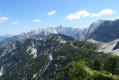
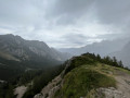
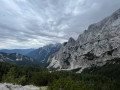
A magnificent, easily accessible viewpoint over the Limarica and Suha Pišnica valleys, as well as the source of the Soča river in good weather. It’s also the perfect spot for a midday meal or a snack.

Details

24967608
Creation:
Last update:
Last review:
  • Walking
    Activity: Walking
  • ↔
    Distance: 1.63 mi
  • ◔
    Average duration: 1h 05 
  • ▲
    Difficulty: Easy

  • ⚐
    Back to start: Yes
  • ↗
    Ascent: + 381 ft
  • ↘
    Descent: - 381 ft

  • ▲
    Highest point: 5,653 ft
  • ▼
    Lowest point: 5,272 ft

Photos

Description of the walk

You can start the walk from anywhere in the car park along the main road to the pass (206).

(S/E) Depending on where you are parked, make your way to the end of the car park area on the Col de Vrisc side, where there is a wooden hut and a viewpoint. Just before the road starts to descend, a path leads uphill to the left; take this path. Follow this path as it climbs; it turns into a white gravel track after about 100 m, passing a mountain hut.

After climbing for about 600 m, continue along the white path, taking a hairpin bend to the left.
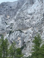
Keep following the same white path and, after about 300 m, opposite you, carved into the mountain rock, you can make out a face. Walk a further 200 m or so along the path to reach the Col de Vrsic mountain hut: Postraski Dom Na Vrsicu (toilets, bar, food and drink).

(1) On leaving the refuge, turn left towards the pass. Follow the path, which narrows and begins to climb. After about 10 minutes’ climb along the winding path (be careful not to confuse it with the stream bed), you will reach the Vrsic Pass. You can admire a magnificent 360° panorama.

(2) Descend from the pass via the same route to return to the clearing by the refuge. Once you reach the plateau, turn left to rejoin the white path, which descends slightly. Follow it for about 300 m to reach the first hairpin bend.

(3) At this first hairpin bend, take a small path that continues straight on and descends directly to the third hairpin bend (or continue along the white path to this same third hairpin bend, which is a longer route). Then leave the white path to take a small path that crosses the forest.

Follow it for about 550 m until, just after a small clearing, you join another white path which, further on, winds its way down. After 350 m on the descending white path, including two hairpin bends, you’ll reach the main road at the pass, which runs alongside the car park (206). Turn left and continue along the road to return to your car (S/E). A small, raised path on the left is passable if you prefer not to walk on the road.

Waypoints

  1. S/E : mi 0 - alt. 5,272 ft - Car park along the road to the pass
  2. 1 : mi 0.59 - alt. 5,541 ft - Postarski Dom Na Vrsicu mountain hut
  3. 2 : mi 0.74 - alt. 5,650 ft - Vrsic Pass
  4. 3 : mi 1 - alt. 5,466 ft - Route to follow
  5. S/E : mi 1.63 - alt. 5,272 ft - Car park along the road to the pass

Notes

The quickest and easiest way to get to the starting point is by car. Please note, however, that the car park fills up quickly, so it can sometimes be difficult to find a space. You may have to wait your turn...
The road over the pass (206) is also very well known and popular with cyclists. It’s much easier to park there, but it’s a more challenging route and best suited to experienced walkers

The walk can be done in either direction.

I recommend wearing walking boots (the paths are rocky, with roots and loose earth). This can help prevent you from slipping on both the ascents and descents. In particular, when it’s raining, the forest path can be more slippery.

Remember to take water with you, even though there are mountain huts along the way.

Always be careful and prepared when out hiking. Visorando and the author of this guide cannot be held liable for any accidents or incidents of any kind that may occur on this route.

Worth a visit

  • During the hike:


# As mentioned in the description, there are two mountain huts along this route. The second is situated right next to the pass. Both offer the same facilities, and you can enjoy local specialities there.
They also serve as water points where you can buy various drinks or simply ask to have your water bottles topped up.
Toilets are also available there.

  1. About 1 km from the indicated starting point, heading in the direction of the walk, you’ll be able to see a face taking shape in the rock face of the mountain opposite.
  2. Of course, the highlight of this hike is crossing the Vrsic Pass with its 360° view of the two surrounding valleys and the mountain ranges encircling them.
  3. You may be lucky enough to spot sheep roaming freely around the pass, on the paths and roads in the vicinity.
  • Nearby:


# There are plenty of walks starting from the pass, specifically from the car park by the road leading up to it.

  1. Just before reaching the pass, you can stop off at the Russian Chapel. This is situated beside the main road (206). It was built in memory of the Russian prisoners of the First World War who died whilst building this road.
  2. Further along Route 206, as you descend on the other side of the pass (towards the Soča Valley), you can stop to see the statue of Julius Kugy.
  3. Continuing further along this main road (206), you’ll reach the Soča Valley, where you can admire the river’s Small and Great Gorges.

Reviews and comments

4.7 / 5
Based on 4 reviews

Reliability of the description
5 / 5
Ease of following the route
4.8 / 5
Route interest
4.3 / 5
raymondos57
raymondos57

Overall rating : 4.7 / 5

Date of your route : Jul 13, 2026
Reliability of the description : ★★★★★ Very good
Ease of following the route : ★★★★★ Very good
Route interest : ★★★★☆ Good
Very busy route : No

A short walk before heading down into the Soća Valley
The views are stunning!

Machine-translated

KateD
KateD

Overall rating : 4.7 / 5

Date of your route : Aug 19, 2024
Reliability of the description : ★★★★★ Very good
Ease of following the route : ★★★★☆ Good
Route interest : ★★★★★ Very good
Very busy route : No

A lovely circular path with little difficulty (unless you decide to visit the viewpoint (2), which involves a steep climb – in which case you’ll need good walking shoes). There are sunny sections but also quite a few in the shade, which means you can do it even at midday in the height of summer 👌 (fewer people, I think, than at other times of day)
There are two small huts along the way where you can grab a bite to eat or extend your outing. I combined this walk with a swim in the cool Jezero Jasna lake, where the view of the mountains is simply magnificent!

Machine-translated

denis.meens
denis.meens

Overall rating : 4.7 / 5

Date of your route : Sep 10, 2023
Reliability of the description : ★★★★★ Very good
Ease of following the route : ★★★★★ Very good
Route interest : ★★★★☆ Good
Very busy route : No

Beautiful scenery

Machine-translated

Patrican
Patrican

Overall rating : 4.7 / 5

Date of your route : Oct 05, 2023
Reliability of the description : ★★★★★ Very good
Ease of following the route : ★★★★★ Very good
Route interest : ★★★★☆ Good
Very busy route : No

A very easy one-hour circular walk that takes you through a variety of landscapes.

Machine-translated

Other walks in the area

For more walks, use our search engine .

The GPS track and description are the property of this route's author. Please do not copy them without permission.