Starlings in the Pays Fort

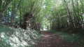
In this undulating landscape of the Pays Fort, the walk winds its way through pastures, farmland and wooded areas rich in game, following the ‘bouch’tures’ – a term used by the people of Berry to describe the tall hedgerows lining the hedgerow-lined paths.

Details

2609039
Creation:
Last update:
Last review:
  • Walking
    Activity: Walking
  • ↔
    Distance: 7.84 mi
  • ◔
    Average duration: 4h 00 
  • ▲
    Difficulty: Moderate

  • ⚐
    Back to start: Yes
  • ↗
    Ascent: + 440 ft
  • ↘
    Descent: - 443 ft

  • ▲
    Highest point: 899 ft
  • ▼
    Lowest point: 656 ft

Photos

Description of the walk

Start from the car park near the church in Pierrefitte-ès-Bois

(S/E) From the car park, take Rue de la Mairie, which passes in front of the church and then the town hall, heading north-east.

(1) At the Fork in the road 200m past the town hall, continue along Rue de la Mairie towards Beaulieu. This narrow street becomes Route de Beaulieu just before a junction.

(2) Leave this narrow street and take a hard-standing track on the left towards La Cour. Pass the farm, avoiding the two private turnings on the left. As soon as you’ve passed La Cour farm, the hard-standing track gives way to a hedgerow-lined path. Follow this until you come to a cross-cutting hedgerow path, which you should take to the left.

(3) At the hamlet of Les Beaux Bois, take a sharp right-hand bend northwards onto the hedgerow-lined track, ignoring the small road ahead of it. Ignore the side turnings. The track becomes a gravel track as you approach Saint-Posent, then crosses a small side street.

(4) Turn left onto the lane known as ‘Les Pielleries’, then turn right at the hamlet of ‘Les Milleriaux’ onto the narrow street, ‘La Grande Pièce’ (do not head towards the centre of the hamlet), which is quickly followed by a little-used grassy path as soon as you pass the last house.

(5) Turn right at the junction with the D49, which you’ll leave after about a hundred metres to take a hedgerow-lined path on the left, just before the Pont des Gains. Follow the busiest path.

(6) After Les Quétinières, carry on straight ahead at the Fork in the road until you reach a crossroads.

(7) Cross the narrow street towards Les Étourneaux. The path becomes less well-travelled as soon as you pass the hamlet of Les Étourneaux.

(8) Turn left onto the cross-road, then left again onto the small road at the hamlet of Les Palliers. At Les Guilbaudières, keep to the right onto a hard-surfaced track at the Fork in the road just past the long farm building (cattle farm).

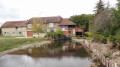
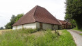
(9) Cross the D153. Opposite, the small road signposted ‘Le Moulin Botton’ is slightly set back to the right. On reaching Le Moulin Botton, turn left onto a quiet track just before the bridge over the Notreure, from where you can see the mill. The path first follows the river on the right-hand side, then moves away from it. Ignore the path branching off to the left.

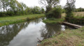
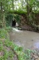
(10) At La Pinardière, the lane becomes tarmacked. Keep to the right at the Fork in the road to leave the tarmac and take a hedgerow path. This crosses the Notreure via a narrow footbridge and then passes through the hedgerow.

(11) Turn left at the junction with the D853 to walk alongside the ponds on your right and continue eastwards towards Pierrefitte-es-Bois. Once past the cemetery, turn left onto the Grande Rue, which leads to the car park near the church (S/E).

Waypoints

  1. S/E : mi 0 - alt. 692 ft - Car park near the church in Pierrefitte-ès-Bois
  2. 1 : mi 0.15 - alt. 712 ft - Rue de la Mairie towards ‘Beaulieu’
  3. 2 : mi 0.53 - alt. 751 ft - Gravel path on the left towards ‘La Cour’
  4. 3 : mi 1.05 - alt. 869 ft - A place known as Les Beaux Bois
  5. 4 : mi 2.19 - alt. 758 ft - On the left is the alleyway ‘les Pielleries’
  6. 5 : mi 2.97 - alt. 699 ft - Turn right at the junction with the D49
  7. 6 : mi 3.78 - alt. 761 ft - Les Quétinières
  8. 7 : mi 4.31 - alt. 886 ft - Opposite, head towards ‘les Étourneaux’
  9. 8 : mi 4.93 - alt. 797 ft - Turn left onto the cross-path
  10. 9 : mi 5.72 - alt. 728 ft - Opposite, the road is signposted ‘le Moulin Botton’
  11. 10 : mi 6.55 - alt. 735 ft - La Pinardière – Turn right towards the - Notreure (rivière)
  12. 11 : mi 6.89 - alt. 673 ft - Turn left at the junction with the D853
  13. S/E : mi 7.84 - alt. 692 ft - Car park near the church in Pierrefitte-ès-Bois

Notes

Most of the paths you’ll take are quiet. Wear suitable walking shoes.

Worth a visit

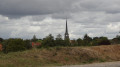
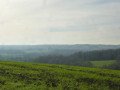
During the walk, you’ll enjoy the views over the rolling hills of the Sancerrois region and the hedgerow-lined countryside.

Reviews and comments

4.5 / 5
Based on 2 reviews

Reliability of the description
4.5 / 5
Ease of following the route
5 / 5
Route interest
4 / 5
Matt1678
Matt1678

Overall rating : 4.7 / 5

Date of your route : Feb 23, 2025
Reliability of the description : ★★★★★ Very good
Ease of following the route : ★★★★★ Very good
Route interest : ★★★★☆ Good
Very busy route : No

The route was very wet, but that’s normal for this time of year and given the weather!!!

Machine-translated

Abeille_65
Abeille_65
• Edited:

Overall rating : 4.3 / 5

Date of your route : Sep 16, 2024
Reliability of the description : ★★★★☆ Good
Ease of following the route : ★★★★★ Very good
Route interest : ★★★★☆ Good
Very busy route : No

For those who love the countryside, this is a lovely walk through woods and fields. The final tarmac section feels a bit long after walking along paths and tracks. Apart from a tree surgeon, I didn’t come across anyone else.
As there were few signposts, the map was a great help in finding my way. I must admit I only use the route description when I’m really in doubt, which wasn’t the case here.
Thank you for the walk.

Machine-translated

Other walks in the area

For more walks, use our search engine .

The GPS track and description are the property of this route's author. Please do not copy them without permission.