Country:

 City:
City:


Park in the car park of the Villechevène multi-purpose hall.
(S/E) Head straight on towards the church; at thefirst junction, turn right down Chemin de la Grange. Continue down to the bins and turn left onto Chemin des Placettes; carry on along the tarmac path to the right, then head uphill to the departmental road.
On your left you’ll see a small children’s playground and a picnic table. Carry straight on to join the D27: at the junction, you’ll see the Milottiers state school in the distance on your left.
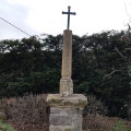
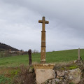
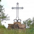
Cross the road and take the Montée de la Grande Croix opposite until you reach the hairpin bend to the right. On your left, you’ll see one of the village’s two wash houses and, on your right, the Grande Croix.
(1) Turn right onto the Chemin de la Terre Ronde. Pass the two factories; after the last one, continue straight on along the Chemin de Montlit.
Pass the Montlit cross on your right and, on your left, the private site featuring stone madonnas marking the places of the Virgin Mary’s apparitions around the world; there’s a lodge on the right, then further on a private pond on the left; carry on straight ahead until you reach the farm.
(2) Take the small dirt track on the right.
Reach the bottom of the path. Dangerous stretch: cross the departmental road and turn right, walking along the road for about a hundred metres.
At the junction, turn left down the tarmac-surfaced Chemin des Placettes again. You’ll reach another junction after the ‘30 km/h zone’ sign at the sewage treatment works.
(3) Turn left again onto Chemin de la Grange. Continue straight on along this tarmac track.
At the Grange cross, take thesecond track which slopes quite steeply down to the right.
At the bottom, turn right onto the tarmac track that goes round the house.
At the top of the path, turn left and carry on to the house at the end of the path.
Leave the house on your left and take the path on the right that leads up into the woods (dirt track).
Head towards the middle of the woods.
(4) Carry on straight ahead, leaving the path (not shown on the map) on your left.
As you come out of the woods, on the tarmac road, turn left towards the cross by the pond.
At the junction, head up to the right onto Chemin de Saint-Marcel, go round the back of the farm and carry on straight ahead along the tarmac track. You’ll reach the D4 road.
(5) Take care here: crossing is dangerous. Then head left towards the Brioude crossroads; at the junction, turn right onto the D27. Keep to the right for about a hundred metres until you reach the sign for the Lodge de la Hulotte, then take the tarmac track leading down Chemin du Gouby.
Walk past the Hulotte Lodge and continue down the tarmac track.
At the end of the tarmac road, go straight on, slightly to the left, onto the dirt track.
At a three-way junction, keep well to the left and do not take the tarmac road on the right, which is private.
At the end of the descent, turn right onto the dirt track.
At the next junction, turn left, not onto the private track on the right. You’ll reach the Ruisseau Gouby.
(6) Take the path that goes uphill.
Walk past the house and carry on straight ahead along the grassy track.
After thesecond house, at the end of the track, take the one on the right, then walk back down the dirt track a little way.
At the pond on your left, follow the path and begin the climb. At the top of this climb, you’ll reach
the Yellow Cross crossroads.
(7) Walk down Chemin de la Yellow Cross.
At the bottom of the path, take care here – there is another dangerous crossing. Head down the Impasse de l’École, slightly to the left.
In front of the primary school, go down the steps on your right.
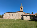
At the end of the path, turn right towards the church
Cross at the pedestrian crossings and keep heading towards the church along Rue de l’Église.
Opposite the church, walk down the street, keeping the town hall on your left. Continue until you reach the car park for the community hall (S/E).

 Association / Club / Walk leader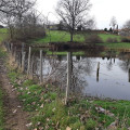
 Easy
Easy 
 Visorando Member