Country:

 City:
City:


Park near the Saint Crépin Post Office.
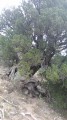
(S/E) Take the wide track that starts at right angles to the road (signposted ‘Les Guions’). Follow the yellow markings. At the first junction, ignore the canal path on both the right and left and continue straight ahead. After a few hairpin bends, you’ll reach the junction (signposted) by the juniper tree known as ‘l’Eléphante’.
(1) Take a short detour to explore this curiosity. Back at the junction, continue the climb and you’ll reach the hamlet of Les Guions with ease.
(2) Then turn right onto the dirt track serving this hamlet and follow it to the hamlet of Le Villard.
(3) At the crossroads, turn right onto the tarmac road and follow it for about 600 metres to rejoin the downhill path.
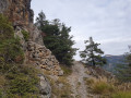
(4) Turn right (signposted) onto the wide track, which quickly becomes a path and winds through the woods via numerous tight bends. Ignore the path branching off to the left at the Torrent de Coste Chaude, and continue the descent to the right (signposted Saint Crépin). At the reservoir, take the path on the right – it’s a shortcut that leads to the Saint Crépin cemetery.
(5) Turn right onto the road, then right again at the crossroads, and you’ll easily reach the car park (S/E).

 Visorando Member