The Crête de Peyre Non

Pleasant circular walk on the western side of the Durance Valley.

Details

n°54736
Creation:
Last update:
Last review:
  • Walking
    Activity: Walking
  • ↔
    Distance: 4.60 mi
  • ◔
    Average duration: 4h 00 
  • ▲
    Difficulty: Average

  • ⚐
    Back to start: No
  • ↗
    Ascent: + 2,162 ft
  • ↘
    Descent: - 2,251 ft

  • ▲
    Highest point: 5,259 ft
  • ▼
    Lowest point: 3,009 ft

Description of the walk

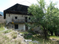
Park in the small car park in the picturesque village of Pra Reboul.
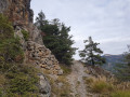
(S/E) Walk through the village, taking the narrow streets that lead to the houses at the top. Then take the main path, which climbs in numerous zigzags; the markings are very sparse (a few Yellow Circles) and there are a few signs bearing the number 4.
When you reach a sign pointing to Champaussel, follow this direction. You’ll arrive at this alpine hamlet.

(1) Continue due north via a shortcut off the path. Reach the path where a sign points to the Crête de Peyre Non. At the hairpin bend to the left, take the shortcut which rejoins the path at the 1463 mark.

(2). Cut across the hairpin bends of the track once more and, via a final climb through the woods, reach the sign indicating the highest point of this ridge.

(3) Join the forest road coming from La Roche de Rame. Follow it to the bend where a new sign points towards Champaussel.

(4). Take this path on the left to rejoin another forest track.

(5) Turn left onto it and stay on it until you reach another sign also pointing to Champaussel and Pra Reboul.
Follow this path; Champaussel is easily reached.

(1) Turn right to retrace your steps, heading back to Pra Reboul and the car park (S/E).

Waypoints

  1. S : mi 0 - alt. 3,097 ft - Pra Reboul car park
  2. 1 : mi 0.75 - alt. 4,236 ft - Champaussel
  3. 2 : mi 1.15 - alt. 4,731 ft - Elevation 1463
  4. 3 : mi 1.64 - alt. 5,243 ft - Highest point of the Crête de Peyre Non
  5. 4 : mi 2.57 - alt. 4,806 ft - Trail junction
  6. 5 : mi 3.22 - alt. 4,564 ft - Trail junction
  7. E : mi 4.6 - alt. 3,012 ft - Pra Reboul car park

Notes

Undertaken in late winter, this walk has no water sources.
However, in summer there is a water source at Champaussel.
On the way back, there are splendid views of the Ecrins, the Pelvoux, the Glacier Blanc and the Durance valley.

Worth a visit

Mont Dauphin and its Vauban platform.

Reviews and comments

4.3 / 5
Based on 2 reviews

Reliability of the description
4.5 / 5
Ease of following the route
4.5 / 5
Route interest
4 / 5
Pitou5300
Pitou5300
• Edited:

Overall rating : 4.7 / 5

Date of your route : Oct 01, 2016
Reliability of the description : ★★★★★ Very good
Ease of following the route : ★★★★★ Very good
Route interest : ★★★★☆ Good

The start of the walk is slightly marred by the noise of traffic on the A-road, all the way to Champaussel. After that, it’s completely peaceful.
The signposting is indeed sparse, but several ‘yellow posts’ have been added, which makes it much easier to find your way; however, we didn’t see the sign marking the Crête de Peyre Non.
An alternative route is possible from point 6: take the path down towards La Roche de Rame (Madalcoure on the map) and, at the next ‘Y’ junction, head south towards Pra Reboul (signposted!). This is hike 6B (Green Circle) from La Roche de Rame; you’ll be walking through woodland dotted with interesting rock formations…
This allows you to complete a circular route rather than retracing your steps along the outward route from Champaussel.
As for the views of the Pelvoux and Ecrins, they are indeed beautiful but fleeting and – in the case of the most sweeping view – the result of recent deforestation.

In short, a good walk to get your legs moving, with an elevation gain-to-distance ratio that requires a bit of effort, but the ‘S’ bends up to Champaussel are well-defined.

Machine-translated

Other walks in the area

For more walks, use our search engine .

The GPS track and description are the property of this route's author. Please do not copy them without permission.