Around Torpes via the lodge and the Rans d’Archaux

Around Torpes via the lodge woods and the Rans d’Archaux, returning via the tarmac road.

Details

21817059
Creation:
Last update:
Last review:
  • Walking
    Activity: Walking
  • ↔
    Distance: 4.14 mi
  • ◔
    Average duration: 2h 15 
  • ▲
    Difficulty: Easy

  • ⚐
    Back to start: Yes
  • ↗
    Ascent: + 410 ft
  • ↘
    Descent: - 410 ft

  • ▲
    Highest point: 961 ft
  • ▼
    Lowest point: 745 ft
  • ⚐ Country: France
  • ⚐ City: Torpes (25320)
  • ⚑
    Start/End: N 47.170565° / E 5.894555°
  • Accessible from the train station Gare de Torpes-Boussières.
  • ❏
    IGN map(s): Ref. 3323ET, 3323O
  • Hour-by-hour weather

Description of the walk

To get to the start point in Torpes, take Rue de la Gare, then Chemin du Moulin, and turn left to park facing the Doubs.

(S/E) Walk alongside the River Doubs, heading up Rue du Moulin until you reach Rue de la Gare.

(1) Cross the D104 and Rue de la Gare (at the pedestrian crossing), continue along the pavement and head up Rue de la Grande Plaine towards the water tower.

(2) At the junction, turn right and then left onto the D12; walk along it, taking care of traffic.

(3) Turn right and take the footpath (municipal boundary).

(4) Cross the D104, take the forest track to the right at the hunting car park and stay on this track, ignoring the side paths.

(5) Turn left after the green chalet and, once you reach the tarmac road, turn right onto this road leading to Torpes.

(6) Cross the D12, then take Rue du Centre and, 150 metres further on, turn left onto Chemin des Prés des Vignes.

(7) Before entering the forest, turn right onto the small path at the end of the meadow. Follow this fairly steep descent back to the car park (S/E).


Waypoints

  1. S/E : mi 0 - alt. 748 ft - Car park - Doubs (rivière)
  2. 1 : mi 0.37 - alt. 827 ft - D104 road
  3. 2 : mi 1.07 - alt. 919 ft - Crossroads
  4. 3 : mi 1.38 - alt. 873 ft - Road x Track
  5. 4 : mi 2.17 - alt. 840 ft - D104 road
  6. 5 : mi 2.74 - alt. 837 ft - Green chalet
  7. 6 : mi 3.72 - alt. 856 ft - Rue du Centre
  8. 7 : mi 3.91 - alt. 820 ft - Path
  9. S/E : mi 4.14 - alt. 748 ft - Car park

Worth a visit

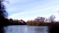
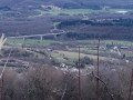
View of the Doubs.
Picnic table and bench at the water tower.

Reviews and comments

4.3 / 5
Based on 3 reviews

Reliability of the description
4.3 / 5
Ease of following the route
4.7 / 5
Route interest
4 / 5
anitaenfraze@gmail.com

Overall rating : 5 / 5

Date of your route : Jun 13, 2023
Reliability of the description : ★★★★★ Very good
Ease of following the route : ★★★★★ Very good
Route interest : ★★★★★ Very good
Very busy route : No

A varied and easy walk.

Machine-translated

cnu25
cnu25

Thank you, FAVIERRAYMOND, for this comment … the name of the walk suggested it would mainly take place in the woods

Machine-translated

cnu25
cnu25

Thanks, michel.francois, for that lovely comment

Machine-translated

michel.francois
michel.francois

Overall rating : 4.7 / 5

Date of your route : May 30, 2022
Reliability of the description : ★★★★★ Very good
Ease of following the route : ★★★★★ Very good
Route interest : ★★★★☆ Good
Very busy route : Yes

Machine-translated

FAVIERRAYMOND
FAVIERRAYMOND

Overall rating : 3.3 / 5

Date of your route : May 30, 2022
Reliability of the description : ★★★☆☆ Average
Ease of following the route : ★★★★☆ Good
Route interest : ★★★☆☆ Average
Very busy route : No

THE START IS NOT CLEARLY EXPLAINED
THERE IS A LOT OF WOOD

Machine-translated

Other walks in the area

For more walks, use our search engine .

The GPS track and description are the property of this route's author. Please do not copy them without permission.