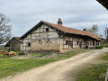
The Corneillons circular route in Ozan

This route takes you on a tour of the village of Ozan, the woods surrounding it and the market gardens.

Details

n°45303616
Creation:
Last update:
Last review:
  • Walking
    Activity: Walking
  • ↔
    Distance: 3.81 mi
  • ◔
    Average duration: 1h 45 
  • ▲
    Difficulty: Easy

  • ⚐
    Back to start: Yes
  • ↗
    Ascent: + 39 ft
  • ↘
    Descent: - 66 ft

  • ▲
    Highest point: 669 ft
  • ▼
    Lowest point: 597 ft
  • ⚐ Country: France
  • ⚐ City: Ozan (01190)
  • ⚑
    Start/End: N 46.391667° / E 4.914944°
  • ❏
    IGN map(s): Ref. 3028OT
  • Hour-by-hour weather

Description of the walk

The route starts on the square next to Ozan Town Hall.

(S/E) With the town hall on your left, follow the Grande Route to the left, passing in front of the church, then turn right onto the Route d’Allonziat until you reach the first street on the left. Take this street and turn immediately right, walking alongside the cemetery, crossing a stream and arriving at a Fork in the road.

(1) Turn right onto a path leading into the woods and passing through the hamlet of La Gouille. On leaving the woods, turn right until you reach the Route de Chevroux.

(2) Keep left, then turn right at the first junction onto the Route du Pelou. Continue until you reach a sharp right-hand bend.

(3) Take the track on the left. At the junction, turn left to rejoin the road. Keep left until you reach the first path on the right, which starts between some houses.

(4) Follow this and, at the end of the tarmac section, continue along a path through the woods. Cross the first forest track and start a gentle climb. Carry on to the edge of the woods.

(5) Carry on to the left. Keep going in this direction until you reach the pumping station on the right-hand side of the track. Carry on straight ahead to reach the junction from the outward journey.

(1) Return to the starting point by following the route in reverse. (S/E)

Waypoints

  1. S/E : mi 0 - alt. 636 ft - Ozan Town Hall
  2. 1 : mi 0.53 - alt. 600 ft - Junction for both outward and return routes
  3. 2 : mi 1.12 - alt. 607 ft - Route de Chevroux
  4. 3 : mi 1.5 - alt. 623 ft - Turn right
  5. 4 : mi 2.08 - alt. 623 ft - Path between the houses
  6. 5 : mi 2.63 - alt. 669 ft - Edge of the forest
  7. S/E : mi 3.81 - alt. 636 ft - Ozan Town Hall

Worth a visit

Ozan and its surroundings: woodland and market gardens

Reviews and comments

4.7 / 5
Based on 1 review

Reliability of the description
5 / 5
Ease of following the route
5 / 5
Route interest
4 / 5
gugusse
gugusse

Overall rating : 4.7 / 5

Date of your route : Oct 14, 2024
Reliability of the description : ★★★★★ Very good
Ease of following the route : ★★★★★ Very good
Route interest : ★★★★☆ Good
Very busy route : No

A leisurely walk in fine weather, very easy and without any difficulties.
You walk through the woods and along the fields

Machine-translated

Other walks in the area

For more walks, use our search engine .

The GPS track and description are the property of this route's author. Please do not copy them without permission.