


 Country:
 City:


Park at the Combe Lavaux car park.
(S/E) Walk up opposite the car park to reach the small path above the car park, then turn left down towards the Combe, heading towards Gevrey-Chambertin and the vineyards. Follow the vineyards until you reach the Chemin du Tacot, a former railway line, a section of which climbed the Côtes de Nuits and linked Gevrey-Chambertin to Beaune.
(1) Take the track on the right and follow the Chemin du Tacot for about 2 km to the Combe Grisard tunnel, cut through the rock above the valley. This engineering structure is the only spectacular feature along the entire Tacot route in the Côte d’Or. It is a 17-metre-long tunnel between Gevrey station and Curley halt. There is an information board near the tunnel.
(2) Resume the route by crossing the valley and continue along the Chemin du Tacot for a further 500 m, climbing up the other side. You’ll emerge from the woods onto the pastures above Morey-Saint-Denis at a crossroads.
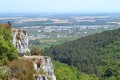
(3) Take a short first turn right then left to stay on the Félix Bâtier trail, leaving the signposted path that descends to the left towards Morey-Saint-Denis through the meadows. Join the small road that climbs up from the village of Morey-Saint-Denis towards the Ferme de la Buère equestrian centre. Cross it, take the path opposite, then leave the pasture to arrive above the picturesque rocks overlooking the Combe de Morey-Saint-Denis and the viewpoint (offering views of the village, its vineyards and the Saône plain).
(4) Continue to the point where the Bâtier trail descends into the valley. At this point, head up the slope opposite, above the meadow, and rejoin the road you crossed earlier. Take the path on the left and continue to the Ferme de la Buère equestrian centre.
(5) Turn right onto the track above the equestrian centre, running alongside the meadows where the horses are grazing. You’ll emerge onto the Chemin de Chambœuf, a wide track running at right angles which takes you back towards the forest if you turn left. Another 500 m brings you to a wide track lined with a grassy verge that cuts straight through the forest on the plateau.
(6) Follow this track to your right for just under 500 m. Ignore the signposted hiking trail and carry on until you come out onto the path that runs along the boundary between Morey-Saint-Denis and Gevrey-Chambertin.
(7) Turn left onto this path for just under 100 m, then turn right and join a wide forest track that climbs up from Gevrey-Chambertin onto the plateau.
(8) Cross this track and head straight ahead to reach the ridge path, directly in front of you. It runs alongside the Combe Lavaux, whilst the Combe de Creuse lies behind you on your left.
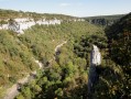
(9) Follow the ridge path straight ahead for 500 metres, until you reach the Corniche du Bec de Judry, and take a moment to admire the viewpoint situated right beside the path.
(10) Follow theofficial path (the Barnard Quarteaux path) which winds along the marked switchbacks shown on the left of the map (not on the right). Hikers who wish to do so can take a return trip to the cave. The climb to the cave is fairly easy, and there is also a sign on the path pointing the way.
(11) Finally, follow the path that leads straight back down to the car park (S/E).

 Visorando Member

 Difficult
 Easy

