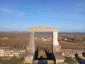
À travers vignes et forêts de Gevrey-Chambertin

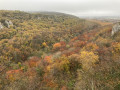
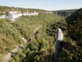
This circular walk allows you to admire the Combe Lavaux with its rocks and moss-covered valleys, and to wander through the vineyards, from piles of stone gathered from fields to ‘cabottes’. The route through the old town of Gevrey rounds off this walk, which combines natural heritage with cultural heritage (wine-growing, the Cluniac abbey, etc.).

Details

119234
Creation:
Last update:
Last review:
  • Walking
    Activity: Walking
  • ↔
    Distance: 7.22 mi
  • ◔
    Average duration: 4h 10 
  • ▲
    Difficulty: Moderate

  • ⚐
    Back to start: Yes
  • ↗
    Ascent: + 997 ft
  • ↘
    Descent: - 997 ft

  • ▲
    Highest point: 1,654 ft
  • ▼
    Lowest point: 948 ft

Photos

Description of the walk

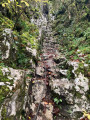
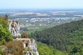
(S/E) At the Combe Lavaux car park, take the signposted path on your left (west) which climbs steeply up the hillside. After a few hairpin bends, you’ll find yourself at the foot of a cliff. Take the path on the right which goes round the Bec de Judry to reach the Bois de Forey plateau at the edge of the cliff, offering a stunning view over the valley.

(1) Turn right to join the signposted path (Sentier Bernard Quarteaux) until you reach the D31 road (elevation 415).

(2) Cross the road and continue straight ahead into the Combe Vanoche. After 1 km, at a bend that curves to the left, take the path on the right at a right angle to reach the Combe Saint-Martin.

(3) Turn right. After about 600 m along this valley, at elevation 444, follow the ridge path to your left. Walk along the edge of the cliff, amongst the small oaks and boxwoods.

(4) After 700 m, continue along the signposted path for a further 500 m and turn left onto a track that starts slightly above the ridge path and which, after 300 m, veers slightly to the left before turning right downhill onto the Félix Batier path.

(6) Carry on straight ahead to descend the valley (small caves on the left after 200 m).

(7) At the end of the valley, take the vineyard path on the left which climbs and then turns right, running alongside the forest. The path crosses the vineyards until it reaches a hut. Leave the path and walk left along the top of the vineyards at the edge of the forest. After passing through a pile of stone gathered from fields, head down into the vineyard (Clos Saint-Jacques), then turn left to join the main track (you’ll pass by a vineyard hut called ‘Les Cazetiers’).

(8) Then join the road on the right to walk down to the château. At the château, follow Rue Haute to the right through the old village of Gevrey-Chambertin to reach the D31.

(9) At the junction, turn left, then take the first road on the right. Continue along the vineyard track ‘en Craipillot’; at the crossroads, carry straight on down the cul-de-sac and take the footpath for 100 metres until you reach another road at a bend.

(10) Turn right, taking the hairpin bend, onto the footpath above the vineyards up to the 305-metre mark, then turn left above the road to reach the car park, the starting point (S/E).


Waypoints

  1. S/E : mi 0 - alt. 1,040 ft - Combe Lavaux car park
  2. 1 : mi 0.33 - alt. 1,378 ft - Judry Cave
  3. 2 : mi 1.73 - alt. 1,365 ft - Crossing the D31
  4. 3 : mi 2.82 - alt. 1,562 ft - Combe Saint-Martin
  5. 4 : mi 3.59 - alt. 1,509 ft - Junction at the end of the signposted route
  6. 5 : mi 3.85 - alt. 1,522 ft - Junction
  7. 6 : mi 4.41 - alt. 1,394 ft - Combe de la Bossière
  8. 7 : mi 4.85 - alt. 1,073 ft - Vineyard path on the left
  9. 8 : mi 5.69 - alt. 1,060 ft - Turn right
  10. 9 : mi 6.16 - alt. 955 ft - D31 road
  11. 10 : mi 6.51 - alt. 1,066 ft - Path above the vineyards
  12. S/E : mi 7.22 - alt. 1,040 ft - Combe Lavaux car park

Notes

Picnics are permitted in the shelter (7).
Provisions: there is a grocery shop in the centre of Gevrey (leave the route just after (9), continue straight on towards the town hall: stay on the main road and turn right at the main junction: (+1 km there and back).
This walk should be done in the direction described, as the section at Bec de Judry would be very tricky when going downhill. In wet weather, the handrail is slippery: so take care!

⚠️ WARNING

  • This route passes through the Combe Lavaux – Jean Roland National Nature Reserve, a remarkable and sensitive natural site protected by specific regulations. To avoid disturbing the local flora and fauna, please respect these regulations whilst on your walk.
  • Dogs must be kept on a lead; picking plants (leaves, flowers, twigs) is prohibited; you must stay strictly on the existing paths; and all types of fires are prohibited.

This route passes through a protected area, which may be subject to special regulations:

Worth a visit

Bec Judry Cave.
Beautiful views over the Combe Lavaux: a designated nature reserve.
Stone winegrowers’ huts.
A walk through the prestigious vineyards.
Château.

Reviews and comments

4 / 5
Based on 3 reviews

Reliability of the description
4.3 / 5
Ease of following the route
3 / 5
Route interest
4.7 / 5
KaéesS
KaéesS

Overall rating : 4.3 / 5

Date of your route : Jun 07, 2026
Reliability of the description : ★★★★★ Very good
Ease of following the route : ★★★☆☆ Average
Route interest : ★★★★★ Very good
Very busy route : Yes

top-notch

Machine-translated

chris21bzh
chris21bzh

Overall rating : 3.7 / 5

Date of your route : Jul 18, 2024
Reliability of the description : ★★★★☆ Good
Ease of following the route : ★★★☆☆ Average
Route interest : ★★★★☆ Good
Very busy route : No

Some paths are obscured by summer vegetation, so you need to take care to follow the route. In the vineyards, where there are sometimes no paths, you have to walk through the rows.

Machine-translated

malene21
malene21
• Edited:

Overall rating : 4 / 5

Date of your route : Aug 16, 2023
Reliability of the description : ★★★★☆ Good
Ease of following the route : ★★★☆☆ Average
Route interest : ★★★★★ Very good
Very busy route : No

A lovely, varied route. Unfortunately, I didn’t manage to reach the castle by walking along the edge of the forest above the vineyards.

Machine-translated

Other walks in the area

For more walks, use our search engine .

The GPS track and description are the property of this route's author. Please do not copy them without permission.