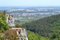
Sur le sentier Batier au départ de Gevrey-Chambertin

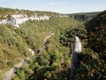
Although a short hike in terms of distance, the route is quite challenging due to its alternating ascents and descents, some of which are exposed. The top of the valleys offers a beautiful view of the Grand Cru hillside.

⚠️ 18/08/2026: route amended following orders prohibiting access to certain paths within the nature reserve.

Details

3498253
Creation:
Last update:
Last review:
  • Walking
    Activity: Walking
  • ↔
    Distance: 5.16 mi
  • ◔
    Average duration: 3h 30 
  • ▲
    Difficulty: Difficult

  • ⚐
    Back to start: Yes
  • ↗
    Ascent: + 1,283 ft
  • ↘
    Descent: - 1,293 ft

  • ▲
    Highest point: 1,486 ft
  • ▼
    Lowest point: 955 ft

Description of the walk

To reach the start point, from Gevrey-Chambertin, take the D31 towards Combe Lavaux. On leaving the village, after the last houses, take a small road to the right of the CD31 which climbs through the vineyards. Park at the edge of the forest near a spring.

(S/E) Walk up the road through the vineyards for a few metres and take the path that climbs straight into the forest to join the Batier path, which comes in from the right.

(1) Here, look for the yellow markings and turn left up the slope. Begin a steep climb up a path made of rock steps, with a short, easy scramble towards the end of the ascent.

(2) At the top, turn left, following the yellow markings for about a hundred metres. Cut left, then begin a descent to return almost to the car park where you started.
Turn right into the Combe Chaudron – there are markings at the start of the valley – and follow it uphill for about 200 metres until you reach the yellow markings.

(3) Take the path on the left. The climb is gentle at first, then becomes more challenging. Then take a path that roughly follows the contour line to reach the edge of the cliffs.
The markings are on the ground on a broken signpost. Turn immediately right, then up a short slope and left. From there, follow the yellow markings where visible, which will guide you as you weave your way between the rocks. Reach the downclimbing section.

(4) Take care here: turn right to follow the Bernard Quarteaux path to a junction of paths.

(5) Turn left and climb slightly for 50 metres, then turn right to rejoin the Félix Batier path, followed by the Bernard Quarteaux path downhill to the D31.

(6) Cross the road and reach a junction of paths.

(7) Turn right, walk past a car park and arrive at another junction.

(8) Turn left and head uphill along the path to reach another junction.

(9) Turn right again and rejoin the Bernard Quarteaux path, then the Félix Batier path.

(10) Turn left onto it, follow it along a straight, almost flat stretch until you reach a junction with a wide stony track (elevation 447). Turn left onto this and continue along it until you reach the junction by the houses in the hamlet of Craipillot at the entrance to Gevrey-Chambertin.

(11) At the vineyards, turn immediately left onto the path that runs behind the houses; follow it to the CD31 and from there, turn left until you reach the small vineyard road on the right, which leads back to the car park at the spring (S/E).

Waypoints

  1. S/E : mi 0 - alt. 1,073 ft - Car park by the spring
  2. 1 : mi 0.18 - alt. 1,198 ft - Chemin Batier
  3. 2 : mi 0.36 - alt. 1,486 ft - End of the climb
  4. 3 : mi 0.95 - alt. 1,155 ft - Path on the left
  5. 4 : mi 1.19 - alt. 1,345 ft - Bernard Quarteaux Trail
  6. 5 : mi 1.43 - alt. 1,325 ft - Path junction
  7. 6 : mi 1.79 - alt. 1,010 ft - D31
  8. 7 : mi 1.82 - alt. 1,020 ft - Bernard Quarteaux Path junction
  9. 8 : mi 1.98 - alt. 1,030 ft - Junction
  10. 9 : mi 2.12 - alt. 1,362 ft - Junction
  11. 10 : mi 2.66 - alt. 1,391 ft - Combe de Creuse
  12. 11 : mi 4.23 - alt. 1,030 ft - Craipillot
  13. S/E : mi 5.16 - alt. 1,073 ft - Car park by the spring

Notes

Bonnes chaussures de marche. Bâtons.
Certains voudront prendre une petite corde courte pour les descentes en désescalade mais cet itinéraire n'est pas pour un débutant.

⚠️ ATTENTION

Cet itinéraire circule au sein de la réserve naturelle nationale de la Combe Lavaux - Jean Roland, un site naturel remarquable et sensible qui est protégé par une réglementation spécifique. Afin de ne pas déranger les espèces animales et végétales présentes, merci de respecter cette réglementation lors de votre randonnée.
Les chiens doivent être tenus en laisse, la cueillette des végétaux est interdite (feuilles, fleurs, rameaux), la circulation doit se faire exclusivement sur les sentiers existants, tous les types de feux sont interdits.

This route passes through a protected area, which may be subject to special regulations:

Worth a visit

Vues sur les combes et la Côte.

Reviews and comments

4.7 / 5
Based on 1 review

Reliability of the description
4 / 5
Ease of following the route
5 / 5
Route interest
5 / 5
SergeR
SergeR

Overall rating : 4.7 / 5

Date of your route : Aug 10, 2023
Reliability of the description : ★★★★☆ Good
Ease of following the route : ★★★★★ Very good
Route interest : ★★★★★ Very good
Very busy route : Yes

The Batier trail is a well-known route in the Côte d’Or and provides excellent training for mountain races.
But be warned: on Visorando, this short 7 km route is classified as ‘moderate’ in difficulty. It isn’t suitable for everyone, as it can at times verge on rock climbing. Personally, I’d classify it as difficult, even though it’s short.
You’ll need a good pair of shoes, and it’s best to tackle it in dry weather if possible.
That said, it’s a superb route which I completed in 3 hours and 5 minutes with virtually no breaks.

Machine-translated

Other walks in the area

For more walks, use our search engine .

The GPS track and description are the property of this route's author. Please do not copy them without permission.