Country:

 City:
City:


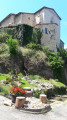
Park in the square by Issac church, where you’ll find a sign showing the village’s walking routes.
(S/E) With the church on your right, take Rue Saint-Avit, which runs alongside the school. Shortly afterwards, turn left onto Chemin de la Gabriale (sign on the corner). Note that the route is lined with signs displaying poems written by the schoolchildren. At the next junction, leave Impasse de Talabot on your right and continue straight ahead (yellow marker). After a short climb, turn left onto Chemin de la Fontaine de Contie (sign on the corner) and leave the signpost for the Saint-Séverin, Bourgnac and Saint-Jean d’Estissac circulars on your right. About fifty metres further on, leave a path leading uphill on your right and take the one going downhill straight ahead (yellow marker). When you reach the road from Issac to Mussidan, turn left: be careful, as this is a busy road.
(1) Turn immediately right towards “Château de Montréal”. The road crosses the Crempse, which rises at Beauregard and Bassac and flows into the Isle at Mussidan. Note that a little further on there is a former gatekeeper’s house situated on the Angoulême–Marmande railway line, which ran via Ribérac, Mussidan, Issac, Bergerac and Eymet; it was built in sections during the 1860s and dismantled, also in sections, from 1938 onwards.
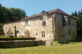
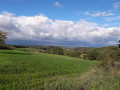
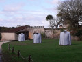
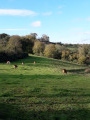
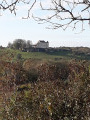
Follow the road to the right: views of Montréal Castle. A Renaissance castle surrounded by 12th- and 13th-century fortifications, it is said to have given its name to the city in Quebec. Open to visitors only in summer. Viewpoint over the Crempse Valley.
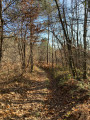
Continue along the road to the left (yellow marker on the corner). At the end of the tarmac, by a house on the right, the path continues straight ahead into the woods. Then ignore a path on the right and continue straight ahead on the main path (yellow marker).
(3) When you reach a T-junction at the corner of a house, turn left: follow the sign for ‘Sentier des 10 000 ans, le Laquin’. Pass the junction with Bourgnac and Joan de l’Ors on your right. The path becomes a tarmac road and passes through the hamlet of Landrevie. At the end of Chemin de Landrevie, turn right onto a slightly wider road and, about 200 metres further on, take the road on the left towards Guibert.
(4) After walking alongside a fence, turn right onto the path which also runs alongside the same fence (signpost in the corner). At a crossroads, turn right (signpost in the corner). Just after a charming little wood, turn left (signpost in the corner). The path leads to the hamlet of Bontemps. Leave the Pyraine road on your left. After a descent, join a road and follow it to the left (marker at the corner) until you reach a junction with signposts.
(5) Pass the path linking to the Église Neuve d’Issac circular loop on your right and, a little further on to the right, take the Chemin de Malaroumet. When you reach a gate, pass the Impasse de Malaroumet on your left and continue to the right (yellow marker). Carry straight on until you reach a four-way junction.
(6) Take the path opposite (yellow marker in the bend) and leave a track suitable for vehicles on your left. After skirting a meadow on your right, follow the path into the woods on the left (yellow marker).
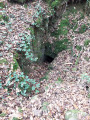
(7) The path passes close to Labatut Castle (information board), a feudal motte. You can see traces of it, as well as a cluzeau. A little further on, on the right, find the path leading to the Laquin bog; you can walk around it: information board.
(8) Turn back to rejoin the path, which you should follow to the right. You’ll pass another gatekeeper’s cottage before reaching a road; follow this carefully to the left. You’ll pass a memorial stone in honour of a member of the Resistance.
(9) Shortly afterwards, turn right onto the Chemin de Lespinasse (yellow signpost at the corner). Leave the Impasse de Lespinasse on your right. When you reach the last house in the hamlet, continue along the path opposite. After a climb, leave the main path, which turns right, and take a slightly smaller path opposite (yellow signpost). At a T-junction, turn right and you’ll soon come out onto a track.
(10) Turn left, following the sign for “Sentier des 10 000 ans”, and pass the junction with the Belisama and Lagudal circular loops on your right. At the next junction, turn left (signpost) and join a road at a place called La Lande.
(11) Continue to the right and then join a main road.
(12) Turn right and follow the road with care to reach the village of Issac. Cross the D38, pass under an archway to reach the church (S/E).


 Visorando Member
 Easy
Easy 
 Tourist office