The Royal Circular Loop in Sourzac

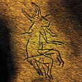
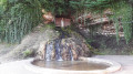
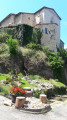
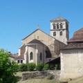
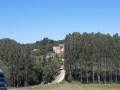
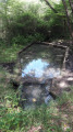
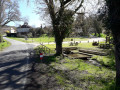
A lovely walk through lush countryside and forest paths in the shade of tall trees. You can admire the Romanesque church of Sourzac, built on a rocky outcrop above the Isle, and the petrifying fountain opposite it. Another treasure lies nearby: the decorated cave of Gabillou (not open to visitors).

Details

34288277
Creation:
Last update:
Last review:
  • Walking
    Activity: Walking
  • ↔
    Distance: 8.50 mi
  • ◔
    Average duration: 4h 15 
  • ▲
    Difficulty: Moderate

  • ⚐
    Back to start: Yes
  • ↗
    Ascent: + 381 ft
  • ↘
    Descent: - 351 ft

  • ▲
    Highest point: 476 ft
  • ▼
    Lowest point: 161 ft

Photos

Description of the walk

From Mussidan, take the D6089 towards Neuvic. Park near the church in Sourzac.

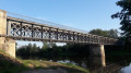
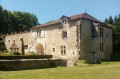
(S/E) Head towards the church and go round it to the right, taking the small road. Then turn left to follow the River Isle and go under the bridge to reach the campsite. Turn right at the campsite road. When you reach the back of Sourzac town hall, keep to the right. At the Caillade junction, turn left, walk past a pretty 16th- or 17th-century house and continue along the tarmac road. Walk past the gates of a property and turn left at the next junction to reach the D6089.

(1) Cross the A-road _with care_ to take the road opposite, then keep left onto it. Continue, go round a small pond and head up the hill. At the next junction, turn right towards Le Terme (Route Suzanne Lacore). Continue straight on, ignoring the small path on the right.
After 200 m, turn right at the next junction, then, after passing a large fir tree in a meadow on the left, take the grassy path on the right which further on becomes a dirt track through the forest. Continue straight on to reach a junction of paths.

(2) Turn left, passing between the woods (on the right) and a field (on the left). At the end of the path, follow the tarmac road to the right. Walk a few dozen metres and take the grassy path on the right. Join the road on the right (Route Royale). Stay on the road for 100 m until you reach the tarmac path on the right.

(3) Turn right towards Les Marzey onto a small tarmac path which turns into a limestone track and then a grassy path.

(4) After about 1 km, take a path on the left that crosses a field (do not go as far as the edge of the forest). Stay on the track until the next fork. Leave the path and take the tarmac road on the left. At the next junction, take the road on the left and cross the hamlet of Les Pierres.

(5) As you leave the hamlet, take the limestone track on the right. Gabillou Cave is very close by!
Then leave the path at the bend and head straight on along the grassy track. Continue round a few bends. At the end of the track (pond on the right), turn right onto the tarmac road (Route Royale) to reach the hamlet of Le Bost.

(6) At the sign indicating a Stop 150m ahead, take the path on the left, then another gravel path leading up towards the forest. Once at the edge of the forest, continue along the path on the left, ignoring the one on the right. Carry on straight ahead, ignoring the path on the left (elevation 113). At the ‘Give Way’ sign, take the tarmac road on the right to reach the bridge crossing the A89.

(7) Continue straight on along the road, then take the path on the left which leads to another gravel track. Immediately take the small path on the left. Follow the edge of a field on the left and rejoin the road at the hamlet of La Lande in the commune of Bourgnac (Route de la Bourle).

(8) At the junction with a firebreak, continue straight on along the road. At the end, turn left then immediately right onto the dirt track running alongside a field at a place called Talabot. Continue, leaving the track on your right, until you reach a multi-way junction.

(9) Turn left to reach another junction. Continue straight ahead, leaving the dirt track on your right and a grassy path on your left. The path becomes a tarmac road. At the ‘Give Way’ sign, turn right and follow the road to the A89.

(10) Go under the motorway bridge, then turn left towards Puyréal. After about a hundred metres, turn right onto the limestone track, which becomes a dirt track through the woodland. Pass a private stone building in the middle of the woods (hunters’ lodge) and reach the end of the track.

(11) Turn right onto the Route Royale, go downhill and keep left at the three-way junction. After a few dozen metres, turn left onto the Chemin de Castine. Walk past a farm, keeping the path on your left. Continue straight ahead, take the path to the right of a gate, walk along a meadow and then a fence.

(12) Turn left at the corner of the field. Further on, walk alongside a field on the left, then turn right at a right angle onto the dirt track. At the end of this, you’ll reach the road at a place called Parouty.

(13) Turn right onto the road and continue straight on. Opposite the ‘no entry’ sign, turn right onto the dead-end lane leading to the back of the restaurant (S/E).

Waypoints

  1. S/E : mi 0 - alt. 203 ft - Church of Saint Pierre and Saint Paul in Sourzac. Towards - Isle (rivière)
  2. 1 : mi 0.72 - alt. 187 ft - D6089
  3. 2 : mi 1.54 - alt. 279 ft - At the junction, turn left
  4. 3 : mi 2.03 - alt. 308 ft - Tarmac path
  5. 4 : mi 2.6 - alt. 269 ft - At the junction, turn left
  6. 5 : mi 3.15 - alt. 266 ft - Les Pierres
  7. 6 : mi 3.84 - alt. 325 ft - The hamlet of Le Bost
  8. 7 : mi 4.69 - alt. 394 ft - A89
  9. 8 : mi 5.54 - alt. 472 ft - Route de la Bourle
  10. 9 : mi 6.3 - alt. 469 ft - Multi-way junction, turn left
  11. 10 : mi 6.95 - alt. 381 ft - A89
  12. 11 : mi 7.53 - alt. 367 ft - Route Royale
  13. 12 : mi 7.87 - alt. 322 ft - Junction, turn right
  14. 13 : mi 8.1 - alt. 289 ft - Parouty
  15. S/E : mi 8.5 - alt. 203 ft - Church of Saint Pierre and Saint Paul in Sourzac

Notes

Alternative route: from the campsite car park, take the small limestone path directly below the toilet block. Join the small road below the town hall, continue straight on, passing between the town hall/village hall and the campsite. Go round the back of the tennis court (where you rejoin the signposted route) and head towards the hamlet of La Caillade, with a view of the spring.

Worth a visit

A pretty 16th- or 17th-century house with defensive loopholes just past the campsite.

There are several Magdalenian sites in the Isle Valley. Many were uncovered by Dr Gaussen, a doctor with a passion for archaeology who purchased and studied the decorated cave at Gabillou. He identified and excavated numerous open-air camps associated with hunting and the pursuit of game, including the site at Solvieux, well known to archaeologists, which was excavated with Professors Bordes and Sackett at Saint-Louis en l’Isle on the other side of the river.
Excavations around Mussidan have revealed distinct archaeological layers: –115,000 to –90,000 years (Mousterian), –45,000 years (Châtelperronian), and –35,000 to –25,000 years (Aurignacian). Alongside several bifaces, a flint deposit indicates that the Mousterians (Neanderthals) quarried flint blocks from the alluvial terrace to produce the flakes from which they fashioned their tools.

Reviews and comments

3.9 / 5
Based on 6 reviews

Reliability of the description
4 / 5
Ease of following the route
4.5 / 5
Route interest
3.3 / 5
Office de Tourisme de Neuvic
User 9738268

Overall rating : 4 / 5

Date of your route : May 18, 2026
Reliability of the description : ★★★★☆ Good
Ease of following the route : ★★★★☆ Good
Route interest : ★★★★☆ Good
Very busy route : No

Do not go there in the rain as it gets very muddy

Machine-translated

Office de Tourisme de Neuvic
crouzatier monique
crouzatier monique

Overall rating : 3.7 / 5

Date of your route : Apr 06, 2025
Reliability of the description : ★★★☆☆ Average
Ease of following the route : ★★★★★ Very good
Route interest : ★★★☆☆ Average
Very busy route : Yes

too many stretches of road

Machine-translated

Office de Tourisme de Neuvic
AlainMike
AlainMike

Overall rating : 4 / 5

Date of your route : Mar 03, 2025
Reliability of the description : ★★★★☆ Good
Ease of following the route : ★★★★☆ Good
Route interest : ★★★★☆ Good
Very busy route : No

We really enjoyed this walk; the village of Sourzac is well worth a visit! However, the church was closed; we reckon it’s always closed on weekdays and outside holiday periods!

Machine-translated

Office de Tourisme de Neuvic
FredTD
FredTD

Overall rating : 4 / 5

Date of your route : Feb 24, 2025
Reliability of the description : ★★★★☆ Good
Ease of following the route : ★★★★★ Very good
Route interest : ★★★☆☆ Average
Very busy route : No

A rather unremarkable walk. A few pleasant stretches through the woods, some charming paths, but many areas scarred by clear-cutting. Just one viewpoint over the Isle Valley at the end of the route.

Machine-translated

Montagnon d'isarbe
Montagnon d'isarbe

Overall rating : 3.3 / 5

Date of your route : Oct 23, 2023
Reliability of the description : ★★★★☆ Good
Ease of following the route : ★★★★☆ Good
Route interest : ★★☆☆☆ Disappointing
Very busy route : No

Not exactly thrilling.

Machine-translated

bernardyvesmartine
bernardyvesmartine

Overall rating : 4.7 / 5

Date of your route : Jun 05, 2023
Reliability of the description : ★★★★★ Very good
Ease of following the route : ★★★★★ Very good
Route interest : ★★★★☆ Good
Very busy route : No

To save yourself a bit of a detour, simply follow the narrow path that runs alongside the motorway fence at point 7. Then, once you reach the road (point 10), resume the normal route.

Machine-translated

Other walks in the area

For more walks, use our search engine .

The GPS track and description are the property of this route's author. Please do not copy them without permission.