Circular route from Le Tourne and Langoiran

The official name of the walk is: "Le Tourne-Langoiran - Circular 8 - Cdc Portes de l'Entre-deux-Mers"

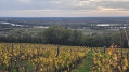
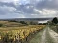
A 9 km route between the river and the hillsides, offering magnificent views of the colourful marshes that encircle the Garonne as you walk through the ever-present vineyards. You could easily lose yourself in the narrow streets of these two bustling villages where water always finds its way. We follow its course, imagining another story; that of villages where life revolved entirely around the river, its trade and the fishing boats.

Details

n°92942366
Creation:
Last update:
Last review:
  • Walking
    Activity: Walking
  • ↔
    Distance: 4.90 mi
  • ◔
    Average duration: 2h 40 
  • ▲
    Difficulty: Easy

  • ⚐
    Back to start: Yes
  • ↗
    Ascent: + 472 ft
  • ↘
    Descent: - 482 ft

  • ▲
    Highest point: 285 ft
  • ▼
    Lowest point: 13 ft
  • ⚐ Country: France
  • ⚐ City: Le Tourne (33550)
  • ⚑
    Start/End: N 44.710611° / W 0.401701°
  • ❏
    IGN map(s): Ref. 1537SB
  • Hour-by-hour weather

Description of the walk

Start at Square Alaric Desmond.

(S/E) Go round the church to the right and take the Sentier des Écoles on the right. At the junction, turn right onto theD240E2 and you’ll come to a fork.

(1) Take the small path on the left leading into the woods between the houses. At the exit, turn right onto Route de Tabanac.

(2) At the four-way junction, turn right onto Chemin de la Cave. At the second junction, turn right and cross the bridge over the Estey. Immediately afterwards, take the path on the right which runs alongside the stream. Turn left to head back up towards the stadium.

(3) At the junction with the D239, cross the road carefully and then turn left. At the roundabout, continue straight ahead.

(4) After the shopping area, turn right onto Chemin de Berquin, then take the path on the left that leads into the woods. Once in the vineyard, stay on the path on the left; after passing the hamlet of Sauvage, turn right along a hedge. Continue straight on along the vines.

(5) Cross the tarmac road and continue straight ahead.

(6) When you reach the D240, turn left and, after Château Lauretan, turn right into the vineyards. Go round the vineyard plot on the left and join the D119.

(7) Cross carefully, then follow the path, turning right twice, which takes you back to the D119 at Château de Langoiran.

(8) Continue down the road and take Rue Berard d'Albret opposite. At the wash house, turn right then right again. Cross Rue Bernard d'Escoussan and continue straight on towards the woods. Head back down to the D10 via the path on the left, then cross carefully. Follow this departmental road to the right. Then leave it and walk alongside the D10 through the vineyards for safety.

(9) At the end of the vineyards, turn left onto the small path leading into the woods. Follow the Garonne river to the village of Le Tourne.

(10) At L’Estey, cross the footbridge and turn right to follow the stream. After the bridge, turn left onto Rue de la Liberté, then straight ahead to return to the starting point (S/E).

Waypoints

  1. S/E : mi 0 - alt. 23 ft - Alaric Desmond Square
  2. 1 : mi 0.15 - alt. 36 ft - Three-way junction
  3. 2 : mi 0.27 - alt. 131 ft - Chemin de la Cave
  4. 3 : mi 0.61 - alt. 23 ft - Stade - Le Grand Estey
  5. 4 : mi 0.86 - alt. 26 ft - Chemin de Berquin
  6. 5 : mi 2.01 - alt. 230 ft - Tarmac road
  7. 6 : mi 2.45 - alt. 285 ft - D140
  8. 7 : mi 2.85 - alt. 187 ft - D119
  9. 8 : mi 3.25 - alt. 131 ft - D119 - Château de Langoiran
  10. 9 : mi 3.89 - alt. 20 ft - Edge of the vineyards
  11. 10 : mi 4.55 - alt. 16 ft - Le Tourne - Garonne (fleuve)
  12. S/E : mi 4.9 - alt. 23 ft - Alaric Desmond Square

Notes

This circular route is part of the 11 bell towers route organised by the Portes de l'Entre-deux-Mers Community of Communes.

Worth a visit

- Villages of Le Tourne and Langoiran

Reviews and comments

5 / 5
Based on 1 review

Reliability of the description
5 / 5
Ease of following the route
5 / 5
Route interest
5 / 5
bx86
bx86

Overall rating : 5 / 5

Date of your route : Oct 11, 2026
Reliability of the description : ★★★★★ Very good
Ease of following the route : ★★★★★ Very good
Route interest : ★★★★★ Very good
Very busy route : No

Hello
A route completed on Sunday 11 October 2026 in fine weather, travelling clockwise.
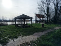
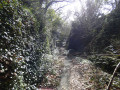
An interesting and very varied route, both in terms of the terrain – with climbs, descents and flat sections – and the scenery along the way. The outskirts of Langoiran – as we actually set off from Le Tourne, but 95 per cent of the route is within the municipality of Langoiran. So there are narrow lanes, forest tracks, woods, vineyards, lovely views over the Tabanac hills, pretty houses (some dating from the 19th century and listed as historic monuments just before the church at Haut Langoiran), a fortified castle, of course, the banks of the Garonne (developed in Langoiran, though part of it is currently closed following the floods of spring 2026) and the Estey, which the route runs alongside at the end and which, at low tide, reveals lovely scenes of mud and silt.
The only downside – though one is hard to avoid – is the stretch along the D10, which is a very busy road even on Sundays.
Let’s give credit, for once, to the local council, which has marked out the route (in yellow) using… finally, the codes employed by the GR network. The markings have been affixed to the old signposts, which isn’t always ideal as these posts were never positioned strategically. Still, it’s a great help, and additional markers have been added to electricity poles, for example. They even indicate the approach to a road or a tricky descent. A major effort, therefore, that deserves recognition.
One final ‘minor’ snag: after point 6, to reach point 7 you do indeed need to turn right (which is clearly signposted). However, as you head downhill, you do indeed have to skirt a vineyard on your right and a hedge on your left. But if you carry on like this, you’ll find yourself blocked at the bottom of the vineyard plot. You therefore need to go through a gap in the hedge at some point to find yourself with another vineyard plot on your left and the hedge on your right. However, I don’t think I saw a marker at this point; the only one is at the end of the hedge, but obviously you can’t see it when you turn right.
Thank you for this route.
Kind regards.

Machine-translated

Other walks in the area

For more walks, use our search engine .

The GPS track and description are the property of this route's author. Please do not copy them without permission.