Country:

 City:
City:


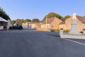
Start at the square in the centre of the village, in front of the town hall; large car park.
(S/E) With your back to the car park, turn left onto Rue du Village, walk past the town hall and you’ll come to a junction (marked by a cross).
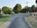
(1) Take the road on the left heading north towards Saint-Aubin-de-Lanquais. Follow this tarmac road for about 1 km until you reach a junction.
(2) Take the first track on the right and continue straight on for just over a kilometre until you reach the edge of a woodland.
(3) Turn right, heading south, onto the track that runs through the middle of a field of plum trees. Follow this track for about 600 m until you reach a tarmac road.
(4) Follow it to the right for about 100 metres.
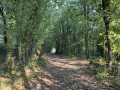
(5) At the sign for “Le Touron”, turn left onto the path through the woods heading south and follow it down through the woods until you reach a pond.
(6) Turn left, heading north-east, onto the path running alongside this pond, then head towards the second pond, which you’ll go round to the right along its southern bank. Take in the scenery, the bank and the island in the middle of the pond. You’ll come to a road.
(7) Turn right onto this road to cross the bridge and head up towards the hamlet of Le Rocal.
(8) At the top of the hill, when you reach the first houses, take the path on the left and follow it until you reach the buildings in the hamlet of Cantelouve and a tarmac road.
(9) Take this road on your left for about 150 m, then veer slightly to the right onto the track, which you’ll follow for about 1,200 m until you reach a junction you passed on the way out.
(3) Carry on straight ahead along the path in the opposite direction to the outward journey until you reach the next path on your left heading south. Follow this until you reach the tarmac road, where you’ll turn right towards Saint-Cernin-de-Labarde.
(10) When you reach the hamlet of Sainte-Luce, turn left onto the road leading down towards the south.
(11) About 50 metres past the buildings at the hamlet of La Tuilière, take the small path on your right which climbs up to the plateau through the woods. Once on the plateau, follow the edge of the forest to the village and its car park in front of the town hall (S/E).


 Visorando Member


 Moderate