Country:

 City:


Park in the car park by the shops, on Avenue du 11 Novembre 1918.
(S/E) Set off to the left, towards the old town, and follow Rue Georges Clémenceau, which continues as Rue Victor Hugo. Stay on the side of the road: watch out for traffic.
(1) At the end of the bridge over the Touyre, turn left and then immediately right, behind the flowerbed, to reach Rue de l’Hôtel de Ville. Cross carefully at the pedestrian crossing and continue straight ahead along the uphill street called Rue de la Joie
(2) Cross Place de la Cabanette, where one of the statues by the sculptor Antoine Vivancos stands, and continue straight ahead along the uphill street (Rue Vaillant Couturier) through the old town, which leads towards the church visible at the top of the hill and Place de la République.
(3) Carry on by taking the steps opposite that lead up towards the church, which is the highest point in the town: the Church of Castella, a listed historic monument. Its 14th-century octagonal bell tower is impressive. The restored surroundings and interior are well worth exploring.
(4) From the church, head left towards the nearby grassy plateau.
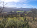
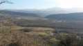
(5) After taking in the panoramic view and reading the information boards, go down the steps to the right of the wayside cross. Walk alongside and round the wall of the old fortification, which lies below the church. Behind the church, continue for about a hundred metres along the road opposite.
(6) Yellow markings. Turn right onto Chemin Saint-Roch: look out for the ‘Porte d’Armont’ signpost (alt. 487 m). This path starts as a tarmac road and, after the water tower, consists of flat stones dating from the 16th century, leading up to the Saint-Roch Chapel, built in the wake of the Great Plague of 1549.
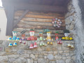
(7) After taking in the panoramic view and examining the chapel’s walls, which feature small sculptures, rejoin the route and continue along the path to the D16: the yellow markings end here and you’ll find the ‘Périnet’ signpost, at an altitude of 513 m.
(8) Turn right onto the tarmac road leading down from Leran, towards “La Bastide-sur-l’Hers” – “Voie Verte”. Watch out for traffic. You will reach the junction with the D620.
(9) Cross the road carefully and turn right. Walk along the left-hand verge where there is space and pass the ‘end of built-up area’ sign.
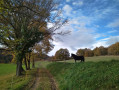
(10) At this junction, leave the tarmac road. Turn left and then immediately right onto the wide path called Chemin des Filatiers, which forms part of the Voie Verte. Please be aware that this route is a former railway line used by walkers, cyclists and horse riders. Continue along this very pleasant, tree-lined stretch. After a long tunnel, pass the old Laroque d’Olmes railway station. Carry on straight ahead, go under a bridge and arrive at a junction: yellow signposting and a ‘Voie Verte’ sign at an altitude of 474 m.
(11) Turn right onto the path, heading towards Laroque d’Olmes. This path joins, further down, a short tarmac section, which quickly becomes a track suitable for vehicles running alongside the River Touyre. Continue along the track until you reach the tarmac road: end of the yellow markings, signpost for Laroque d’Olmes, alt. 451 m.
(12) Turn left and walk along the pavement on Avenue Pierre Sémard.
(1) Turn left onto Avenue Victor Hugo, cross the bridge over the Touyre and continue straight on to reach the shopping centre car park (S/E).


 Visorando Member


 Easy