Country:
 City:


Parking is available at the Raymond Niccoletti boules court car park.
(S/E) Return to the road, turn right, then head left to cross the small bridge over the Bresque.
(1) Take the road, Chemin des Lones, on the right and head towards the Biocoop.
(2) Turn right and cross the bridge towards Salernes. You’ll come out onto Rue Jean-Jacques Rousseau; continue left along this road until you reach the roundabout.
(3) Take the first exit on the right to follow Chemin du Parouvier. At the three-way junction, turn right and carry on straight ahead to reach the D560 (Route de l’Europe).
(4) Cross it carefully, follow it to the right for about thirty metres, then turn left onto the path leading to the Lauve megalithic tomb.
(5) Head to the right, then turn right again towards the Brague valley. Continue along the river until you reach the bridge crossing it. Cross the bridge to reach the car park.
(6) Carry on straight ahead and cross the Brague three times before reaching a junction.
(7) Take the path straight ahead, leaving the path on your right which continues along the Brague. Then take the path on your right leading to the Saint-Barthélémy Chapel, nestled in the heart of the forest, which you reach via a flight of steps. Retrace your steps, rejoin the route by curving to the right and head right to the top to reach the viewpoint.
(8) Follow the path you came along in the opposite direction until you reach the junction where the circular chapel loop meets the viewpoint.
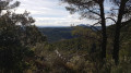
(6) Take the Chemin de Saint-Barthélémy straight ahead, taking in the lovely view in this picturesque part of Salernes. Keep going in the same direction until you reach the junction with the Chemin des Espèces, which joins from the left.
(9) Carry on to the right. Cross the D560 very carefully and continue straight ahead onto the Chemin de la Roque. Keep going straight on, ignoring the streets or paths on either side.
(10) Turn right onto the path leading to the ruins of Salernes Castle, which overlooks the village from its rocky hilltop. Originally built in the Middle Ages, it was extensively remodelled over the centuries, particularly during the Renaissance and in the 19th century. Today, it offers a remarkable view of the village and its surroundings, whilst serving as an iconic heritage site bearing witness to the town’s medieval and seigneurial history.
(11) Retrace your steps.
(10) Continue the route to the right. Head towards Rue du Château via the steps. Turn left, then take another set of steps on the right.
(12) Look out for the wash house on your left before turning right. Walk past the fountain, then turn left onto Rue Barbe Caron. Next, turn left at a 90° angle, walk past Saint-Pierre Church and you’ll come out onto Rue Pierre Blanc. Turn left again and follow Cours Théodore to the junction.
(13) Turn right onto Rue Victor Hugo, then turn right off it to follow Avenue Pierre Gaudin (D231). Take the first street on the left to reach the boules court car park (S/E).
 Visorando Member

 Moderate