The hills above Entrecasteaux via Valpeironne

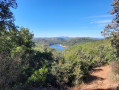
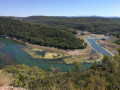
A walk comprising two circular loops on the hills above Entrecasteaux, offering a view of the source of the Verdon and passing by the foot of the castle, its gardens and its church.

Details

3981729
Creation:
Last update:
Last review:
  • Walking
    Activity: Walking
  • ↔
    Distance: 4.32 mi
  • ◔
    Average duration: 2h 35 
  • ▲
    Difficulty: Easy

  • ⚐
    Back to start: Yes
  • ↗
    Ascent: + 663 ft
  • ↘
    Descent: - 669 ft

  • ▲
    Highest point: 984 ft
  • ▼
    Lowest point: 466 ft

Description of the walk

Start from the stadium car park.

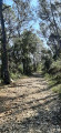
(S/E) Set off eastwards next to a house. Follow a signposted path uphill. When you reach the houses, turn left. Then cross the D50 road and continue along the path opposite. Carry on uphill.

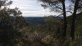
(1) At the crossroads, turn left onto a dirt track. Climb up, pass a sort of summit and descend slightly to reach the Défens de Valpeironne viewpoint.

(2) Turn back to the previous junction.

(1) Go straight on (east) and take a tarmac road. At the next crossroads, take thesecond path on the left, a dirt track running alongside a stone wall. Head down a little until you reach the next junction.

(3) Turn left and continue downhill along a track. Reach a tarmac road and follow it as it continues (west-north-west) and downhill.

(4) At a junction, turn left onto a tarmac road. Ignore the turn-offs on the right and pass the hamlet of Roche Marine.

(5) At the junction in the hamlet of Les Prés, turn right. Ignore the turn-offs on either side.

(6) Take thesecond road on the left. Ignore a turn-off on the left and continue straight on, with the stadium some distance away on your right. Go round a sewage treatment plant on the right and return to the starting point.

(S/E) First turn right then left, and cross the river over a very pretty bridge. Take thesecond left, Rue du Collet, and arrive at the foot of the castle.

(7) Continue along Rue du Collet, pass a car park on the right and turn right to reach the town hall. Head down the Montée du Château to the left, then turn right towards the church. Retrace your steps, then turn right to reach the bridge. Cross the river again and return to the car park (S/E).

Waypoints

  1. S/E : mi 0 - alt. 505 ft - Stadium car park - Bresque (rivière)
  2. 1 : mi 0.52 - alt. 915 ft - Crossroads leading to the viewpoint
  3. 2 : mi 0.88 - alt. 978 ft - Point de vue de Valpeironne
  4. 3 : mi 1.67 - alt. 833 ft - Junction
  5. 4 : mi 2.38 - alt. 620 ft - Junction
  6. 5 : mi 3.06 - alt. 584 ft - Les Prés
  7. 6 : mi 3.25 - alt. 545 ft - Junction
  8. 7 : mi 3.95 - alt. 502 ft - Castle
  9. S/E : mi 4.32 - alt. 505 ft - Stadium car park

Worth a visit

Stunning views of Entrecasteaux and the surrounding area.

Reviews and comments

4.3 / 5
Based on 3 reviews

Reliability of the description
4.3 / 5
Ease of following the route
4.7 / 5
Route interest
4 / 5
User 12295197

Overall rating : 4 / 5

Date of your route : Sep 29, 2025
Reliability of the description : ★★★★☆ Good
Ease of following the route : ★★★★☆ Good
Route interest : ★★★★☆ Good
Very busy route : Yes

difficulty finding access to the viewpoint after the water reservoir (part of the round trip route)

Machine-translated

gerard06440
gerard06440

Overall rating : 4.7 / 5

Date of your route : Apr 17, 2023
Reliability of the description : ★★★★★ Very good
Ease of following the route : ★★★★★ Very good
Route interest : ★★★★☆ Good
Very busy route : No

A lovely walk. The view is only 180°.

Machine-translated

Le ny
Le ny

Overall rating : 4.3 / 5

Date of your route : Jan 02, 2023
Reliability of the description : ★★★★☆ Good
Ease of following the route : ★★★★★ Very good
Route interest : ★★★★☆ Good
Very busy route : No

An easy walk with enough shade to make it suitable for summer; take it easy on the descent to the village as the path is stony.

Machine-translated

Other walks in the area

For more walks, use our search engine .

The GPS track and description are the property of this route's author. Please do not copy them without permission.