Circular Boussières via Blâme and the Bois de la Taille

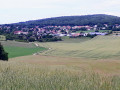
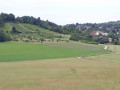
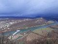
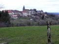
A lovely little walk around Boussières, through open countryside and woodland, and following a stream for a short while before fording it. A short, steep climb will take you to the top of the hill, then a long descent will bring you closer to the village, which you’ll reach via the fitness trail to arrive at the beautiful church and its porch, listed as Historic Monuments.

Details

3259847
Creation:
Last update:
Last review:
  • Walking
    Activity: Walking
  • ↔
    Distance: 6.28 mi
  • ◔
    Average duration: 3h 40 
  • ▲
    Difficulty: Moderate

  • ⚐
    Back to start: Yes
  • ↗
    Ascent: + 919 ft
  • ↘
    Descent: - 915 ft

  • ▲
    Highest point: 1,476 ft
  • ▼
    Lowest point: 784 ft
  • ⚐ Country: France
  • ⚐ City: Boussières (25320)
  • ⚑
    Start/End: N 47.15851° / E 5.900218°
  • ❏
    IGN map(s): Ref. 3323ET, 3323O, 3324ET
  • Hour-by-hour weather

Photos

Description of the walk

The walk starts in the car park of the Maison des Loups (the nickname for the people of Boussières).

(S/E) Set off along Rue des Richets on your right, passing through the oldest houses in the village. Join the departmental road and walk down through the village, turning right.

(1) At a right-angle bend to the right, turn left onto Rue des Résistants and follow the signs forthe GR®59A. Then turn right twice and follow the Chemin du Vigney.

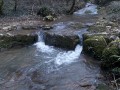
(2) At the first junction in the fields, veer left, then go straight on at the next one to head up towards the edge of the woodland. Enter the woodland and stay on this path. Ignore all the paths or tracks running perpendicular to it, and make your way to the stream, which you’ll wade across. Immediately turn left and head up along the bank. After crossing a small bridge, continue along the water’s edge.

(3) The path then veers away from the stream and heads uphill to the left. A little further on, it splits into two: take the right-hand branch. Continue climbing until you reach a small tarmac road. Turn right, then, when you reach the crossroad (Chemin de la Grand Fin), turn left. Cross the valley and a small wood, and at the next junction, rejoin the main branch ofthe GR®59.

(4) At a magnificent walnut tree, turn right. Enter the woodland, and about 250 metres further on, look out for a very clearly marked path on the left.

(5) Climb this short but very steep slope to emerge onto the ridge.

(6) This ridge path marks the highest point in the parish (452 m), as well as the boundary with the parish of Vorges-les-Pins. Turn left and stay on this path throughout the descent until you reach a tarmac road. Continue to the right to come out onto the D104 about 100 m further on. Follow it to the left.

(7) Cross the road carefully, and shortly after the property, enter the woods via an uphill path. In the valley, turn left and walk uphill for a few metres to reach the edge of the fitness trail. Follow it for its entire length.

(8) When the two paths split, take the fitness trail down the slope until you reach the roadside.

(9) Enter the village by heading straight on along the Route du Mont Joli. Walk down the entire street to reach the church.
Warning!!! Crossing the housing estate can be dangerous as there are four roads with right of way coming from the right and one from the left.

(10) When you reach the church, walk between it and the town hall, cross the courtyard and join the departmental road. Cross at the pedestrian crossing, then follow the pavement (which is wider) to the right until you reach the school. Turn left onto Rue des Richets and head for the car park (S/E).


Waypoints

  1. S/E : mi 0 - alt. 942 ft - Maison des Loups car park. Valley of the - Doubs (rivière)
  2. 1 : mi 0.25 - alt. 879 ft - Rue des Résistants
  3. 2 : mi 0.84 - alt. 784 ft - Junction, on the left
  4. 3 : mi 2.04 - alt. 1,020 ft - Turn left
  5. 4 : mi 3.28 - alt. 1,201 ft - Carrefour du Noyer
  6. 5 : mi 3.52 - alt. 1,253 ft - Climb up through the woods on the left
  7. 6 : mi 3.71 - alt. 1,476 ft - Ridge path
  8. 7 : mi 4.96 - alt. 1,020 ft - D104
  9. 8 : mi 5.53 - alt. 1,184 ft - Exit from the fitness trail
  10. 9 : mi 5.77 - alt. 1,027 ft - Entrance to the village, Rue du Mont Joli
  11. 10 : mi 6.11 - alt. 928 ft - Church and town hall
  12. S/E : mi 6.28 - alt. 945 ft - Car park at the Maison des Loups

Worth a visit

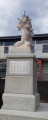
The church and porch are listed as Historic Monuments.

Always be cautious and plan ahead when you're outdoors. Visorando and the author of this route cannot be held responsible for any accidents occurring on this route.

The GR® and PR® markings are the intellectual property of the Fédération Française de Randonnée Pédestre.

Reviews and comments

4.7 / 5
Based on 2 reviews

Reliability of the description
5 / 5
Ease of following the route
5 / 5
Route interest
4 / 5
pnuninger
pnuninger

Thank you for your kind comment.
What’s more, the weather was perfect for a walk.
There are other possible walks starting from Boussières.
Have a lovely day and enjoy your walks

Machine-translated

Paps
Paps

Overall rating : 4.7 / 5

Date of your route : Apr 27, 2025
Reliability of the description : ★★★★★ Very good
Ease of following the route : ★★★★★ Very good
Route interest : ★★★★☆ Good
Very busy route : No

A partly shaded route that is accessible to everyone. The only slight difficulty is the short, steep slope between points 5 and 6.
What’s lovely about it is that you quickly find yourself surrounded by peaceful natural scenery.

Machine-translated

pnuninger
pnuninger

Hello. Thank you for your comment.
I’m glad you enjoyed the route.
Have a lovely day and enjoy your walks.
Kind regards.

Machine-translated

GISORANDO
GISORANDO

Overall rating : 4.7 / 5

Date of your route : Jul 03, 2023
Reliability of the description : ★★★★★ Very good
Ease of following the route : ★★★★★ Very good
Route interest : ★★★★☆ Good
Very busy route : No

The walk was exactly as described. There are two short steep sections that add to the charm of this lovely walk, and doing part of the fitness trail towards the end is a bonus.
We did have a bit of a moment or two where we weren’t quite sure about the route compared to the description, but with the GPS and the little ball, there were no problems.
We took the opportunity to visit the village church
Well worth a go.

Machine-translated

Other walks in the area

For more walks, use our search engine .

The GPS track and description are the property of this route's author. Please do not copy them without permission.