Country:
 City:




Car park at the Boussières village hall.
(S/E) Walk down Rue des Richets on your right and, at the start of the descent, take the gravel path on the left to join the D104. Cross the road and walk up Rue de l’Église straight ahead. Continue, ignoring the side streets, until you reach the edge of the woods via Chemin de la Planche Ronde.
(1) Look out for the entrance to the fitness trail and turn right, walking alongside the houses. After the left-hand bend, carry on uphill until you reach a junction.
(2) Leave the fitness trail and take the path opposite, which leads slightly downhill. Be careful not to go down into the valley. This stony path runs alongside some small ‘cliffs’ on the left. Carry on to the bottom.
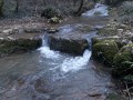
(3) You are now at the Pierre de Vorges. Cross the Ruisseau du Moulin Caillet and head right into the pasture along a well-marked path. Continue until you reach the entrance to the woods.
(4) Near the corner of the park, you’ll see numerous piles of wood. Turn left onto the path , which is very poorly marked – almost non-existent. Keep your bearings by staying about ten metres from the pasture fence. The vegetation isn’t too dense, making for a relatively easy walk.
You’ll easily spot the Source de Buy; once you’ve passed it, carry on in the same way. Cross a bend in the park and rejoin the track through the forest to reach, a little further on, a lovely path coming in from the right. Turn left. You’ll soon reach the entrance to the pasture.
(5) Turn left to stay as close as possible to the fields. The path runs alongside the stream flowing from the spring you saw earlier and joins the Ruisseau du Moulin Caillet, which you crossed earlier. You can stay on the path or follow the right bank of the small stream as it meanders. You will then reach the cycle route running alongside the river.
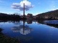
(6) Follow the cycle route to the left, taking in the view of the ruins of the feudal castle of Montferrand. On your left, on the ridge, you’ll see the chapel, your destination. Continue in this direction until you reach the bridge over the canal.
(7) Leave the cycle route and head straight on along a forest track which will soon veer left as it enters the woodland. Continue along this lovely track, signposted in the colours ofthe GR®59(red and white). Ignore the two paths branching off to your left and climb the hairpin bends. Follow the wall running alongside the steep slopes on your right. A short distance further on, you’ll reach the Chapel of Notre-Dame du Mont.
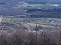
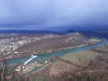
(8) Enjoy the view over the Doubs valley and Besançon and its western outskirts.
Start your descent by turning your back on the chapel entrance. Turn right a little further down. Continue along the tarmac road and pass the recycling centre.
(9) At the junction with the D105, turn left towards Boussières. Walk past the sawmill and enter the village. When you come within sight of the war memorial, cross the road and take Rue des Richets to return to your car park (S/E).


 Visorando Member
 Moderate