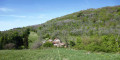
The 4 Castles Route – Saint Rambert en Bugey – Saint Germain * alternative route

This route forms part of a route of around 30 km linking four medieval castles (the ‘Circuit des 4 châteaux’).

This is a less demanding alternative to the walk of the same name, and is accessible all year round.

Details

n°41326
Creation:
Last update:
Last review:
  • Walking
    Activity: Walking
  • ↔
    Distance: 7.82 mi
  • ◔
    Average duration: 5h 10 
  • ▲
    Difficulty: Easy

  • ⚐
    Back to start: No
  • ↗
    Ascent: + 1,759 ft
  • ↘
    Descent: - 1,870 ft

  • ▲
    Highest point: 2,188 ft
  • ▼
    Lowest point: 837 ft

Description of the walk

(S) The entire route is signposted in yellow and purple, with a few additional directional signs.
Park on Place Guichard, near the station.

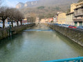
(1)Cross the River Albarine via the footbridge. Continue straight on along Rue de la Grenette, cross the D1504 and carry on straight until you reach a steep flight of steps (route sign). Follow the steps; at the top, turn left onto the tarmac road for a few dozen metres, then turn right (sign). Climb up a narrow, steep path until you reach a wider track; turn left and carry on until you can see a meadow on your left.

(2) Cross this meadow to the entrance of the Cornillon site (the first castle), which features a few information boards.
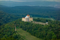
As you walk, near the ruins, head to your left and take a narrow, fairly steep path that skirts the base of the site until you reach a tower topped by a statue of the Virgin Mary.
Turn right until you reach the tarmac road, then continue uphill until you see the sign on your left indicating the start of the narrow path that descends to the Le Brevon stream.

(3) Cross this stream. This is the site of Saint Rambert’s martyrdom. Turn right to walk up a shaded path until you reach a tarmac road. On your left (50m away, you’ll find the crypt of Saint Domitien). Visits are possible if you contact the Sisters of the Abbey in advance.

(4) Turn left onto the tarmac road leading back down towards the town centre. You’ll pass close to the cemetery. When you reach the bottom of this road, you’ll see a metal barrier (sign) in front of you. Turn right; you’re now on a tarmac road that climbs for several kilometres towards the hamlet of Angrières.

(5) There are two short detours off the road: the first at a place called Périne on the right, and the second after passing the Rochers de Talourd cliff, also on the right.

(6) Join the tarmac road on the right and follow it for a few hundred metres until you reach a farm track branching off to your left (signposted)

(7). This track begins with a long, straight uphill stretch; at the end of this, turn right, following the signposts. You are now in an area of pastureland, and the track continues, zigzagging through the countryside. After a few hundred metres, you’ll enter a wooded area; follow the signposts until you reach a clearing in the forest beneath a high-voltage power line (sign).

(8) Pass under the high-voltage line and take the well-marked forest track, which curves through a coniferous forest for 2 to 300 metres. At the bottom of the descent, turn left onto another, less well-marked track for about 50 metres; this leads to a wide path that crosses the previous one at an angle of approximately 90°.
Follow this path until you reach a sharp bend to the right (marked by a permanent large puddle). Immediately afterwards, take the path that descends steeply to the right in a straight line.

(9) At the bottom of the descent, turn left onto a wide path that is almost level at first, then descends slightly to a flat area (marked by a hunters’ hut surrounded by metal sheeting). Continue to the right along a well-marked path downhill for just over 100 metres. The path then climbs slightly to the left (northwards) to go round the hill, heading west, then south-west.

(10) It then joins theGR®59, which comes in from the right. On your left, you’ll see a recently cleared area and a large meadow.
Continue the descent along a stony farm track until you reach the ruins of Saint Germain Castle. These are open to visitors (there are information boards and/or members of the heritage society present at weekends).
The walk continues down through the pointed archway (a narrow, steep path) until you rejoin theGR®59route. Turn left onto theGR®59route as far as the Tour de Gy (private property). (12).

(13) Turn right and continue to a water reservoir. Just before it (a few metres away), turn left towards the hamlet of Saint Germain. When you reach the first houses, turn left towards a chapel (downhill).

(14) At this chapel, turn left into Rue de la Tour or Rue de la Reine Clotilde and head downhill to a car park situated on a former section of the D1504 (there is a British coach there) (E).

Waypoints

  1. S : mi 0 - alt. 948 ft - Park on Place Guichard, near the station - Gare de St-Rambert-en-Bugey
  2. 1 : mi 0.02 - alt. 948 ft - Cross the - Albarine (rivière)
  3. 2 : mi 0.27 - alt. 1,138 ft - Cross this meadow
  4. 3 : mi 0.69 - alt. 1,161 ft - Cross the Brévon stream
  5. 4 : mi 1.03 - alt. 1,135 ft - Turn left onto the tarmac road
  6. 5 : mi 1.83 - alt. 1,089 ft - A place called Périne
  7. 6 : mi 2.51 - alt. 1,509 ft - Turn right towards the road
  8. 7 : mi 3.04 - alt. 1,811 ft - Farm track branching off to the left (signposted)
  9. 8 : mi 4.05 - alt. 2,175 ft - Pass under the high-voltage power line
  10. 9 : mi 4.65 - alt. 2,096 ft - At the bottom of the descent, turn left
  11. 10 : mi 5.83 - alt. 1,798 ft - GR°°®°°59. Turn left
  12. 11 : mi 6.45 - alt. 1,516 ft - Château de Saint-Germain (Ambérieu-en-Bugey)
  13. 12 : mi 6.88 - alt. 1,083 ft - Tour de Gy
  14. 13 : mi 7.14 - alt. 978 ft - Turn right until you reach a water reservoir
  15. 14 : mi 7.35 - alt. 935 ft - Turn left onto Rue de la Tour
  16. E : mi 7.83 - alt. 837 ft - Car park on a former section of the RD

Notes

No special equipment is required.

There are no drinking water points on this route.

Shelter is available in the hunters’ hut mentioned in the description.

Worth a visit

The ruins of Saint Germain Castle.
The chapel, which can be visited from time to time.
Below the chapel, the fortified house of La Barre (private property).

Always be cautious and plan ahead when you're outdoors. Visorando and the author of this route cannot be held responsible for any accidents occurring on this route.

The GR® and PR® markings are the intellectual property of the Fédération Française de Randonnée Pédestre.

Reviews and comments

4 / 5
Based on 2 reviews

Reliability of the description
4 / 5
Ease of following the route
3.5 / 5
Route interest
4.5 / 5
DUBUISSON GEORGES
DUBUISSON GEORGES

Access to the Château de St Germain has been temporarily altered (due to building works). It is a section of the route that is very little used, and one that I have not walked for several months. It has not been included in the map of designated footpaths drawn up by the Community of Communes.

Machine-translated

ddlyonnais
ddlyonnais

Overall rating : 3.7 / 5

Date of your route : Oct 16, 2026
Reliability of the description : ★★★★☆ Good
Ease of following the route : ★★★☆☆ Average
Route interest : ★★★★☆ Good
Very busy route : No

I travelled in the opposite direction to the description and got lost twice because of the forest tracks, but the sat-nav helped me find my way.

The access route to Château St Germain has been altered and you can no longer walk all the way round it.

Machine-translated

DUBUISSON GEORGES
DUBUISSON GEORGES

There’s just a mistake in the walking route. What’s described doesn’t match the ‘4 Castles’ route, although it isn’t far off.
Kind regards.

Machine-translated

mayaluce
mayaluce

Overall rating : 4.3 / 5

Date of your route : Oct 14, 2018
Reliability of the description : ★★★★☆ Good
Ease of following the route : ★★★★☆ Good
Route interest : ★★★★★ Very good

A lovely walk that took me back to the routes of my childhood!
We had a bit of trouble at first finding the signposted path that runs from the outskirts of Vaux-en-Bugey to the clearing at the Croix Balthazar, but we found some others.
Then the same went for the path from the cross to Vaux-Fevroux: after coming down from the Saint-Denis tower, we headed back to the clearing. There, turn left onto the main path, which is marked with a cross at the start. A few metres further on, you’ll come across another signpost: leave the main path (which I think heads down towards Bettant) and take a smaller path on the right that leads to the Bettant–Vaux departmental road.
Enjoy your walk in the Bugey, everyone ;-)!

Machine-translated

Other walks in the area

For more walks, use our search engine .

The GPS track and description are the property of this route's author. Please do not copy them without permission.