Oyon Valley Circular Route

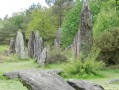
Discover the Oyon Valley and its heritage. Along the way, you’ll pass the Priaudais nature reserve and the Prieuré Saint-Étienne, the oldest chapel in Morbihan.

Details

n°21892287
Creation:
Last update:
Last review:
  • Walking
    Activity: Walking
  • ↔
    Distance: 7.49 mi
  • ◔
    Average duration: 3h 50 
  • ▲
    Difficulty: Moderate

  • ⚐
    Back to start: Yes
  • ↗
    Ascent: + 463 ft
  • ↘
    Descent: - 463 ft

  • ▲
    Highest point: 518 ft
  • ▼
    Lowest point: 112 ft
  • ⚐ Country: France
  • ⚐ City: Porcaro (56380)
  • ⚑
    Start/End: N 47.909596° / W 2.198868°
  • ❏
    IGN map(s): Ref. 1019SB, 1020SB, 1119SB, 1120SB
  • Hour-by-hour weather

Description of the walk

Park in the church car park.

Yellow signposting along the entire route.

(S/E) Walk past the town hall and head downhill towards ‘Le Coteau’ to join the Voie Verte.

(1) Take the Voie Verte on the left.

(2) Carry on straight ahead, noting the return route on your left, and continue along the Voie Verte until you reach the Couëdor junction.

(3) Take the road on the right towards the Prieuré Saint-Étienne. At the junction leading to the Chapelle Saint-Étienne, carry on straight ahead and take the dirt track. Follow this track, which then veers to the right through the woodland before making a 90° left-hand bend. At the end of the track, at the junction, turn right. Cross the road and carry on straight ahead towards Ville Boscher.

(4) At the hamlet, turn left, then turn right towards Le Vauniel and take the path on the right which leads into the woodland. Cross the road, continue straight ahead and you will reach a crossroads near the D776.

(5) Ignore the road and continue along the signposted path straight ahead until you reach a four-way junction.

(6) Take the dirt track on the right. At the bend, turn right to follow a shortcut which rejoins the track you left earlier further on. Continue to the right until you reach the Ville Abel crossroads. Carry on straight ahead along the road.

(7) At the crossroads, turn left, then, at Pâtis Abel, take the dirt track on the right. At the junction of the tracks, turn left and carry on straight ahead, heading due north.

(8) Once in the woods, at the junction, turn left and cross the bridge to rejoin the Voie Verte.

(2) Turn left.

(1) Turn right, leaving the Voie Verte, and head for the church car park (S/E).

Waypoints

  1. S/E : mi 0 - alt. 213 ft - Car park at the - Église Notre-Dame (Porcaro)
  2. 1 : mi 0.3 - alt. 138 ft - Voie Verte
  3. 2 : mi 0.65 - alt. 131 ft - Bridge – Junction of the circular loop - Oyon (rivère) - Affluent de l'Aff
  4. 3 : mi 1.79 - alt. 118 ft - Voie Verte – Launay Couëdor
  5. 4 : mi 2.92 - alt. 295 ft - La Ville Boscher
  6. 5 : mi 4.24 - alt. 443 ft - Junction near the D776
  7. 6 : mi 4.87 - alt. 518 ft - Lande des Cinq Chemins, crossroads
  8. 7 : mi 5.54 - alt. 243 ft - Le Pâtis Abel
  9. 8 : mi 6.57 - alt. 200 ft - Junction
  10. S/E : mi 7.49 - alt. 213 ft - Car park at the - Église Notre-Dame (Porcaro)

Notes

Toilets are available opposite the town hall at the starting point.

Reviews and comments

3.4 / 5
Based on 3 reviews

Reliability of the description
3.3 / 5
Ease of following the route
3 / 5
Route interest
4 / 5
lagire
lagire

Overall rating : 4 / 5

Date of your route : Feb 24, 2018
Reliability of the description : ★★★★☆ Good
Ease of following the route : ★★★★☆ Good
Route interest : ★★★★☆ Good
Very busy route : No

A lovely route, very hilly and pleasant, running alongside the Oyon

Machine-translated

DEBLOIS
DEBLOIS

Overall rating : 3 / 5

Date of your route : Nov 19, 2024
Reliability of the description : ★★★☆☆ Average
Ease of following the route : ★★★☆☆ Average
Route interest : ★★★☆☆ Average
Very busy route : Yes

A route with a good elevation gain but not much of interest

Machine-translated

balou17
balou17

Overall rating : 3.3 / 5

Date of your route : Sep 23, 2024
Reliability of the description : ★★★☆☆ Average
Ease of following the route : ★★☆☆☆ Disappointing
Route interest : ★★★★★ Very good
Very busy route : No

A very pleasant walk. Mostly through woodland. Lots of wide, shaded paths, and a few sunken paths.

Machine-translated

Other walks in the area

For more walks, use our search engine .

The GPS track and description are the property of this route's author. Please do not copy them without permission.