Country:
 City:
City:


Park in the car park at the Col de la Laverie.
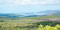
(S/E) Walk along the main road heading south: you’ll already have a magnificent view of the bay. Walk for about 640 m.
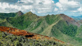
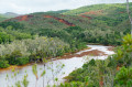
(1) Take the track slightly to the left that branches off from the main road. On this section and all the way to Baie du Carénage, this wide and very well-maintained track presents no particular difficulties, apart from the red earth becoming slippery in wet weather. You’ll reach a lovely viewpoint overlooking a beautiful canyon on the left.
(2) Continue along the track until you rejoin the main road.
(3) Cross it and carry on straight ahead. You’ll reach a junction just past a lovely little pond on the left.
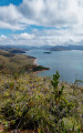
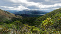
(4) Stay on the path on the right. This descending path offers lovely views of Carénage Bay before reaching sea level.
(5) Take the track on the right to head up the mouth of the Rivière du Carénage.
(6) Ford the river: make sure you’re wearing suitable footwear and keep a close eye on the water level in wet weather. Just after the river, the GR® path branches off to the right. But before taking it, you can take a short optional detour for a slightly different view of the bay. To do this, turn left at the junction and head up a short slope.
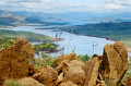
(7) Leave the GR® markings and head for a path somewhat hidden in the undergrowth on the left. This path climbs slightly to a viewpoint with unobstructed views over the bay and the river.
(8) Then turn back to rejoin the GR®.
(7) Turn right onto it, pass the junction you previously went past, and continue straight on along the Rivière du Carénage.
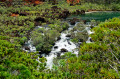
(9) A sign points towards the Carrénage waterfall: head down the path on the right to see it.
(10) Head back up to rejoin the GR®.
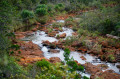
(9) Turn right again, heading north. There is only one possible route; there are no particular difficulties with navigation. Carry on through a stretch of damp woodland, then return to the mining scrub and continue walking to the Oasis, a very beautiful waterhole. Take great care not to get too close to the edge: there is a risk of the walls collapsing due to erosion caused by the river.
(11) Cross a small ford, then continue to follow the GR® markings, which cross the river a second time but in the opposite direction about a hundred metres further on. Carry on until you cross the main road again, having left the GR® trail about fifty metres before reaching it.
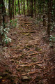
(12) Cross over to rejoin the route on the opposite side. The path slopes gently and climbs very gradually towards the Col de la Laverie. Cross the Rivière du Carénage one last time before reaching a junction.
(13) Take the path on the right. A little further on, you can leave the path to visit the ‘Trou d’eau des Amoureux’, which is just below. Continue until you return to the Col de la Laverie car park (S/E).
 Visorando Member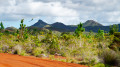

 Easy
Easy