Country:
 City:
City:





There is a car park by the side of the RP1 road; a clear space is available near an old metal barrier, which is open on your left, when approaching from the towns in the Greater Nouméa area.
(S/E) Follow the track which curves to the left. It is wide and well-defined, so you won’t have any trouble finding your way on this first section. You’ll soon have an unobstructed view, allowing you to enjoy the sea and the lovely Pic Ngo, which lies on the other side of the Rivière des Pirogues. Ignore the two paths branching off to the left and stay on the main track until you reach a junction.
(1) A track climbs to the right; carry on straight ahead, due north, until you reach another junction.
(2) Carry on straight ahead, heading north. The path then curves slightly to the left; it disappears from view for about ten metres amongst the grass, but quickly becomes visible again. From there, leave the track to join a pleasant, generally well-maintained hiking trail marked with yellow markings on the ground, which are clearly visible and which you can follow along this section.
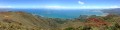
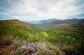
(3) Section of road that has collapsed: easily bypassed on the right. Continue uphill, following the yellow markings. There are no difficulties in finding your way on this section; there is only one possible path, which continues to climb until it reaches the entrance to the wind farm, the highest point of this walk. Enjoy the magnificent panoramic views of the sea and Mont Dore as they unfold before you.
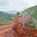
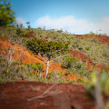
(4) At the entrance to the wind farm, turn right, before the first wind turbine, to rejoin the ultra-trail route (not very visible at first, but it becomes clear very quickly). On this section too, the markings on the ground are regular and clearly visible. Be careful of the red earth, which is very slippery in wet weather. You’ll cross several tracks on the descent; stay on the one with the markings (or follow the GPS track). Please note: you’ll need to leave this wide track at a junction marked on the ground by a branch from a dead tree, adorned with a small, very discreet piece of barrier tape and positioned to the right of the path.
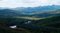
(5) Leave the main track at this fork to join the secondary path leading off to your right. You’ll once again find the yellow markings on the ground. Continue to follow the markings; there are no particular navigation difficulties. You’ll eventually reach the forest track that runs alongside the Rivière des Pirogues.
(6) Follow the forest track to the right. There are hardly ever any cars, but there are a few mining lorries, so do remain vigilant. You’ll cross a small creek at one point, but it shouldn’t be too difficult to keep your feet dry (unless it has rained heavily in the preceding days). You’ll arrive at the junction with the RP1 road.
(7) You can walk a short way across the bridge on your left for a clear view of the Rivière des Pirogues, but be careful as there’s no pavement.
Head in the opposite direction to the bridge. Follow the RP1 until you return to your car park (S/E).
You’ll come across several access points to the Rivière des Pirogues; depending on the water level, you may be able to go down there for a short walk on the sand.
The road is very quiet but drivers go fast, so stay very alert on this stretch; the verges are very wide and therefore quite safe most of the time, except in the bends where the verges disappear and there are metal guardrails on the outer side of the RP1. There are also several beautiful views of Pic Ngo and the sea along this section.
 Visorando Member
 Easy
Easy 
 Difficult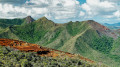
 Association / Club / Walk leader