


Refine your search for walks in Col de la Laverie (270 m)
Col de la Laverie (270 m) walks


 Lac en Huit from the Col de la Laverie (panoramic trail)
 Visorando Member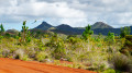
 10.58 mi
 +243 ft
 -282 ft
 5h 05
5h 05
 Moderate
 Departure from New Caledonia
Circular route, but very accessible and easy (wide, flat paths with almost no elevation gain), starting from the Col de la Laverie, allowing you to explore the western part of the Plaine des Lacs and Lac en Huit, and finally offering a return journey with a beautiful view of Prony Bay.
Circular Carénage Bay from the Col de la Laverie
 8.31 mi
+942 ft
-948 ft
4h 40
Moderate
Departure from New Caledonia
8.31 mi
+942 ft
-948 ft
4h 40
Moderate
Departure from New Caledonia
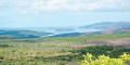
A very accessible circular route offering magnificent panoramic views of Prony Bay; it descends gently towards the sea, runs alongside the beautiful Carénage Bay, and heads back up via the GR® trail, following the Carénage River and passing by the Oasis and Amoureux waterholes.