Country:
 City:
City:




Park at Col de la Laverie.
The route follows the signposting for mountain bike trail number 4, known as the “Panoramic Route”, so there are no particular difficulties with navigation. If in doubt, you can always follow the signs for the mountain bike route.
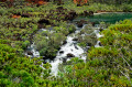
(S/E) At the signposts (on the right-hand side of the road when approaching from the south), join the mountain bike trail and head north-east. The trail is wide, almost flat and very well maintained throughout. There are no difficulties on this section; there is only one possible route. The Plaine des Lacs, with its endemic flora and watercourses, unfolds before your eyes.
(1) First junction, two options:
- continue to the right for a 1.5 km walk, and enjoy your first panoramic view of Lac en Huit.
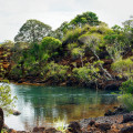
- turn left, following the suggested route, to reach a lovely little pond where it’s nice to take a break. Follow the track until you reach this pond.
(2) Turn round, head left to walk alongside the pond, and come back to it a little further on. Once you’ve done this, head right, then left, along a straight track heading due south, until you reach the wide track of the Route de l’Aérodrome.
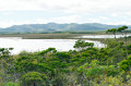
(3) Lac en Huit gradually comes into view on the left. Continue left along the road.
(4) A large mound of red earth lies to the left, offering a superb panoramic view of the lake and a clear view of why it is called Lac “en Huit”. Continue along the track until you spot the beach, about 200 metres further down.
(5) The beach is on the left; you can leave the path to walk along the lake for a short while. You can also walk a bit further to follow the entire southern shore.
(6) Return to the Route de l’Aérodrome and follow it to the left, heading south. There’s a magnificent view over Prony Bay (unfortunately somewhat marred by power lines). Then, opposite, follow the Route du Déversoir, heading broadly west, leaving a road on your left.
(7) The route runs quite close to the road it follows on the right. Continue to follow the mountain bike signposts on this section.
(8) Waterhole from the abandoned mine. After the waterhole, the route continues to the right.
(9) Two road crossings, about a hundred metres apart; there aren’t many cars but they drive fast, so stay alert.
(10) Turn right, heading north.
(11) A rather remarkable laterite canyon. Continue along the path.
(12) Return via the road, which has a wide hard shoulder: it’s safe to walk here, but do remain vigilant. The most beautiful views of the bay are along this section. Head back to the Col de la Laverie car park (S/E).

 Visorando Member

 Easy
Easy