The Convicts’ Trail

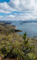
A walking trail that runs alongside Port Boisé Bay and offers a pleasant stroll along a generally well-maintained forest path. There is a small viewpoint higher up, but otherwise there is no significant change in elevation, so there are no particular difficulties.

Details

103687193
Creation:
Last update:
Last review:
  • Walking
    Activity: Walking
  • ↔
    Distance: 5.88 mi
  • ◔
    Average duration: 2h 50 
  • ▲
    Difficulty: Easy

  • ⚐
    Back to start: Yes
  • ↗
    Ascent: + 148 ft
  • ↘
    Descent: - 125 ft

  • ▲
    Highest point: 85 ft
  • ▼
    Lowest point: 3 ft

Photos

Description of the walk

Start at the Port Boisé campsite; if you are not a guest at the campsite, the manager will charge a 300 CFP fee for access to the car park.

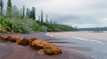
(S/E) Head towards the beach and turn left. Walk for about a hundred metres until you reach a sign indicating the start of the Sentier des Bagnards on your left.

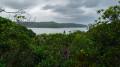
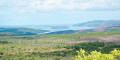
(1) Leave the beach at this point; from here, the path runs slightly above beach level but offers regular unobstructed views of the bay, and even a few access points to quiet beaches. A picnic table is also freely available on this section of the path. You’ll reach a junction before the river.

(2) Turn left and walk uphill for about a hundred metres to enjoy a small panoramic view of the bay. Ignore the first Yellow Cross but stop at the second one. Then head back down to the river.

(2) Cross via a suspended rope bridge. It’s quite a fun crossing, but be careful not to slip. Further on, you’ll come out onto a wider path; follow it in the same direction.

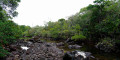
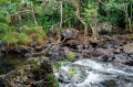
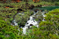
(3) Cross the river at a ford: take care here too, as the stones are very slippery on this section. Do not cross if the river is in flood. Continue along the path.

(4) A sign points out the remains of the old bridge on the right, but there isn’t much left of it. Carry on until you reach a small sheltered jetty.

(5) Carry on along the bay to the beach at the Kanua Tera Hotel: you may wish to go for a swim.

(6) Turn round and follow the outward route in the opposite direction to return to the car park (S/E).

Waypoints

  1. S/E : mi 0 - alt. 13 ft - Camping du Port Boisé
  2. 1 : mi 0.14 - alt. 16 ft - Sign – start of the trail on the left
  3. 2 : mi 0.93 - alt. 30 ft - Junction: viewpoint on the left
  4. 3 : mi 1.64 - alt. 30 ft - Slippery ford
  5. 4 : mi 1.75 - alt. 39 ft - Remains of a bridge on the right
  6. 5 : mi 2.48 - alt. 23 ft - Small jetty
  7. 6 : mi 3.03 - alt. 39 ft - Hotel Kanua Tera
  8. S/E : mi 5.88 - alt. 13 ft - Camping du Port Boisé

Notes

Please note: the southern route is in very poor condition and involves crossing several small fords; a 4x4 is advisable. It can be done in a city car, but should be avoided in wet weather.

It is also possible to do the route in the opposite direction, starting at the point (6) and travelling as far as the Camping du Port Boisé, but you must be a guest at Kanua-Tera.

More information on the official website:

https://www.province-sud.nc/natureweb/app/randonnee/promenade-sud-chemin-bagnards

Worth a visit

Port Boisé Bay.

Other walks in the area

For more walks, use our search engine .

The GPS track and description are the property of this route's author. Please do not copy them without permission.