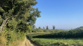
The “Circular Trail of Remembrance” in Blanot

This route offers the chance to discover, as you stroll, a facet of Blanot’s recent history, which remains very much alive in the collective memory of its inhabitants. Blanot is a former Communist stronghold, and was also once a base for the Resistance. This past comes to the fore from the very first steps taken in the village and can still be sensed around the ruins of the Ferme de Crue, the Buisson du Fournil and Notre-Dame-de-la-Roche. There are beautiful views over Donzy-le-Pertuis, Cortambert and the Grosne Valley.

Details

n°10573744
Creation:
Last update:
Last review:
  • Walking
    Activity: Walking
  • ↔
    Distance: 5.41 mi
  • ◔
    Average duration: 3h 15 
  • ▲
    Difficulty: Moderate

  • ⚐
    Back to start: Yes
  • ↗
    Ascent: + 899 ft
  • ↘
    Descent: - 892 ft

  • ▲
    Highest point: 1,788 ft
  • ▼
    Lowest point: 1,158 ft

Description of the walk

Park in the Blanot car park, near the hotel-restaurant and the war memorial.

(S/E) Turn right, passing the “book exchange”, the wash house, the fountain and the communal oven. When the road splits in two, turn left to discover the Romanesque Church of Saint-Martin, the priory and the Merovingian graves.

(1) Turn right again and, at the junction that appears immediately, turn left onto a small road. After the pottery workshop and before a tennis court, turn left and head up the stony path. At the ‘Chemin de Verne’ signpost (elevation 467), carry on straight ahead along theGR®76A(red and white markings). Continue uphill until you come to a wide path.

(2) Then leave theGR® 76A and follow the path opposite to the right. Walk along this ridge path for fifteen to twenty minutes to reach the Bois des Brosses crossroads.

(3) Head towards “Crue-Azé” via the path furthest to the left. At the first Fork in the road, stay on the stony path to the left and continue downwards.

(4) At the second Fork in the road, take the middle path. Follow it to a pond. Turn right onto a track and walk alongside the pond on your right. You’ll come to a gate; open it and close it behind you to discover the Crue farm, which twice provided shelter for the resistance fighters in Blanot. Caution! There may be cows grazing on this site. Walk past the buildings.

(5) Turn left immediately to join the path a little further up. Follow it uphill to the right. Leave the meadow and continue uphill until you reach the route you took on the way there.

(4) Turn left and head for the Bois des Brosses crossroads.

(3) Head down the path on the left, signposted ‘No recreational off-road vehicles’.
Stay on this path without turning off until you reach Péluzot.

(6) You will then rejoin theGR®76Aand follow it to the left until you reach the D146.

(7) Cross it to reach the Buisson du Fournil (“l’Beuchon du Fourniau” in local dialect). Follow the path, ignoring the offshoots on either side; the red and white markings lead you close to Notre-Dame des Roches.

(8) Leave theGR®76Aand turn right to reach the Notre-Dame des Roches site, about a hundred metres away (viewpoint). Retrace your steps.

(8) Pass the “Notre-Dame des Roches” signpost again and ignore the junction with the Ban Sacré route, which heads down to the left. Head back up to the right.

At the signpost indicating the direction of “Buisson du Fournil”, follow the path to the left. The path splits into two just before entering the woods. Follow the right-hand path to the D146. Walk a few metres to the left until you reach the small road below the D146, which descends to the right after the bend.

(9) Follow this road to reach the centre of the village of Blanot (S/E).

Waypoints

  1. S/E : mi 0 - alt. 1,165 ft - Blanot car park
  2. 1 : mi 0.1 - alt. 1,188 ft - Église Saint-Martin (Blanot)
  3. 2 : mi 0.88 - alt. 1,594 ft - Turn right at the fork (end of the GR trail)
  4. 3 : mi 1.57 - alt. 1,788 ft - Carrefour Bois des Brosses
  5. 4 : mi 1.72 - alt. 1,719 ft - Shared return transport
  6. 5 : mi 2.1 - alt. 1,585 ft - Ferme de Crue
  7. 6 : mi 2.9 - alt. 1,473 ft - GR76A junction at Péluzot
  8. 7 : mi 3.22 - alt. 1,483 ft - Crossing the D146
  9. 8 : mi 3.96 - alt. 1,549 ft - Notre-Dame des Roches
  10. 9 : mi 5.13 - alt. 1,240 ft - Les Combes
  11. S/E : mi 5.41 - alt. 1,165 ft - Blanot car park

Notes

Public toilets at the Blanot car park.

Food and accommodation available at La Thébaïde on 03 85 36 09 96.

Community bar ‘Le Coing’ on the village square (opens 13 June 2021).

Cheese shop open in the mornings from Tuesday to Saturday.

La Ferme du Mont-Rouge also offers a range of terrines and is open every morning from Thursday to Saturday and on Friday afternoons.

Worth a visit

(S/E) This is the site where, following a tip-off from an infiltrated traitor, five villagers who were members of the Maquis were arrested on 23 January 1944 by the Gestapo and a number of German soldiers; they were interrogated, interned at Montluc prison, and subsequently executed or deported. None of them returned.
Their names, along with those of five others, appear on the war memorial erected to the left of the school.

(5) The first maquis group was made up of young people from Cluny who had refused to take part in the STO.
There were five of them. They were soon joined by others.
The resistance group set up camp during the night of 9–10 March 1943 at Georges Moreau’s farm.
The Cluny resistance fighters alerted those in Blanot to their arrival with the message: “We’ve put the young people in the maternity ward.”
They had become a group of “outlaws”, without ration cards and with no real means of subsistence.
The Resistance fighters from Cluny, Cormatin and Blanot therefore ensured the supply of provisions to this hidden camp
Some members of the Maquis cut broom so that it could be spun into fabric at the Merzé spinning mill.
Alerted by Mr Pautet, a gendarmerie adjutant from Cluny, to the passage of a ‘spy’ plane, the Maquis evacuated Crue sur La Musette before finding shelter in Mont-Cortevaix.

A second Maquis group, this one comprising fighters, was re-formed at the time of the landings in June 1944, led by Jean Louis Delorme, a police inspector who had resigned in 1942 and was soon put in charge of the sabotage unit. He was replaced in July by Lucien Doussot, a leader of men and an ambiguous figure, feared by the local farmers as well as by some members of the maquis, but in whom his men, for the most part, placed blind trust.
Better armed, thanks to airdrops, and better trained, this Maquis unit took part in the battles of Azé on 2 July and the defence of Cluny on 11 August of the same year.
Together with the resistance units from Montceau, Charolles and elsewhere, it worked to drive the enemy out of the region.
Several of the Crue resistance fighters subsequently joined the Cluny Commando, which would become the4th Shock Battalion and help drive the occupying forces out of France.

Today, it still stands in Crue, despite the heroic deeds to which the last maquis group contributed, and the shadow cast by prisoners and others who were murdered.

(7) The “Buisson du Fournil” (“l’Beuchon du Fourniau” in the local dialect), ** also known as the “Embarcadère” because it served as the maquis’s vehicle depot, from which various operations were launched.
The amount of equipment stationed there increased along with the number of men; there were coaches, lorries and a German light vehicle fitted with a machine gun.
L’Embarcadère was also a place for night-time supplies and deliveries. The local Resistance members would bring provisions, which the maquisards would usually carry on their backs all the way up to Crue.”**

(8) Notre-Dame des Roches was erected in 1951 thanks to donations from the inhabitants of Blanot, Cortambert and Donzy-le-Pertuy – both believers and non-believers – in gratitude for the protection of the Virgin Mary during the bombing of Cluny.
It stands on the site where, in 1944, a camp was set up for between 11 and 15 members of the Resistance, seconded from the Crue resistance network to monitor the roads between the villages of Azé and Massilly, as well as the Grosne valley.''**

As well as the memorial sites visited during this walk, it is also possible to visit the Blanot caves in summer and during Heritage Days

Group visits are also available at other times of the year.

Not to be missed: a detour to Mont-Saint-Romain, the region’s highest peak, which offers a 360° view from the orientation table at its summit.

Always be cautious and plan ahead when you're outdoors. Visorando and the author of this route cannot be held responsible for any accidents occurring on this route.

The GR® and PR® markings are the intellectual property of the Fédération Française de Randonnée Pédestre.

Reviews and comments

4.3 / 5
Based on 2 reviews

Reliability of the description
4 / 5
Ease of following the route
4 / 5
Route interest
5 / 5
User 26834549

Overall rating : 4.7 / 5

Date of your route : Aug 06, 2025
Reliability of the description : ★★★★★ Very good
Ease of following the route : ★★★★☆ Good
Route interest : ★★★★★ Very good
Very busy route : No

Beautiful walk, I just didn't cross the meadow to the pond because there were dogs and a man with a quad bike inside. So I retraced my steps to go back up from the pond without completing the loop. Superb view from Notre Dame

Machine-translated

La Thébaïde
La Thébaïde

Hello,

Thank you for your comments; the changes have been made.
See you soon on the trails.

Machine-translated

ONIMOD
ONIMOD

Overall rating : 4 / 5

Date of your route : Oct 09, 2022
Reliability of the description : ★★★☆☆ Average
Ease of following the route : ★★★★☆ Good
Route interest : ★★★★★ Very good
Very busy route : No

HELLO
I’ve done this walk twice. It’s a lovely walk.
According to our mobile phones, it’s a route of around 10 km, including the two circular routes around the pond and Notre Dame des Roches.

In section 3, I’d say “stay on the stony path on the left”.
In section 4, I’d say “take the middle path, as there are three: one on the left and two on the right. And you can’t see any barbed wire at the start.”

I’d already done this walk on 10 September. The water lilies were in bloom. Magnificent!
A walk I’d highly recommend

Machine-translated

Other walks in the area

For more walks, use our search engine .

The GPS track and description are the property of this route's author. Please do not copy them without permission.