


 Country:

 City:
City:


Park in the car park in the village of Blanot.
(S/E) Cross the road and walk alongside L’Étape, the former hotel and restaurant, which was renamed Le Coing when it was converted into a community bar.
Here, following a tip-off, five villagers who were members of the Resistance were arrested and deported on 23 January 1944. Their names, along with five others, are listed on the war memorial erected to the left of the premises.
Follow the tarmac path lined with houses.
At the junction, head straight ahead. The path becomes grassy and is signposted in blue on a white background.
As you walk, note the view of Mont-Saint-Romain on your right.
It is the highest peak in the Clunisois region. It rises to 579 m and is said to have been a site of Druidic worship. Legend tells of a merciless struggle between the old and the new religions on this wooded and rocky site. A chapel was once built there, but it has since disappeared. The site is now private property and features an orientation table. Access is permitted on certain days.
(1) At a place known as La Musette, there is a group of renovated buildings set in wooded grounds, dotted with a few wooden viewing platforms. Turn left into the open field (or the area left accessible) just before the start of the descent.
At the edge of the field, ignore the path branching off to the right and continue straight on.
(2) Pass Les Échats Loups. At the ‘Bois de la Chassagne’, leave the blue markings on a white background and turn left, heading uphill.
On the ridge, at the junction known as Pierre de Balancin, turn left.
At the ‘Bois de la Roche’ signpost, carry on straight ahead.
(3) At the junction: La Roche, do not head back down towards Blanot but carry on straight ahead on the same path until you reach the edge of the woods. There, take the path that descends to ‘Mollard gros Jacques’ and thus join theGR®76A. Follow it to the right.
(4) At the junction: Notre-Dame des Roches / Ban sacré, follow theGR®76Atowards the Col des 4 Vents.
(5) At the signpost indicating the statue is 100 m away, you can take a detour to visit the site of Notre-Dame de la Roche.
After enjoying the view at the foot of the statue, retrace your steps to rejoin theGR®76A. Follow it down to the left.
Pass the Notre-Dame de la Roche signpost again, then the one for Mollard Gros Jacques, and head towards “Mont St-Romain”.
(6) At Poirier du Prêtre, cross the D146 and turn left onto the path that runs past a large shed.
(7) At Péluzot, stay in the middle of the path, on theGR®76A, heading towards Mont Saint-Romain.
(8) At L’Epinasse, leave theGR® and head down to the left towards Blanot, Place de la Fontaine. At the next junction, carry on straight ahead and, at the pottery, head downhill.
At the three-way junction, turn right to explore the Merovingian tombs, the Priory and the Romanesque church of Saint-Martin. Then continue downhill. Pass the communal oven, the washhouse and its fountain, and the public weigh house to reach the village square (S/E).

 Visorando Member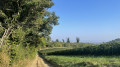
 Moderate
 Difficult
