The Breteuil circular, following in the footsteps of one of the martyrs of Vingré

A route that alternates between quiet country lanes, field paths and a few stretches through woodland. You’ll find yourself hopping over the River Iton. For those so inclined, the grave of a soldier who was shot as an example in 1914 – and whose reputation has since been cleared – adds a touch of remembrance.

Details

n°67607123
Creation:
Last update:
Last review:
  • Walking
    Activity: Walking
  • ↔
    Distance: 6.24 mi
  • ◔
    Average duration: 2h 55 
  • ▲
    Difficulty: Moderate

  • ⚐
    Back to start: Yes
  • ↗
    Ascent: + 66 ft
  • ↘
    Descent: - 66 ft

  • ▲
    Highest point: 614 ft
  • ▼
    Lowest point: 522 ft
  • ⚐ Country: France
  • ⚐ City: Breteuil (27160)
  • ⚑
    Start/End: N 48.836242° / E 0.913937°
  • ❏
    IGN map(s): Ref. 1914SB
  • Hour-by-hour weather

Photos

Description of the walk

Starts from Place Laffite, in the centre of the village. Large free car park (parking prohibited on Wednesdays from 05.15 to 14.00 due to the market).

Yellow + Red and White markings

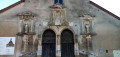
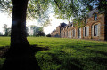
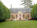
(S/E) Head west and cross the square towards the Town Hall (a neo-Gothic building that looks more like a church than a town hall). Go round a small roundabout with a central fountain and carry on straight ahead to reach Place Pillon de Buhorel. Pass the castle of the same name on your right, follow Rue d’Argentan and cross a branch of the River Iton.

(1) Immediately turn left onto Rue du Trou à la Souris and walk alongside the wall of a property on your right. At the Stop sign (a weir on the right), turn right. Cross another branch of the Iton and walk alongside a campsite. At the junction, take Rue Sainte-Anne opposite. Ignore a dead end on the left.

(2) At number 173, veer right onto a grassy path. Carry on straight ahead (south) between the fields.

(3) At the T-junction, turn left (there are no arrows or signposts here). When you reach a road, turn right onto the path that runs parallel to it. At the end, follow the road as it continues, keeping to the left-hand verge.

(4) Go round a roundabout on the left, cross the first road (D840) and take the next road on the left, which is narrower. Turn right onto this road and ignore another road on the left. Shortly afterwards, leave the road and take a wide track on the left, passing a gas installation on the right.

Yellow + Blue signposting (rare and faded)

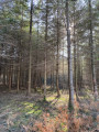
(5) At a junction on the edge of a woodland, continue straight on between the fields (ignore theGR® heading off to the right). Roughly level with an agricultural biogas plant some distance away on the left, turn right onto the track heading towards a woodland. Then turn left at the edge of the woodland and enter the woodland.

Yellow markings (sparse and faded)

(6) At the corner of a fence, turn left (the start is immediately after the arrow indicating it). Leave the woodland (with the biogas plant opposite), turn right straight away and continue along the edge.

(7) First turn right then left to cross a small road and take a path. Stay at the edge of the woodland on your right and follow its twists and turns. At a bend in the woodland, carry on straight ahead (east-north-east) between the fields. Walk alongside a copse on your right and you’ll come to a T-junction.

(8) Then follow a wide dirt track to the left (no arrows or markers here). After a right-hand bend, the dirt track gives way to a grassy path. You’ll reach a junction (a small concrete post with markers).

Yellow + Red and Yellow markings

(9) Continue straight on and descend slightly. Turn left with the path and ignore a small tunnel on the right. Walk alongside an old railway line on your right, the embankment of which has been reclaimed by vegetation.

(10) After about 600 m, look out for some old railway barriers, turn right and cross the railway line. Turn left immediately, before the other old barriers. At the entrance to the railway bridge spanning the D840, turn right and head slightly downhill between two fences. Take a footbridge to cross the Iton and continue for a few dozen metres.

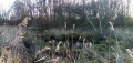
(11) Turn left and go through a small tunnel under the D840. On the other side, cross a wide track and continue along the track opposite. Walk alongside a reed bed on your left, then through a wood. Reach the banks of the Iton, veer right, walk alongside a fence on your left and head slightly uphill. Then walk alongside a hedge.

(12) You’ll come out onto a small road (Chemin du Moulin de Bas) and follow it as it continues. Pass a sewage treatment plant. Further on, cross the Iton again and immediately come out onto another road (with a small pond on the other side).

No signposting

(13) Here, there are two options:
- If you wish to avoid the detour to Breteuil Cemetery, turn right towards the church and then follow the main route from (16).
- Otherwise, as shown on the map, follow the road to the left (Rue du Moulin). Cross the Iton once more and you’ll immediately come to a junction with Rue des Ifs.

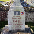
(14) Enter the cemetery through a metal gate. Turn right as soon as possible, then turn left and walk along the low wall on your right-hand side, which separates the two adjoining sections of the cemetery. Continue until you find Henri Floch’s grave, situated against the low wall (see the ‘Nearby’ section).

(15) Retrace your steps and leave the cemetery.

(14) Turn right onto Rue du Moulin and follow it to the junction with Chemin du Moulin de Bas.

Yellow + Red and Yellow signposting

(13) Head straight on towards the church, which is clearly visible.

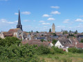
(16) At the Stop sign, cross the D833, follow it to the left and walk past the church on your right. When you reach the front of the church, continue along Rue Aristide Briand. Walk straight on until you reach a small roundabout. Go round it and you’ll find yourself on the other side at Place Laffite (S/E).

Waypoints

  1. S/E : mi 0 - alt. 554 ft - Place Laffite
  2. 1 : mi 0.13 - alt. 564 ft - Rue d’Argentan x Rue du Trou à la Souris
  3. 2 : mi 0.54 - alt. 571 ft - Start of the path
  4. 3 : mi 1.16 - alt. 584 ft - T-junction
  5. 4 : mi 1.6 - alt. 584 ft - Roundabout
  6. 5 : mi 1.97 - alt. 607 ft - Junction
  7. 6 : mi 2.44 - alt. 604 ft - Junction
  8. 7 : mi 2.66 - alt. 584 ft - Crossing the road
  9. 8 : mi 3.44 - alt. 528 ft - T-junction
  10. 9 : mi 3.83 - alt. 545 ft - Crossroads
  11. 10 : mi 4.39 - alt. 548 ft - Old railway barriers
  12. 11 : mi 4.64 - alt. 525 ft - Junction - L'Iton
  13. 12 : mi 5.3 - alt. 535 ft - Small road
  14. 13 : mi 5.68 - alt. 541 ft - Chemin du Moulin de Bas x Rue du Moulin
  15. 14 : mi 5.77 - alt. 545 ft - Entrance to Breteuil Cemetery
  16. 15 : mi 5.83 - alt. 558 ft - Grave of Henri Floch
  17. 16 : mi 6.04 - alt. 548 ft - Crossroads - Église Saint-Sulpice (Breteuil-sur-Iton)
  18. S/E : mi 6.24 - alt. 554 ft - Place Laffite

Notes

Hiking boots are recommended in wet weather.

Bars, restaurants, a bakery and other shops around Place Laffite (S/E).

Opening hours of Breteuil Cemetery:
- 1 November to 31 March: 08:00–18:00.
- From 1 April to 31 October: 08:00–20:00.

A detailed map is useful (at the very least, the one accompanying this description).

Walk undertaken by the author on 23 December 2024.

Worth a visit

Banks of the River Iton.

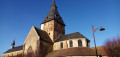
Saint-Sulpice Church (12th century) (16).

The tragic fate of Henri Floch:
Born in Breteuil-sur-Iton in 1881 and buried in the cemetery (15), Henri Floch was one of the six martyrs of Vingré. He was shot as an example in December 1914 and posthumously exonerated in January 1921. His grave is situated along the low wall separating the two adjoining sections of the cemetery, on the side of the section that is first reached when approaching from this point (13) (eastern half). The headstone bears the inscription “Died in the line of duty”.

Always be cautious and plan ahead when you're outdoors. Visorando and the author of this route cannot be held responsible for any accidents occurring on this route.

The GR® and PR® markings are the intellectual property of the Fédération Française de Randonnée Pédestre.

Reviews and comments

4 / 5
Based on 2 reviews

Reliability of the description
4 / 5
Ease of following the route
4 / 5
Route interest
4 / 5
LEGLAUDE
LEGLAUDE

Overall rating : 4 / 5

Date of your route : Apr 07, 2025
Reliability of the description : ★★★★☆ Good
Ease of following the route : ★★★★☆ Good
Route interest : ★★★★☆ Good
Very busy route : No

A pleasant and easy route.

Machine-translated

Halias
Halias

Overall rating : 4 / 5

Date of your route : Mar 30, 2025
Reliability of the description : ★★★★☆ Good
Ease of following the route : ★★★★☆ Good
Route interest : ★★★★☆ Good
Very busy route : No

Completed today.
A lovely, well-detailed circular route.
Thanks @Netra for the walk.

Machine-translated

Netra
Netra ★
• Edited:

Thank you, stjo, for this comment.

I discovered the story of the six men shot in Vingré whilst on a walk through the village of Vingré itself (a walk published on VR; between 2014 and 2018, I undertook several walks on the theme of the Great War, in Seine-et-Marne, the Soissonnais region and along the Chemin des Dames). The final letters from these six unfortunate men, addressed to their respective wives, are displayed in the streets, and reading them is heart-wrenching.

Thank you for the link to the article in*L’Éveil Normand*. This matter must be close to the hearts of the newspaper’s editorial team, as I have found several other articles there commemorating Henri Floch and calling for a street in Breteuil to be named after him.

Machine-translated

stjo
stjo

Thank you @Netra for this walk. I haven’t done it myself and don’t know if I ever will, but I was deeply moved by the tribute you’ve paid to Private Henri Floch, who was unjustly condemned by the stupidity and inflexibility of the administration of the time. So I read his story in this article in *Le Réveil Normand*, and I think this man certainly deserved, at the very least, a fine memorial and a posthumous rehabilitation. If I ever find myself in the Eure, I’ll definitely go on the walk.
Kind regards.

Machine-translated

Other walks in the area

For more walks, use our search engine .

The GPS track and description are the property of this route's author. Please do not copy them without permission.