Around Damville

A lovely little walk around Damville (27).

Details

62468
Creation:
Last update:
Last review:
  • Walking
    Activity: Walking
  • ↔
    Distance: 1.86 mi
  • ◔
    Average duration: 0h 55 
  • ▲
    Difficulty: Easy

  • ⚐
    Back to start: Yes
  • ↗
    Ascent: + 46 ft
  • ↘
    Descent: - 46 ft

  • ▲
    Highest point: 486 ft
  • ▼
    Lowest point: 433 ft
  • ⚐ Country: France
  • ⚐ City: Damville (27240)
  • ⚑
    Start/End: N 48.872133° / E 1.081053°
  • ❏
    IGN map(s): Ref. 1914SB, 2014O
  • Hour-by-hour weather

Description of the walk

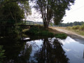
To get to the Damville Ponds, there’s direct access from the car park when coming from Evreux or Saint-André.

(S/E) From the car park, walk round the ponds in an anti-clockwise direction.

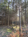
(1) At the pond reserved for anglers, cross the green bridge and follow the path opposite which leads up into the forest.
As you come out of the forest, take the path on the left until you reach the road (Rue des Hauts Mousseaux).

(2) Turn left onto the road and head down towards Damville on your left.
Cross the first bridge as you reach Damville and turn left into the public garden at La Motte Féodale.
Walk through the park to exit on the other side.

(3) Take Rue Sylvain Lagescarde on the left until you reach the roundabout. Turn left and enter the lake area, walking alongside “l’Ilot Mômes”.
Head for the car park (S/E).

Waypoints

  1. S/E : mi 0 - alt. 440 ft - Étangs de Damville car park
  2. 1 : mi 0.53 - alt. 433 ft - Turn right onto the green bridge
  3. 2 : mi 1.04 - alt. 476 ft - On the left along the road - L'Iton
  4. 3 : mi 1.47 - alt. 443 ft - On the left: Rue Sylvain Lagescarde
  5. S/E : mi 1.86 - alt. 440 ft - Étangs de Damville car park

Notes

Large car park, toilets, picnic area – a sort of “small leisure centre”.

Worth a visit

Places to visit:
- La Motte Féodale (along the walk),
- the Chocolatrium (Cluizel Chocolate Factory) on Route de Conches en Ouche, 1 km from Damville,
- Damville Church, a Romanesque church.

Reviews and comments

4.2 / 5
Based on 4 reviews

Reliability of the description
4.8 / 5
Ease of following the route
3 / 5
Route interest
4.8 / 5
Anais0201
Anais0201

Overall rating : 3.7 / 5

Date of your route : Oct 29, 2022
Reliability of the description : ★★★★★ Very good
Ease of following the route : ★☆☆☆☆ Very disappointing
Route interest : ★★★★★ Very good
Very busy route : No

The section in the forest is no longer accessible, as it is a private road (sign: ‘private forest, no entry’). What a shame 😓

Machine-translated

sigismundturbo
sigismundturbo

Overall rating : 5 / 5

Date of your route : Jun 07, 2020
Reliability of the description : ★★★★★ Very good
Ease of following the route : ★★★★★ Very good
Route interest : ★★★★★ Very good
Very busy route : No

A lovely little walk lasting less than an hour. Great fun to do with kids, older people and overweight people. It’s short, varied and easy.

Machine-translated

FRANCOIS27
FRANCOIS27

Overall rating : 3 / 5

Date of your route : Feb 21, 2019
Reliability of the description : ★★★★☆ Good
Ease of following the route : ★☆☆☆☆ Very disappointing
Route interest : ★★★★☆ Good

I went on this walk to relax after a long hike I’d done a few days earlier.
It’s a very pleasant, short and easy route.
Well worth doing in fine weather, either with the family or on your own, to unwind.
A lovely Sunday stroll to enjoy with the children. Keep an eye on the children when walking along the road.

Machine-translated

cclinette
cclinette

Overall rating : 5 / 5

Date of your route : Aug 28, 2016
Reliability of the description : ★★★★★ Very good
Ease of following the route : ★★★★★ Very good
Route interest : ★★★★★ Very good

A lovely family walk, although the section that runs alongside the road is a bit dangerous with children.

Machine-translated

Other walks in the area

For more walks, use our search engine .

The GPS track and description are the property of this route's author. Please do not copy them without permission.