Circular walk around Boussières via the Pierre de Vorges and the Caillet mill

A short walk but featuring a fairly steep descent; take care if the ground is wet, as the pebbles strewn across the path can be slippery and may roll under your feet.
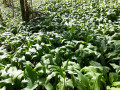
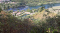
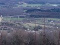
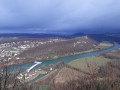
After taking in the view over the Doubs valley from the chapel, you’ll follow part of the strategic path; then, after the long, steep descent, the climb back up to the Caillet mill follows the stream, amidst fields of wild garlic in spring.
Rated as moderate due to the steep descent.

Details

1077403
Creation:
Last update:
Last review:
  • Walking
    Activity: Walking
  • ↔
    Distance: 4.22 mi
  • ◔
    Average duration: 2h 30 
  • ▲
    Difficulty: Moderate

  • ⚐
    Back to start: Yes
  • ↗
    Ascent: + 636 ft
  • ↘
    Descent: - 659 ft

  • ▲
    Highest point: 1,355 ft
  • ▼
    Lowest point: 801 ft
  • ⚐ Country: France
  • ⚐ City: Boussières (25320)
  • ⚑
    Start/End: N 47.158648° / E 5.900248°
  • ❏
    IGN map(s): Ref. 3323ET, 3323O, 3324ET
  • Hour-by-hour weather

Photos

Description of the walk

Park in the car park at the Salle des Fêtes.

(S/E) Walk down Rue des Richets on the right and take the gravel path on the left, between the two large houses. Continue and cross the small square.

Cross the main road (Rue du Centre) and take Rue de l’Église opposite. Walk uphill and through the housing estate. Ignore the side streets and head towards the edge of the woods.

(1) Enter the fitness trail and head straight ahead. Carry on and pass a piece of fitness equipment (an inclined plank) by turning right.

(2) Head up to the left along the edge of the high forest and the clear-cut area where the trees are slowly regrowing. You’ll soon see the valley opening up before you.

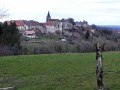
Go down the small slope and turn left onto the strategic path towards the Chapel of Notre-Dame du Mont. Once at the chapel, enjoy the panoramic view over the Doubs valley, Besançon and its western outskirts.

(3) Retrace your steps, pass the path you came up on and continue to a fork in the road. Ignore the white and red markings ofthe GR®® and turn right onto the path that climbs gently. You’ll arrive at the battery site, the highest point in the area. You can still see the square-shaped opening in the rock from which the Prussians bombarded Besançon during the 1870 war. This is why the path winding up from the canal is called the Chemin Stratégique.

(4) Begin the descent, taking care where you step to avoid any nasty surprises on the stony ground. Keep heading in the same direction until you reach the stream.

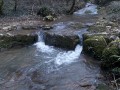
(5) You are now at a place known as La Pierre de Vorges. Head up to the right along the stream on the stony path. In spring, the scent wafting from the undergrowth is unmistakable: it’s wild garlic. There is an abundance of it on both the right and left, appearing as leaves, buds or flowers depending on the season. Continue in this way, skirting the meadows and then the house, until you reach the Caillet mill at the junction with the D104.

(6) Turn right onto the departmental road and follow it all the way through the village. Go round the roundabout on the left and carry on until you reach a ‘Stop’ sign in front of a bakery.

(7) Turn right. After about 50 metres, turn left onto Rue des Richets. Follow this road up to return to your car park (A/D).

Waypoints

  1. S/E : mi 0 - alt. 942 ft - Car park at the Salle des Fêtes
  2. 1 : mi 0.48 - alt. 1,033 ft - Start of the fitness trail
  3. 2 : mi 0.69 - alt. 1,165 ft - Exit the fitness trail to the left
  4. 3 : mi 1.1 - alt. 1,247 ft - Viewpoint by the chapel
  5. 4 : mi 1.43 - alt. 1,355 ft - La Batterie
  6. 5 : mi 1.88 - alt. 801 ft - La Pierre de Vorges
  7. 6 : mi 3.03 - alt. 978 ft - The Caillet Mill
  8. 7 : mi 4.08 - alt. 896 ft - Crossroads by the bakery
  9. S/E : mi 4.22 - alt. 942 ft - Car park at the Salle des Fêtes

Notes

There is a bakery in the village at the junction with the road to Vorges.
Local grocery shop and adjoining bar serving light meals.
A restaurant next to the bar, open for lunch every weekday.
Accommodation available at the Lodges of the Orée du Bois

Worth a visit

Boussières Church and its porch, listed as historic monuments.
Panoramic view from the chapel.
At (6), you can head towards Vorges to see the ruins of the gypsum mine entrances.

Always be cautious and plan ahead when you're outdoors. Visorando and the author of this route cannot be held responsible for any accidents occurring on this route.

The GR® and PR® markings are the intellectual property of the Fédération Française de Randonnée Pédestre.

Other walks in the area

For more walks, use our search engine .

The GPS track and description are the property of this route's author. Please do not copy them without permission.