Circular Boussières to the Abbans signpost and return via the Essart du Loup

This circular walk starting from Boussières will take you to the Abbans-Dessus signpost as you head up the Ruisseau de la Chandole. After enjoying the views over the Loue and Doubs valleys, the return journey follows the Roman road and the descent via the Essart du Loup.

Details

1012635
Creation:
Last update:
Last review:
  • Walking
    Activity: Walking
  • ↔
    Distance: 8.68 mi
  • ◔
    Average duration: 4h 55 
  • ▲
    Difficulty: Moderate

  • ⚐
    Back to start: Yes
  • ↗
    Ascent: + 1,096 ft
  • ↘
    Descent: - 1,093 ft

  • ▲
    Highest point: 1,545 ft
  • ▼
    Lowest point: 784 ft
  • ⚐ Country: France
  • ⚐ City: Boussières (25320)
  • ⚑
    Start/End: N 47.158635° / E 5.900182°
  • ❏
    IGN map(s): Ref. 3323ET, 3323O, 3324ET
  • Hour-by-hour weather

Photos

Description of the walk

Park in the car park by the village hall.

(S/E) Head down Rue des Richets to the right and walk past the bakery. Then continue to the right along Route de Quingey until you reach the bottom of the village, at the large right-hand bend.

(1) Cross over and take Rue des Résistants; a little further on, veer to the right. At the next junction, turn right onto Rue du Vigney, following the red and white markings ofthe GR®59. Walk across the whole plain, then turn left towards the hill and walk 200 metres.

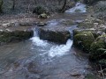
(2) Take Chemin de Blâme on the right, heading up the path. Continue across the meadows and then into the forest along the main path, which soon becomes a stony track. Ignore all the side paths, and after a short descent, you’ll reach the Ruisseau de Pré de Vé.

(3) Ford the stream and follow the bank on your left. Walk uphill, cross the bridge and continue along the opposite bank.

(4) When you reach the confluence of two streams, cross to the right and find a path that runs along the bank, rising gently. Continue uphill until you reach the D107.

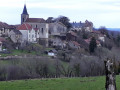
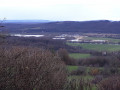
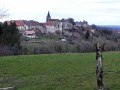
(5) Turn left towards the village of Abbans-Dessus. Take care. Along the road, make the most of the gaps in the vegetation to enjoy the view over the Doubs valley. Admire the castle and carry on until you reach the junction with the Chemin de la Grande Fin.

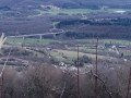
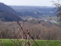
(6) At the corner by the cemetery, turn left and then go straight on along Rue du Signal. Carry on uphill and, at the top, walk past the antennas and take the track ahead of you into the woods. Just before that, a fairly well-defined path through the bushes leads you to a small pasture offering a superb panoramic view of the Chouzelot viaduct, the Loue valley and Mont Poupet. Further along the ridge, you’ll come out onto a wide forest track.

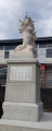
(7) Turn right and head downhill to the tarmac road, where you’ll reach the Chouzelot or Montgardot monument on the Roman road.

(8) Turn left and then continue to the right, leaving theGR®59behind. When the slope levels out, the path turns sharply to the right.

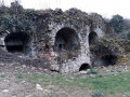
(9) Leave it and take the dirt track on the left. Carry on through the pastures and, further on, alongside the bushes, you’ll find a stony path that soon begins a long descent. When you come within sight of the departmental road, look out for the entrance to the old gypsum mines.

(10) At the junction with the D104, turn left; take care when crossing the Moulin Caillet site. Head uphill, leave the woods and pass the property on your right.

(11) Shortly after the wall of the property, a path branches off to the right. Follow it and cross the valley, heading to the left. Pass the steep slope.

(12) A gravel path comes up ahead. This is the fitness trail. You can either walk alongside it or follow it. At a piece of fitness equipment, the fitness trail branches off and heads down to the left. Follow it to quickly reach a junction with two roads.

(13) At the entrance to the housing estate, go straight on along Chemin de Planche Ronde. Walk back down through the village.

(14) When you reach the church, and after admiring it from various angles, cross the road carefully (Rue du Centre). Walk between the two buildings on the square next to the restaurant, bar and grocery shop. Take the alley opposite and turn right onto Rue des Richets to return to your car park (S/E).


Waypoints

  1. S/E : mi 0 - alt. 942 ft - Car park at the Salle des Fêtes
  2. 1 : mi 0.25 - alt. 883 ft - Rue des Résistants
  3. 2 : mi 0.93 - alt. 791 ft - Chemin de Blâme
  4. 3 : mi 1.78 - alt. 955 ft - Pré de Vé ford
  5. 4 : mi 2.05 - alt. 1,010 ft - Confluent, on the right
  6. 5 : mi 2.49 - alt. 1,201 ft - D107
  7. 6 : mi 3.26 - alt. 1,345 ft - Cemetery
  8. 7 : mi 4.49 - alt. 1,480 ft - Forest track
  9. 8 : mi 4.75 - alt. 1,322 ft - Chouzelot Monument – Roman road
  10. 9 : mi 5.54 - alt. 1,457 ft - Entrance via a dirt track
  11. 10 : mi 6.74 - alt. 1,017 ft - Junction with the D104
  12. 11 : mi 7.38 - alt. 1,020 ft - Path on the right
  13. 12 : mi 7.66 - alt. 1,138 ft - Start of the fitness trail
  14. 13 : mi 8.2 - alt. 1,030 ft - Entrance to the housing estate
  15. 14 : mi 8.54 - alt. 928 ft - Church
  16. S/E : mi 8.68 - alt. 942 ft - Car park at the Salle des Fêtes

Notes

Bakery in Boussières.
Local grocery shop and adjoining bar serving light snacks.
Restaurant open for lunch every day.

Worth a visit

A stroll through the old alleyways around Abbans Castle. Viewpoint opposite the school.
Viewpoint at Le Signal and, a little further on to the right, where you’ll find small paths leading to the pastures, offering views of the viaduct over the Loue and Mont Poupet.
Before rejoining the D104, a view of the old gypsum mines.
The church and porch at Boussières are listed as historic monuments.

Always be cautious and plan ahead when you're outdoors. Visorando and the author of this route cannot be held responsible for any accidents occurring on this route.

The GR® and PR® markings are the intellectual property of the Fédération Française de Randonnée Pédestre.

Reviews and comments

4.5 / 5
Based on 2 reviews

Reliability of the description
4.5 / 5
Ease of following the route
4.5 / 5
Route interest
4.5 / 5
pnuninger
pnuninger

Hello, and thank you for your comment.
When I mapped it out, the path was very clearly visible, as forestry work had taken place shortly beforehand.
I think the bushes must have grown back since then!!!
There is a possible alternative route. Carry on to the left and head up the track. At the fork, the right-hand path is very steep, whilst the left-hand one is less so. It leads to the same destination. Follow the meadows and turn right onto the road towards Abbans Dessus
Have a lovely day and enjoy your walks.

Machine-translated

cathbat
cathbat

Overall rating : 4 / 5

Date of your route : Jun 06, 2023
Reliability of the description : ★★★★☆ Good
Ease of following the route : ★★★★☆ Good
Route interest : ★★★★☆ Good
Very busy route : No

A pleasant walk in summer as it’s well shaded.
We had a bit of trouble finding our way after crossing the wooden bridge. You need to keep an eye out for the fork in the path on the right.

Machine-translated

par les sentiers
par les sentiers

Overall rating : 5 / 5

Date of your route : Mar 24, 2019
Reliability of the description : ★★★★★ Very good
Ease of following the route : ★★★★★ Very good
Route interest : ★★★★★ Very good

A pleasant, easy walk, very well described. No problems with the route. Lovely woodland. Very little tarmac.
Thanks to the hiker who posted it.

Machine-translated

Other walks in the area

For more walks, use our search engine .

The GPS track and description are the property of this route's author. Please do not copy them without permission.