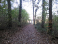
Bennecourt Circular Loop

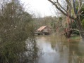
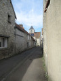
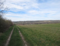
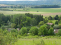
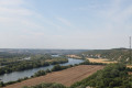
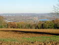
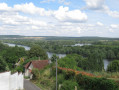
This easy walk takes in fields, copses, the River Epte, the River Seine and a short stroll through two villages.

Details

46062175
Creation:
Last update:
Last review:
  • Walking
    Activity: Walking
  • ↔
    Distance: 6.13 mi
  • ◔
    Average duration: 3h 00 
  • ▲
    Difficulty: Easy

  • ⚐
    Back to start: Yes
  • ↗
    Ascent: + 197 ft
  • ↘
    Descent: - 197 ft

  • ▲
    Highest point: 253 ft
  • ▼
    Lowest point: 49 ft
  • ⚐ Country: France
  • ⚐ City: Bennecourt (78270)
  • ⚑
    Start/End: N 49.040223° / E 1.568088°
  • ❏
    IGN map(s): Ref. 2113ET, 2113O
  • Hour-by-hour weather

Photos

Description of the walk

The route starts from the car park of the media library near the Bennecourt nursery school at 6ter Rue de l’Église.

(S/E) With your back to the media centre, turn right onto Rue de l’Église and follow it until you reach this point.

(1) First turn right then left (towards the cemetery) onto Rue de Limetz, then turn immediately right onto Rue du Val. Continue along the path that runs from it until you reach the first path on the left.

(2) Follow this path uphill and, at the T-junction, turn right onto the path until you reach another T-junction.

(3) Head slightly to the left. At the next junction, turn right, then left at the following one. Walk through a small wood, ignoring all the side paths. Further on, at a Fork in the road, continue to the right, pass under a high-voltage power line and arrive at another T-junction.

(4) Turn right, then immediately left at the crossroads that comes up shortly afterwards. Join Rue Gabriel Girondon, which you’ll take to the left. At the junction, turn right onto Rue des Femmes Fraîches, heading towards the church.

(5) At the T-junction, first turn left then right to join Ruelle des Platigniers, which curves left at number 1bis. Ignore a turning on the left, cross a road and continue to the banks of a branch of the Epte.

(6) Follow a path on the left that runs alongside the river until you reach a road.

(7) Turn left. At the first Fork in the road, turn right onto Rue du Cas Rouge. Cross a road, then turn left immediately followed by a right onto Rue de la Sergenterie, and continue along the path that extends from it.

(8) At the T-junction, head slightly to the left. A little further on, cross a road, then ignore two paths on the left until you reach a third.

(9) Take this path on the left, keeping a copse on your right. You’ll come out onto Rue des Mares Cadets. Turn sharp right onto Rue des Bâtards. Carry on until you reach a T-junction.

(10) Carry on to the right. Just before a bridge, veer right onto a path, then head left. At the end of the path, pass by a pétanque court, cross a small car park and continue along Promenade des Tilleuls until you reach a roundabout. Go round it to return immediately to the starting point (S/E).

Waypoints

  1. S/E : mi 0 - alt. 56 ft - Médiathèque car park: 6ter Rue de l’Église - Seine [la]
  2. 1 : mi 0.22 - alt. 79 ft - Church
  3. 2 : mi 0.48 - alt. 125 ft - Path on the left
  4. 3 : mi 0.68 - alt. 177 ft - T-junction
  5. 4 : mi 1.91 - alt. 108 ft - T-junction after the high-voltage power line
  6. 5 : mi 2.29 - alt. 62 ft - Rue des Femmes Fraîches x Rue de la Mairie
  7. 6 : mi 2.54 - alt. 52 ft - The - Epte (l')
  8. 7 : mi 3.18 - alt. 49 ft - T-junction near a wash house
  9. 8 : mi 3.45 - alt. 52 ft - T-junction of paths
  10. 9 : mi 4.47 - alt. 49 ft - Path on the left
  11. 10 : mi 5.27 - alt. 59 ft - Rue des Bâtards, turning right
  12. S/E : mi 6.13 - alt. 56 ft - Médiathèque car park: 6ter Rue de l’Église

Notes

The Suricate Gate
As users of the trails and natural environments, you can get involved in this scheme today by reporting any issues you come across during your walks: Sentinelles sports de nature.

Nearest station: Bonnières (approx. 1.5 km from the start)

Worth a visit

Bennecourt
Saint-Ouen Church: 16th century

Limetz-Villez
Saint-Sulpice-Saint-Pierre Church: 12th century. The church was remodelled in the 15th and 16th centuries. The belfry houses a 16th-century dedicated bell.
Washing house.

Reviews and comments

4 / 5
Based on 3 reviews

Reliability of the description
4.7 / 5
Ease of following the route
4.7 / 5
Route interest
2.7 / 5
Manu 27
Manu 27

Overall rating : 3 / 5

Date of your route : Sep 02, 2024
Reliability of the description : ★★★★☆ Good
Ease of following the route : ★★★★☆ Good
Route interest : ★☆☆☆☆ Very disappointing
Very busy route : No

A rather uninteresting circular route. A lovely view at the start of the walk, but not much else after that. The end of the route involves a long stretch of path with lots of tall grass, making the walk very tiring and endlessly tedious.

Machine-translated

COCHARDMOD
COCHARDMOD

Machine-translated

Dom1949
Dom1949

Overall rating : 4.7 / 5

Date of your route : Mar 22, 2024
Reliability of the description : ★★★★★ Very good
Ease of following the route : ★★★★★ Very good
Route interest : ★★★★☆ Good
Very busy route : No

A very pleasant walk; the route follows the route map perfectly.

Machine-translated

ealet
ealet

Overall rating : 4.3 / 5

Date of your route : Mar 17, 2024
Reliability of the description : ★★★★★ Very good
Ease of following the route : ★★★★★ Very good
Route interest : ★★★☆☆ Average
Very busy route : No

A well-described route that’s easy to follow, with lovely views of the Epte before number 4, and a walk through two charming villages
but the section from marker 9 onwards is boring (nothing but tarmac for over 2 km) with little of historical interest
Best avoided on rainy days or when it’s very hot, as you’re often out in the open
Thanks to the author for sharing this

Machine-translated

Other walks in the area

For more walks, use our search engine .

The GPS track and description are the property of this route's author. Please do not copy them without permission.