Bathéou circular via Le Puy

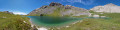
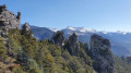
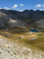
A lovely walk above the village of La Roche-de-Rame, offering a chance to discover the area’s mountain heritage (canals, ruins) and, above all, a panoramic view of the Durance valley. But on the way back, do take the time to explore the climbing spot beneath the Bathéou rock.

Details

n°52385677
Creation:
Last update:
Last review:
  • Walking
    Activity: Walking
  • ↔
    Distance: 4.51 mi
  • ◔
    Average duration: 3h 50 
  • ▲
    Difficulty: Moderate

  • ⚐
    Back to start: Yes
  • ↗
    Ascent: + 2,064 ft
  • ↘
    Descent: - 2,057 ft

  • ▲
    Highest point: 5,351 ft
  • ▼
    Lowest point: 3,366 ft

Photos

Description of the walk

In La Roche-de-Rame, near the Pont de Bouchouse, leave the N94 and take the D338 towards Le Bathéou. Carry on straight ahead, ignoring any roads to the right or left. At the junction with the hydroelectric power station on the right, go straight on. At the sign for the hamlet of Le Bathhou, continue straight on and, when you reach the first houses, look out for the car park to park.

(S/E) Take the road on the left and head uphill to a house on the right, recognisable by the sculptures on the balcony.

(1) In front of this house, turn right onto the narrow lane that climbs uphill: it feels as though you’re walking through people’s gardens, but it is indeed the lane. Walk uphill, pass between two houses and emerge onto a small square. Take the road on the left and then, just before the bend, look out for a path on the right.

(2) Leave the road to follow this path, go round a bend and turn onto a track on the right about twenty metres further on. You’ll soon reach a fork in the path. 

(3) Take the path leading off to the left, walk alongside a small canal, then keep going straight on, ignoring the paths branching off on either side, until you reach a larger canal. Cross it and turn immediately right to reach a junction.

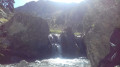
(4) Ignore the return path on the left. Go straight on and continue climbing up the mountainside. Cross a footbridge at the foot of a waterfall, at the top of which a boulder is wedged. Continue climbing until you reach another fork. 

(5) Turn left and climb through the forest until you come out onto a large plateau.

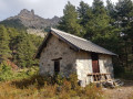
(6) Turn left onto the forest track and continue along the path that follows it. Carry on along the ledge until you reach Le Puy, an open area where you can see some ruins. 

(7) At the crossroads, take the path on the left which leads downhill, passing in front of the ruins. Walk downhill for a good while through the woods, following a series of hairpin bends, until you reach a junction.

(8) Stay alert: do not continue straight down. Look out for the start of the path on the left and follow it until you rejoin the path you took on the way up. 

(4) Turn right and retrace your steps along the route you took on the way up to return to the car park (S/E).

Waypoints

  1. S/E : mi 0 - alt. 3,366 ft - Car park
  2. 1 : mi 0.05 - alt. 3,379 ft - Crossroads, house with a carved balcony
  3. 2 : mi 0.15 - alt. 3,458 ft - Road/path junction
  4. 3 : mi 0.24 - alt. 3,566 ft - Junction for both outbound and return routes
  5. 4 : mi 0.39 - alt. 3,701 ft - Junction of the circular loop
  6. 5 : mi 0.84 - alt. 4,226 ft - Junction, turn left
  7. 6 : mi 1.44 - alt. 5,026 ft - Trail junction, on the left
  8. 7 : mi 2.41 - alt. 5,341 ft - Puy crossroads
  9. 8 : mi 3.28 - alt. 4,439 ft - Junction, turn left
  10. S/E : mi 4.51 - alt. 3,366 ft - Car park

Notes

  • Take some water.
  • Binoculars for the view.

Worth a visit

  • On the way back, at the far end of the car park, pop over to the climbing spot at the foot of the rock.
  • Lake Roche-de-Rame.

Reviews and comments

4.7 / 5
Based on 1 review

Reliability of the description
5 / 5
Ease of following the route
5 / 5
Route interest
4 / 5
patembrun
patembrun

Thank you for your initial feedback. Of course, depending on the season, it is a good idea to adapt the itinerary. I described it for cooler seasons, whereas you have described it for warmer periods. Thank you for your contribution and enjoy your hikes.

Machine-translated

jp11
jp11

Overall rating : 4.7 / 5

Date of your route : Aug 22, 2025
Reliability of the description : ★★★★★ Very good
Ease of following the route : ★★★★★ Very good
Route interest : ★★★★☆ Good
Very busy route : No

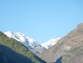
We changed the direction of the circuit, from 4 to 8 then 7 and back down from Le Puy to 5 and 4. This direction is more interesting because of the heat: the climb is in the shade and the descent is mostly in the sun. A pleasant walk with views of the Vautisse massif, the Freissinières and Fournel valleys and Pelvoux (on a clear day).

Machine-translated

Other walks in the area

For more walks, use our search engine .

The GPS track and description are the property of this route's author. Please do not copy them without permission.