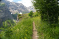
A circular route to the Aiguilles Hut

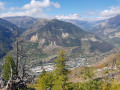
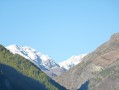
A very varied circular walk above the Durance valley. After visiting a hut where you’d love to spend some time, the path opens out onto a stunning panorama taking in L’Argentière-la-Bessée and Le Pelvoux. Then descends through a forest that was ravaged by a massive fire on Monday 7 July 2003, which engulfed 350 hectares.

Details

15663625
Creation:
Last update:
Last review:
  • Walking
    Activity: Walking
  • ↔
    Distance: 7.08 mi
  • ◔
    Average duration: 5h 40 
  • ▲
    Difficulty: Moderate

  • ⚐
    Back to start: Yes
  • ↗
    Ascent: + 2,802 ft
  • ↘
    Descent: - 2,815 ft

  • ▲
    Highest point: 5,879 ft
  • ▼
    Lowest point: 3,176 ft

Photos

Description of the walk

Park in the car park at the Chapelle Saint-Roch in Géro, in the Roche-de-Rame neighbourhood.

(S/E) Cross the bridge and immediately turn left onto the tarmac road heading uphill towards L’Eyrette. At the right-hand bend, continue straight ahead onto the footpath. At the next junction, ignore the path leading straight ahead towards the Trou du Diable and take the one on the right that goes uphill. You’ll emerge onto a plateau; continue along the path that runs along the hillside to join the forest track.

(1) Head up to the left, following the path that cuts across the bends in this track, until you reach the water reservoir. At the reservoir, stay on the track that goes round it; then, once you’re above it, rejoin the path until you meet the track again at L’Eyrette.

(2) Continue along the forest track, cross the footbridge over the Torrent de l’Ascension and you’ll come to a crossroads of paths immediately afterwards.

(3) Take the path on the left, passing the ruins of Villars. Here, begin a winding ascent through the undergrowth before reaching a slightly flatter area. Stay alert and look out for a junction marked by a cairn.

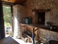
(4) Turn right to reach the Cabane des Aiguilles very quickly.

(5) Return to the cairn junction.

(4) Follow the path on the right. Continue down through the forest; as you emerge, you’ll be greeted by a magnificent panorama. You’ll reach a crossroads at the edge of another forest.

(6) Take the path on the left. Pass close to a few rocky outcrops without much difficulty. Carry on to reach another junction.

(7) Take the left-hand path again. Stay on this path, ignoring the branches to the right and left, until you reach a wide forest track.

(8) Cut across this track by taking the path opposite, rejoining it at the foot of a gigantic electricity pylon that looks like a rugby post.

(9) Turn left onto the track here, passing through the gate. Continue along the track, following the pylons. Look out for the start of the path near one of the pylons.

(10) Leave the track and take the marked mountain-bike path on the left, heading through a wood. Ignore the path on the right that goes downhill and carry on straight ahead to exit the wood.

(11) Carry on with the hamlet of Géro in sight. Walk along the hillside, passing the Croix des Officiers. You’ll reach the entrance to the hamlet of Géro; walk through it to emerge onto the main square. Head straight on along the road towards the Chapelle Saint-Roch to reach the car park (S/E).

Waypoints

  1. S/E : mi 0 - alt. 3,189 ft - Car park at the Chapelle Saint-Roch in Géro
  2. 1 : mi 0.42 - alt. 3,576 ft - Crossroads of the footpath and the reservoir track
  3. 2 : mi 0.76 - alt. 3,950 ft - Eyrette crossroads
  4. 3 : mi 1.15 - alt. 4,055 ft - Crossroads at the footbridge
  5. 4 : mi 2.87 - alt. 5,866 ft - Cairn Crossroads
  6. 5 : mi 2.94 - alt. 5,869 ft - Aiguilles Hut
  7. 6 : mi 3.58 - alt. 5,735 ft - Upper junction in the burnt-out forest
  8. 7 : mi 4.6 - alt. 4,774 ft - Lower junction in the burnt-out forest
  9. 8 : mi 5.2 - alt. 4,058 ft - Forest Track Junction
  10. 9 : mi 5.46 - alt. 3,684 ft - Junction of the large pylon and the forest track
  11. 10 : mi 5.86 - alt. 3,809 ft - Junction at the large pylon/path
  12. 11 : mi 6.56 - alt. 3,304 ft - Exit from the forest
  13. S/E : mi 7.08 - alt. 3,189 ft - Car park at the Chapelle Saint-Roch in Géro

Notes

(5) Spring at the Cabane des Aiguilles.

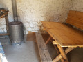
(5) Cabane des Aiguilles: sleeps 4 (a bit cramped on the mezzanine) with a wood-burning stove, table and chairs. Please respect the premises and take care with the fire.

Note for this outing: given the direction of the walk, it’s best to go at a time of year when it’s not too hot; otherwise, bring water with you.

Worth a visit

(S/E) The little hamlet of Géro is well worth a visit.

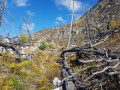
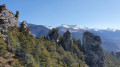
Between (4) and (6), the view stretches from L’Argentière-la-Bessée at our feet all the way to the Écrins massif. The path now descends right through the heart of an area ravaged by a terrible fire in 2003.

Between (6) and (8), note the forest’s ability to regenerate following the fire.

La Roche de Rame and its lake.

L’Argentière-la-Bessée and its industrial heritage.

The Fournel Mines

Reviews and comments

4.3 / 5
Based on 3 reviews

Reliability of the description
4.7 / 5
Ease of following the route
3.7 / 5
Route interest
4.7 / 5
Randoestelle
Randoestelle

Overall rating : 4.3 / 5

Date of your route : Jul 30, 2024
Reliability of the description : ★★★★★ Very good
Ease of following the route : ★★★★☆ Good
Route interest : ★★★★☆ Good
Very busy route : No

A lovely, shaded route on the first section
From the hut onwards, however, there are no more trees
Not to be attempted on a very hot day
But there are stunning views of the mountain ranges and glaciers

Machine-translated

januarta
januarta

Overall rating : 4.3 / 5

Date of your route : Sep 02, 2023
Reliability of the description : ★★★★☆ Good
Ease of following the route : ★★★★☆ Good
Route interest : ★★★★★ Very good
Very busy route : No

A really lovely route, even on the descent towards L’Argentière, despite the sections where it was a bit ‘slippery’ due to the small pebbles and stones that came loose from under our feet. However, we couldn’t find any shortcuts to bypass the hairpin bends and reach the pylon. So we followed the track all the way to the reservoir, which made the route considerably longer. Otherwise, it was a lovely day with no one else around.

Machine-translated

patembrun
patembrun

Many thanks for this lovely account of your hike!

Machine-translated

manu4x405
manu4x405

Overall rating : 4.3 / 5

Date of your route : Jun 10, 2023
Reliability of the description : ★★★★★ Very good
Ease of following the route : ★★★☆☆ Average
Route interest : ★★★★★ Very good
Very busy route : No

A really lovely walk – the people of Briançon are wrong to think this area is uninteresting; that’s far from the case… and what’s more, we only came across two other people on the circular walk. The signposting was average, but Visorando helps to make up for that.
A big thank you to Patembrun

Machine-translated

Other walks in the area

For more walks, use our search engine .

The GPS track and description are the property of this route's author. Please do not copy them without permission.