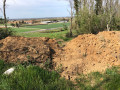
Circular walk through the Bois de la Péciat and the Haut de Satolas-et-Bonce

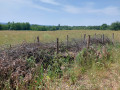
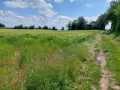
Hiking or mountain biking through woodland, fields, meadows and hedgerows.

Details

50831290
Creation:
Last update:
Last review:
  • Walking
    Activity: Walking
  • ↔
    Distance: 5.25 mi
  • ◔
    Average duration: 2h 45 
  • ▲
    Difficulty: Easy

  • ⚐
    Back to start: Yes
  • ↗
    Ascent: + 358 ft
  • ↘
    Descent: - 351 ft

  • ▲
    Highest point: 928 ft
  • ▼
    Lowest point: 719 ft

Photos

Description of the walk

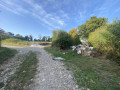
Parking is available, but not very convenient, in the Ruette neighbourhood.

(S/E) From this neighbourhood, head south-west until you reach a junction and theGR®422.

(1) Turn right, follow the main path and begin your walk through the Bois de la Péciat, a cool and pleasant woodland with many oak trees.

(2) Ignore the return path on the right and carry on until you reach a Fork in the road where you leave theGR® and the 
PR®.

(3) Turn left and join a cross-country path.

(4) Turn left and walk alongside a non-hazardous waste storage facility (marked as a quarry on IGN maps) on your left, and a small woodland on your right. You’ll reach a fork in the path, just before a second woodland.

(5) Turn right at the hairpin bend and join the Route de Satolas, heading due north, then cross it. Continue straight on until you reach a path on the right, up on the hillside.

(6) Turn right towards the Bois du Recou and stay on the main track.

(7) Turn right to join the Chemin de Planbois and the Haut de Bonce.
Follow this road through the Haut de Bonce until you reach a crossroads.

(8) Cross the Route de la Savane and head down the Route de Bonce, then take the Impasse du Lavoir where you’ll rejoin theGR®422and turn right onto the Montée du Roy.

(9) At the Fork in the road, turn right following the signposts onto the Chemin de Villonne. Follow it south-west to reach the Bois de la Péciat.

(2) Leave theGR®422by turning left and continue until you rejoin it 300 metres further on.

(1) rejoin theGR®422, following it to the left.
One hundred metres further on, turn off into a rural meadow and follow the route in the opposite direction to the outward journey to return to the car park (S/E).


Waypoints

  1. S/E : mi 0 - alt. 719 ft - La Ruette neighbourhood
  2. 1 : mi 0.23 - alt. 738 ft - Junction and GR°°®°°422
  3. 2 : mi 0.53 - alt. 787 ft - Return route
  4. 3 : mi 0.78 - alt. 840 ft - Junction and departure from the GR/PR
  5. 4 : mi 1.05 - alt. 860 ft - T-junction
  6. 5 : mi 1.54 - alt. 840 ft - Junction towards the Satolas road
  7. 6 : mi 2.24 - alt. 860 ft - Junction
  8. 7 : mi 2.76 - alt. 922 ft - Fork
  9. 8 : mi 3.41 - alt. 906 ft - Crossroads
  10. 9 : mi 3.84 - alt. 735 ft - Chemin de Villonne
  11. S/E : mi 5.25 - alt. 719 ft - La Ruette neighbourhood

Notes

Alternative route:
(6) Alternatively, for a shadier path, continue for 100 m to the next junction. Turn right and carry on straight ahead until you rejoin the route at (7).

No water source.
Bring water and a cap, as some sections are not shaded.
There’s a bakery in Satolas-et-Bonce.

Always be cautious and plan ahead when you're outdoors. Visorando and the author of this route cannot be held responsible for any accidents occurring on this route.

The GR® and PR® markings are the intellectual property of the Fédération Française de Randonnée Pédestre.

Reviews and comments

4.1 / 5
Based on 3 reviews

Reliability of the description
4 / 5
Ease of following the route
4.7 / 5
Route interest
3.7 / 5
PERHASTAM
PERHASTAM

Overall rating : 4 / 5

Date of your route : Dec 08, 2025
Reliability of the description : ★★★★☆ Good
Ease of following the route : ★★★★☆ Good
Route interest : ★★★★☆ Good
Very busy route : Yes

Independent observation of the route
The start of the route is disappointing due to the presence of all kinds of litter over a distance of approximately 400 metres, despite the barrier placed at the start.

Machine-translated

christianbd
christianbd

Overall rating : 4 / 5

Date of your route : Nov 24, 2024
Reliability of the description : ★★★★☆ Good
Ease of following the route : ★★★★★ Very good
Route interest : ★★★☆☆ Average
Very busy route : No

An easy walk – we did it in a fierce southerly wind, which wasn’t very pleasant, especially as we
walked alongside (high fences) what I assume was a rubbish tip; rubbish was strewn all over the ground and there were
a few rather unpleasant smells…

Machine-translated

palmyr
palmyr

Overall rating : 4.3 / 5

Date of your route : Jun 27, 2024
Reliability of the description : ★★★★☆ Good
Ease of following the route : ★★★★★ Very good
Route interest : ★★★★☆ Good
Very busy route : No

Parking is available at the end of Rue de la Ruette, opposite the Amazon warehouse (you can’t miss the large grey warehouse). When the road bends left as you approach the warehouse, carry on straight ahead for about a hundred metres along the unpaved but very passable track to reach the start of the walk; you can park on the right-hand side of the track.
I did this walk on a hot June morning… Don’t forget a hat, sunglasses and sun cream: I can confirm this advice is spot on. It might not be advisable in very hot weather, as the route is often exposed to the sun.

Machine-translated

Other walks in the area

For more walks, use our search engine .

The GPS track and description are the property of this route's author. Please do not copy them without permission.