Circular walk starting from Saint-Christophe

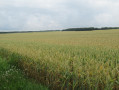
Pass through the village of Saint-Christophe, in the hamlet of Cugné. A path through the fields, through a small wood and along a few shaded roads.

Details

3832367
Creation:
Last update:
Last review:
  • Walking
    Activity: Walking
  • ↔
    Distance: 4.63 mi
  • ◔
    Average duration: 2h 10 
  • ▲
    Difficulty: Easy

  • ⚐
    Back to start: Yes
  • ↗
    Ascent: + 43 ft
  • ↘
    Descent: - 43 ft

  • ▲
    Highest point: 98 ft
  • ▼
    Lowest point: 56 ft

Description of the walk

Park in the car park at the Garenne lake in Saint-Christophe.

Follow the yellow signposts

(S/E) Take the road on the right. At the stop sign, turn right again, then shortly afterwards left into Venelle Boyer. Continue straight on until you reach a right-angled junction in the Gâte-Chien neighbourhood.

(1) Turn right onto a track just before a house. Continue to the Y-junction on the Chemin Vert.

(2) Take thefirst track on the left. Continue across the fields to return to Chemin de Gâte-Chien. Turn right onto it and you’ll come to another right-angled junction.

(3) Turn right. Carry on straight ahead, crossing the junction. You’ll reach the Belle-Oie junction with the D264.

(4) First turn left then right onto this road, then leave it. Head towards Maison Neuve, then turn left to reach Les Sablières. Follow the road on the right to reach the village of Cugné. Turn left to reach the Croisée des Malettes junction.

(5) Turn right heading due north, go round Cugné, cross the road and, after passing through the La Couronne neighbourhood, reach Rue des Landries.

(6) Turn right onto this road, then veer left at the Y-junction, following the yellow markings. You’ll reach a three-way junction. Keep right, following the markings, to reach the hamlet of La Brangelière.

(7) Turn right into La Brangelière, walking on the left-hand side of the houses, alongside a field. Keep to the left until you cross the small stream. Turn left into the street, walk straight through the village of Saint-Christophe heading due east. Turn left, walk past the church and over a footbridge to reach the car park at the Garenne lake (S/E).

Waypoints

  1. S/E : mi 0 - alt. 56 ft - Car park at the Garenne lake
  2. 1 : mi 0.29 - alt. 79 ft - Chemin de Gate de Chien
  3. 2 : mi 0.46 - alt. 69 ft - Chemin Vert
  4. 3 : mi 0.87 - alt. 95 ft - Chemin du Fief Goulu
  5. 4 : mi 1.35 - alt. 59 ft - Belle d’Oie
  6. 5 : mi 2.3 - alt. 75 ft - Croisée des Malettes
  7. 6 : mi 2.82 - alt. 79 ft - Rue des Landries
  8. 7 : mi 3.92 - alt. 66 ft - La Brangelière
  9. S/E : mi 4.63 - alt. 56 ft - Car park at the Garenne lake

Reviews and comments

3.7 / 5
Based on 5 reviews

Reliability of the description
3.8 / 5
Ease of following the route
3.8 / 5
Route interest
3.4 / 5
Myo17
Myo17

Overall rating : 4.7 / 5

Date of your route : Jan 19, 2025
Reliability of the description : ★★★★★ Very good
Ease of following the route : ★★★★★ Very good
Route interest : ★★★★☆ Good
Very busy route : No

Hello,
This is the second time I’ve done this walk; I find it ideal for getting back into exercise – it’s quite long but not too difficult, apart from the pain of getting back into shape ☺
I just altered one section because the first time I felt I was walking across private property; I didn’t turn right at marker 7, which branches off towards La Brangelière. I carried on along Rue de la Baugé and took the path on the right to get back on the route.

Machine-translated

ap75rb17
ap75rb17

Overall rating : 3 / 5

Date of your route : Jul 12, 2021
Reliability of the description : ★★★☆☆ Average
Ease of following the route : ★★★☆☆ Average
Route interest : ★★★☆☆ Average
Very busy route : No

Not great.

Machine-translated

Soizig87
Soizig87

Overall rating : 1.7 / 5

Date of your route : Mar 30, 2021
Reliability of the description : ★★☆☆☆ Disappointing
Ease of following the route : ★☆☆☆☆ Very disappointing
Route interest : ★★☆☆☆ Disappointing
Very busy route : No

The description and map of the start of the route (leaving St Christophe) are vague, as are some sections of the circular route. This is often due to intersections with farm tracks used by farmers.
Too many tarmac sections and rather uninteresting scenery: vast cultivated fields, currently planted with rapeseed and winter wheat.

Machine-translated

larochenet
larochenet

Overall rating : 4.7 / 5

Date of your route : Mar 02, 2021
Reliability of the description : ★★★★★ Very good
Ease of following the route : ★★★★★ Very good
Route interest : ★★★★☆ Good
Very busy route : No

The route took just over an hour and a half – without rushing. A lovely walk as winter draws to a close. The end of the circular route is the most interesting part. It’s good that this route exists, and it’s worthwhile in that it allows us to enjoy a lovely walk in the countryside. I wouldn’t recommend it in the height of summer as there’s very little shade.

Machine-translated

jlecollier
jlecollier

Overall rating : 4.3 / 5

Date of your route : Sep 12, 2020
Reliability of the description : ★★★★☆ Good
Ease of following the route : ★★★★★ Very good
Route interest : ★★★★☆ Good
Very busy route : No

The yellow markings have faded and/or are missing along much of the route.

Machine-translated

Other walks in the area

For more walks, use our search engine .

The GPS track and description are the property of this route's author. Please do not copy them without permission.