Circular walk starting from Notre-Dame des Neiges near Gourdon

A short family walk on the outskirts of Gourdon in Quercy. Local heritage, shaded path.

Details

n°59176292
Creation:
Last update:
Last review:
  • Walking
    Activity: Walking
  • ↔
    Distance: 3.99 mi
  • ◔
    Average duration: 2h 25 
  • ▲
    Difficulty: Easy

  • ⚐
    Back to start: Yes
  • ↗
    Ascent: + 630 ft
  • ↘
    Descent: - 610 ft

  • ▲
    Highest point: 860 ft
  • ▼
    Lowest point: 636 ft

Photos

Description of the walk

From Gourdon, head to the car park at the Notre-Dame des Neiges chapel *.

(S/E) Behind the chapel, turn left onto the path markedGR®®652,PR®® and MTB for about 200 m.

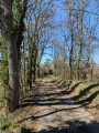
(1) Leave theGR®® and head up to the right along a narrow path, marked with yellowPR®® signs and wooden signposts, through the middle of a woodland. You’ll come out onto a road at Mas de Fraysse; follow it, then turn right off it, go over the hill and you’ll reach the crossroads at Mas de Guzou.

(2) Take the path on the right, which leads downhill; walk alongside the Métairie Petite and then cross a stream before reaching a road, where you’ll find a cross.

(3) Cross this road and continue uphill to reach the hamlet of La Bruge.

(4) Take the road leading down to the left to reach the hamlet of Verdié Bas.

(5) Continue along the small road until you come to a bridge.

(6) Cross the bridge, then turn left onto a forest track that takes you along the valley floor in the shade. Pass a tennis court and walk alongside a beautiful property along a path through the woodland until you reach a five-way junction.

(7) Take thesecond path on the left (yellow markings), then leave the road leading to the Mas de Guzou on your right. Carry on straight ahead and you will come back to the junction you passed on the way out.

(2) Turn right and retrace your steps along the outbound route to return to the car park at the Chapel of Notre-Dame des Neiges (S/E).

Waypoints

  1. S/E : mi 0 - alt. 640 ft - Chapelle car park - Notre-Dame-des-Neiges (Gourdon)
  2. 1 : mi 0.16 - alt. 656 ft - Common junction. Return
  3. 2 : mi 0.58 - alt. 794 ft - Crossroads at the end of the circular loop
  4. 3 : mi 1.27 - alt. 669 ft - Saint-Romain junction
  5. 4 : mi 1.62 - alt. 853 ft - La Brugue
  6. 5 : mi 1.82 - alt. 787 ft - Bread oven
  7. 6 : mi 2.26 - alt. 732 ft - Bridge
  8. 7 : mi 2.82 - alt. 807 ft - Five-way junction
  9. S/E : mi 3.99 - alt. 640 ft - Notre-Dame des Neiges Chapel car park. Near the - Bléou (ruisseau) - Affluent du Céou

Notes

  • It’s best to park in the Place du Foirail rather than at Notre-Dame des Neiges, where space is limited. What’s more, your car will be in the shade.

You can reach Notre-Dame-des-Neiges by walking down Rue des Névéges at the far end of the square.
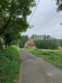
- A lovely walk in hot weather as it takes you through woodland or shaded areas all the way.
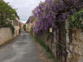
- The walk takes you along quite a few small roads, but they are very quiet and very picturesque.
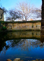
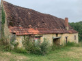
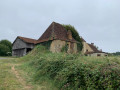
- Plenty of typical rural Quercy architecture.

Worth a visit

Always be cautious and plan ahead when you're outdoors. Visorando and the author of this route cannot be held responsible for any accidents occurring on this route.

The GR® and PR® markings are the intellectual property of the Fédération Française de Randonnée Pédestre.

Reviews and comments

4.7 / 5
Based on 1 review

Reliability of the description
5 / 5
Ease of following the route
5 / 5
Route interest
4 / 5
User 15692667

Overall rating : 4.7 / 5

Date of your route : Nov 07, 2026
Reliability of the description : ★★★★★ Very good
Ease of following the route : ★★★★★ Very good
Route interest : ★★★★☆ Good
Very busy route : No

A lovely walk with very little road walking. Please note that if you set off from the Foirail car park, you’ll need to add about 2 km to the walk – and, more importantly, there’s a steep climb at the end. For those who’d rather not walk down the shared path, which is very stony, I took the stretch of road that leads down to the chapel.

Machine-translated

Other walks in the area

For more walks, use our search engine .

The GPS track and description are the property of this route's author. Please do not copy them without permission.